Todireşti elevation
Todireşti (Vaslui, Comuna Todireşti), Romania elevation is 183 meters and Todireşti elevation in feet is 600 ft above sea level [src 1]. Todireşti is a seat of a second-order administrative division (feature code) with elevation that is 69 meters (226 ft) smaller than average city elevation in Romania.
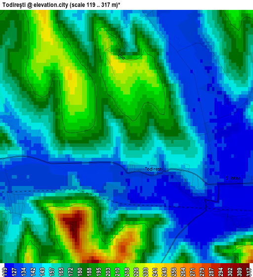
Below is the Elevation map of Todireşti, which displays elevation range with different colors. Scale of the first map is from 119 to 317 m (390 to 1040 ft) with average elevation of 168.4 meters (=552 ft) [note 1]
These maps also provides idea of topography and contour of this city, they are displayed at different zoom levels. More info about maps, scale and edge coordinates you can find below images.
| \ | Map #1 | Map #2 | Topo.Map |
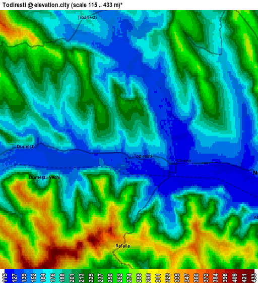
| Scale [m] | 119..317 m | 115..433 m | × |
| Scale [ft] | 390..1040 ft | 377..1421 ft | × |
| Average | 168.4 m = 552 ft | 207 m = 679 ft | × |
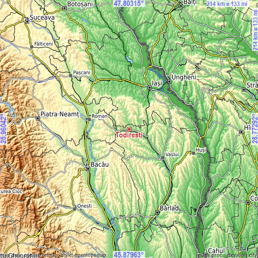
| Width | 6.68 km = 4.2 mi | 13.37 km = 8.3 mi | 213.9 km = 132.9 mi |
| Height | 6.68 km = 4.2 mi | 13.37 km = 8.3 mi | 213.9 km = 132.9 mi |
| ↑Max Latitude | 46.880046° | 46.910076° | 47.80315° |
| Latitude at center | 46.85° | 46.85° | 46.85° |
| ↓Min Latitude | 46.819937° | 46.789857° | 45.87963° |
| ← Min Longitude | 27.322725° | 27.278779° | 25.96042° |
| Longitude center | 27.36667° | 27.36667° | 27.36667° |
| →Max Longitude | 27.410615° | 27.454561° | 28.77292° |
Nearby cities:
Cities around Todireşti sort by population:
• Negreşti elevation 119 m
5.4 km,  110°
110°
• Ţibăneşti 150 m
7.8 km,  341°
341°
• Băceşti 153 m
10.1 km,  270°
270°
• Dumeşti 216 m
6.3 km, 270°
• Oşeşti 178 m
12 km,  140°
140°
• Gârceni 389 m
11.2 km,  214°
214°
• Glodenii Gândului 218 m
12.4 km, 335°
• Ipatele 214 m
8.3 km,  27°
27°
• Rafaila 312 m
5.5 km,  183°
183°
• Suhuleț 423 m
10.2 km,  305°
305°
• Buda 157 m
10.6 km,  156°
156°
• Drăgușeni 164 m
12.5 km,  62°
62°
Multilingual:
 En español:
Todireşti elevación 183 m.
 En France:
Todireşti élévation 183 m.
 Auf Deutsch:
Todireşti höhe über dem Meeresspiegel ist 183 m.

Sources and notes:
- [note 1] Map square and city borders are not equal. Map elevation data is calculated only from area inside that square.
- [src 1] Elevation data from geonames database provided with same terms of usage.
- [src 2] The elevation map of Todireşti is generated using elevation data from NASA's 3 arcsec (90m) resolution SRTM data.
- [src 3] Base (background) map © OpenStreetMap contributors tiles are generated by Geofabrik and OpenTopoMap.
Copyright & License:
This Todireşti Elevation Map is licensed under CC BY-SA. You may reuse any part from this page, if you give a proper credit by linking to this URL:
 More info on terms of use page.