Toporu elevation
Toporu (Giurgiu, Comuna Toporu), Romania elevation is 87 meters and Toporu elevation in feet is 285 ft above sea level [src 1]. Toporu is a seat of a second-order administrative division (feature code) with elevation that is 165 meters (541 ft) smaller than average city elevation in Romania.
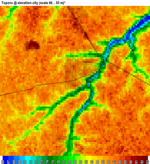
Below is the Elevation map of Toporu, which displays elevation range with different colors. Scale of the first map is from 66 to 93 m (217 to 305 ft) with average elevation of 84.3 meters (=277 ft) [note 1]
These maps also provides idea of topography and contour of this city, they are displayed at different zoom levels. More info about maps, scale and edge coordinates you can find below images.
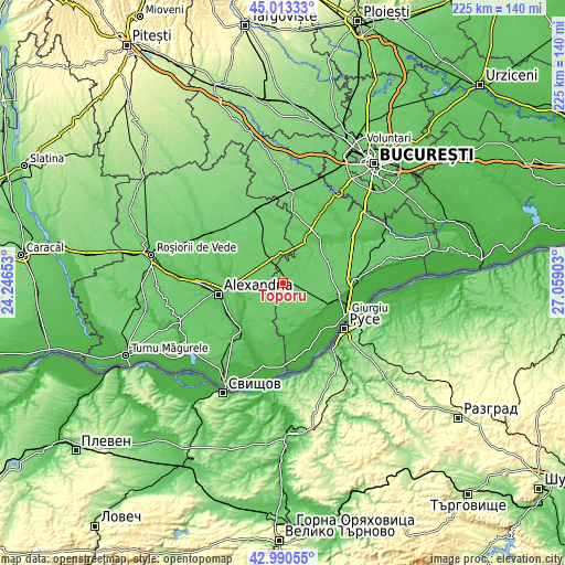
| \ | Map #1 | Topo.Map |
| Scale [m] | 66..93 m | × |
| Scale [ft] | 217..305 ft | × |
| Average | 84.3 m = 277 ft | × |
| Width | 7.03 km = 4.4 mi | 224.9 km = 139.7 mi |
| Height | 7.03 km = 4.4 mi | 224.9 km = 139.7 mi |
| ↑Max Latitude | 44.042158° | 45.01333° |
| Latitude at center | 44.01056° | 44.01056° |
| ↓Min Latitude | 43.978946° | 42.99055° |
| ← Min Longitude | 25.608835° | 24.24653° |
| Longitude center | 25.65278° | 25.65278° |
| →Max Longitude | 25.696725° | 27.05903° |
Nearby cities:
Cities around Toporu sort by population:
• Izvoarele elevation 80 m
10.1 km,  75°
75°
• Drăgăneşti-Vlaşca 70 m
11 km,  336°
336°
• Mârzăneşti 37 m
17.2 km,  240°
240°
• Răsuceni 71 m
9.1 km,  5°
5°
• Putineiu 80 m
13.9 km,  152°
152°
• Gogoşari 50 m
16.4 km,  166°
166°
• Târnava 79 m
16.5 km,  334°
334°
• Chiriacu 85 m
10.9 km,  66°
66°
• Cucuruzu 70 m
10 km,  39°
39°
• Teleormanu 52 m
16.4 km,  251°
251°
• Răsmireşti 79 m
8.8 km, 249°
• Bujoreni 69 m
11.9 km,  352°
352°
Multilingual:
 En español:
Toporu elevación 87 m.
 En France:
Toporu élévation 87 m.


Sources and notes:
- [note 1] Map square and city borders are not equal. Map elevation data is calculated only from area inside that square.
- [src 1] Elevation data from geonames database provided with same terms of usage.
- [src 2] The elevation map of Toporu is generated using elevation data from NASA's 3 arcsec (90m) resolution SRTM data.
- [src 3] Base (background) map © OpenStreetMap contributors tiles are generated by Geofabrik and OpenTopoMap.
Copyright & License:
This Toporu Elevation Map is licensed under CC BY-SA. You may reuse any part from this page, if you give a proper credit by linking to this URL:
 More info on terms of use page.