Izvoarele elevation
Izvoarele (Giurgiu, Comuna Izvoarele), Romania elevation is 80 meters and Izvoarele elevation in feet is 262 ft above sea level [src 1]. Izvoarele is a seat of a second-order administrative division (feature code) with elevation that is 172 meters (564 ft) smaller than average city elevation in Romania.
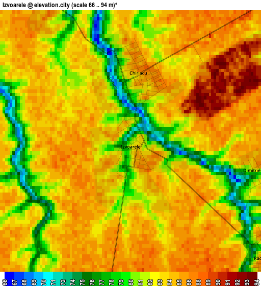
Below is the Elevation map of Izvoarele, which displays elevation range with different colors. Scale of the first map is from 66 to 94 m (217 to 308 ft) with average elevation of 83.5 meters (=274 ft) [note 1]
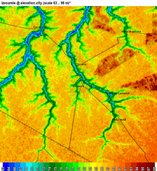
These maps also provides idea of topography and contour of this city, they are displayed at different zoom levels. More info about maps, scale and edge coordinates you can find below images.
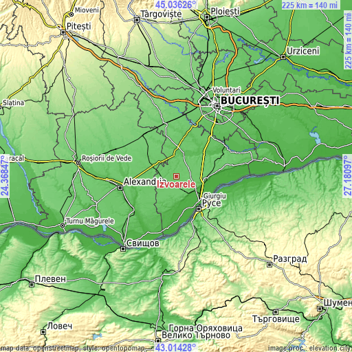
| \ | Map #1 | Map #2 | Topo.Map |
| Scale [m] | 66..94 m | 63..98 m | × |
| Scale [ft] | 217..308 ft | 207..322 ft | × |
| Average | 83.5 m = 274 ft | 84.6 m = 278 ft | × |
| Width | 7.03 km = 4.4 mi | 14.05 km = 8.7 mi | 224.8 km = 139.7 mi |
| Height | 7.03 km = 4.4 mi | 14.05 km = 8.7 mi | 224.8 km = 139.7 mi |
| ↑Max Latitude | 44.065475° | 44.097043° | 45.03626° |
| Latitude at center | 44.03389° | 44.03389° | 44.03389° |
| ↓Min Latitude | 44.002288° | 43.970669° | 43.01428° |
| ← Min Longitude | 25.730775° | 25.686829° | 24.36847° |
| Longitude center | 25.77472° | 25.77472° | 25.77472° |
| →Max Longitude | 25.818665° | 25.862611° | 27.18097° |
Nearby cities:
Cities around Izvoarele sort by population:
• Drăgăneşti-Vlaşca elevation 70 m
16 km,  298°
298°
• Stăneşti 47 m
13.9 km,  160°
160°
• Răsuceni 71 m
10.9 km,  305°
305°
• Putineiu 80 m
15.3 km,  192°
192°
• Stoeneşti 58 m
15.6 km,  38°
38°
• Toporu 87 m
10.1 km,  255°
255°
• Schitu 90 m
12.9 km,  22°
22°
• Chiriacu 85 m
1.8 km,  6°
6°
• Naipu 72 m
13.2 km,  355°
355°
• Cucuruzu 70 m
6.2 km,  326°
326°
• Cetatea 27 m
15.8 km,  125°
125°
• Bujoreni 69 m
14.6 km, 309°
Multilingual:
 En español:
Izvoarele elevación 80 m.
 En France:
Izvoarele élévation 80 m.
 Auf Deutsch:
Izvoarele höhe über dem Meeresspiegel ist 80 m.

Sources and notes:
- [note 1] Map square and city borders are not equal. Map elevation data is calculated only from area inside that square.
- [src 1] Elevation data from geonames database provided with same terms of usage.
- [src 2] The elevation map of Izvoarele is generated using elevation data from NASA's 3 arcsec (90m) resolution SRTM data.
- [src 3] Base (background) map © OpenStreetMap contributors tiles are generated by Geofabrik and OpenTopoMap.
Copyright & License:
This Izvoarele Elevation Map is licensed under CC BY-SA. You may reuse any part from this page, if you give a proper credit by linking to this URL:
 More info on terms of use page.