Mârzăneşti elevation
Mârzăneşti (Teleorman, Comuna Mârzãneşti), Romania elevation is 37 meters and Mârzăneşti elevation in feet is 121 ft above sea level [src 1]. Mârzăneşti is a seat of a second-order administrative division (feature code) with elevation that is 215 meters (705 ft) smaller than average city elevation in Romania.
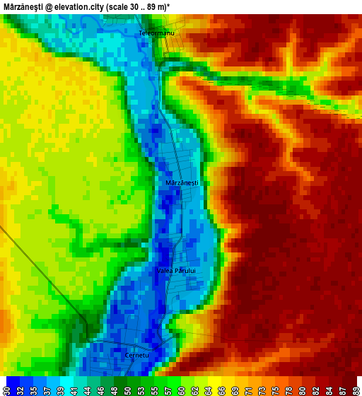
Below is the Elevation map of Mârzăneşti, which displays elevation range with different colors. Scale of the first map is from 30 to 89 m (98 to 292 ft) with average elevation of 65 meters (=213 ft) [note 1]
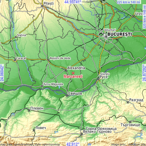
These maps also provides idea of topography and contour of this city, they are displayed at different zoom levels. More info about maps, scale and edge coordinates you can find below images.
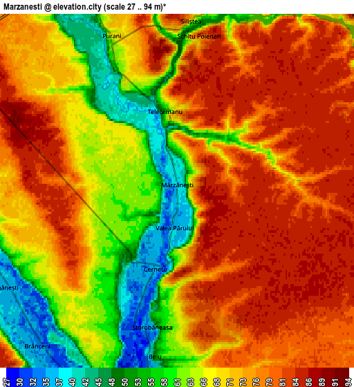
| \ | Map #1 | Map #2 | Topo.Map |
| Scale [m] | 30..89 m | 27..94 m | × |
| Scale [ft] | 98..292 ft | 89..308 ft | × |
| Average | 65 m = 213 ft | 70.7 m = 232 ft | × |
| Width | 7.04 km = 4.4 mi | 14.08 km = 8.7 mi | 225.2 km = 139.9 mi |
| Height | 7.04 km = 4.4 mi | 14.08 km = 8.7 mi | 225.2 km = 139.9 mi |
| ↑Max Latitude | 43.964969° | 43.996591° | 44.93741° |
| Latitude at center | 43.93333° | 43.93333° | 43.93333° |
| ↓Min Latitude | 43.901674° | 43.870002° | 42.912° |
| ← Min Longitude | 25.422725° | 25.378779° | 24.06042° |
| Longitude center | 25.46667° | 25.46667° | 25.46667° |
| →Max Longitude | 25.510615° | 25.554561° | 26.87292° |
Nearby cities:
Cities around Mârzăneşti sort by population:
• Ţigăneşti elevation 38 m
8.8 km,  245°
245°
• Poroschia 38 m
8 km,  270°
270°
• Storobăneasa 35 m
5.7 km,  193°
193°
• Vităneşti 45 m
8.4 km,  331°
331°
• Brânceni 33 m
7.7 km,  223°
223°
• Beiu 53 m
6.7 km, 187°
• Cernetu 34 m
3 km,  195°
195°
• Purani 63 m
5.7 km,  335°
335°
• Teleormanu 52 m
3.3 km,  349°
349°
• Calomfirești 39 m
8.9 km,  258°
258°
• Răsmireşti 79 m
8.7 km,  50°
50°
• Valea Părului 38 m
1.8 km,  182°
182°
Multilingual:
 En español:
Mârzăneşti elevación 37 m.
 En France:
Mârzăneşti élévation 37 m.
 Auf Deutsch:
Mârzăneşti höhe über dem Meeresspiegel ist 37 m.

Sources and notes:
- [note 1] Map square and city borders are not equal. Map elevation data is calculated only from area inside that square.
- [src 1] Elevation data from geonames database provided with same terms of usage.
- [src 2] The elevation map of Mârzăneşti is generated using elevation data from NASA's 3 arcsec (90m) resolution SRTM data.
- [src 3] Base (background) map © OpenStreetMap contributors tiles are generated by Geofabrik and OpenTopoMap.
Copyright & License:
This Mârzăneşti Elevation Map is licensed under CC BY-SA. You may reuse any part from this page, if you give a proper credit by linking to this URL:
 More info on terms of use page.