Sobreira elevation
Sobreira (Vila Real, Ribeira de Pena), Portugal elevation is 422 meters and Sobreira elevation in feet is 1385 ft above sea level [src 1]. Sobreira is a populated place (feature code) with elevation that is 254 meters (833 ft) bigger than average city elevation in Portugal.
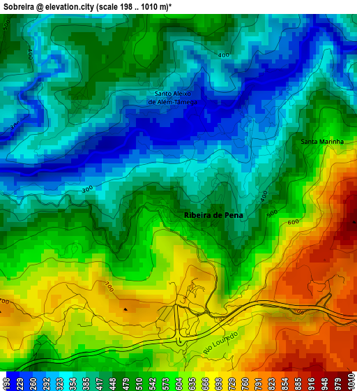
Below is the Elevation map of Sobreira, which displays elevation range with different colors. Scale of the first map is from 198 to 1010 m (650 to 3314 ft) with average elevation of 505.6 meters (=1659 ft) [note 1]
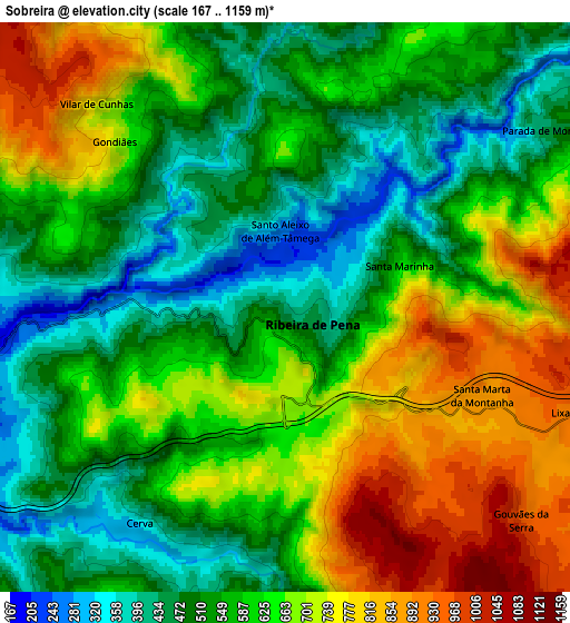
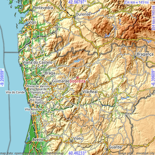
These maps also provides idea of topography and contour of this city, they are displayed at different zoom levels. More info about maps, scale and edge coordinates you can find below images.
| \ | Map #1 | Map #2 | Topo.Map |
| Scale [m] | 198..1010 m | 167..1159 m | × |
| Scale [ft] | 650..3314 ft | 548..3802 ft | × |
| Average | 505.6 m = 1659 ft | 606.2 m = 1989 ft | × |
| Width | 7.32 km = 4.5 mi | 14.63 km = 9.1 mi | 234.1 km = 145.5 mi |
| Height | 7.32 km = 4.5 mi | 14.63 km = 9.1 mi | 234.1 km = 145.5 mi |
| ↑Max Latitude | 41.556603° | 41.589479° | 42.56797° |
| Latitude at center | 41.52371° | 41.52371° | 41.52371° |
| ↓Min Latitude | 41.490801° | 41.457874° | 40.46233° |
| ← Min Longitude | -7.846285° | -7.890231° | -9.20859° |
| Longitude center | -7.80234° | -7.80234° | -7.80234° |
| →Max Longitude | -7.758395° | -7.714449° | -6.39609° |
Nearby cities:
Cities around Sobreira sort by population:
• Vila Real elevation 462 m
25.3 km,  168°
168°
• Fafe 338 m
31.9 km,  255°
255°
• Cabeceiras de Basto 295 m
15.6 km,  266°
266°
• Mondim de Basto 201 m
17.8 km,  225°
225°
• Boticas 491 m
21.5 km,  31°
31°
• Refojos de Basto 313 m
16.1 km, 265°
• Vieira do Minho 396 m
30.8 km,  293°
293°
• Montalegre 996 m
33.4 km,  1°
1°
• Murça 488 m
31.8 km,  114°
114°
• Celorico de Basto 222 m
22.5 km, 227°
• Vila Pouca de Aguiar 734 m
13.5 km,  101°
101°
• Ribeira de Pena 432 m
0.2 km,  180°
180°
Multilingual:
 En español:
Sobreira elevación 422 m.
 En France:
Sobreira élévation 422 m.
 Auf Deutsch:
Sobreira höhe über dem Meeresspiegel ist 422 m.

Sources and notes:
- [note 1] Map square and city borders are not equal. Map elevation data is calculated only from area inside that square.
- [src 1] Elevation data from geonames database provided with same terms of usage.
- [src 2] The elevation map of Sobreira is generated using elevation data from NASA's 3 arcsec (90m) resolution SRTM data.
- [src 3] Base (background) map © OpenStreetMap contributors tiles are generated by Geofabrik and OpenTopoMap.
Copyright & License:
This Sobreira Elevation Map is licensed under CC BY-SA. You may reuse any part from this page, if you give a proper credit by linking to this URL:
 More info on terms of use page.