Fafe elevation
Fafe (Braga), Portugal elevation is 338 meters and Fafe elevation in feet is 1109 ft above sea level [src 1]. Fafe is a seat of a second-order administrative division (feature code) with elevation that is 170 meters (558 ft) bigger than average city elevation in Portugal.
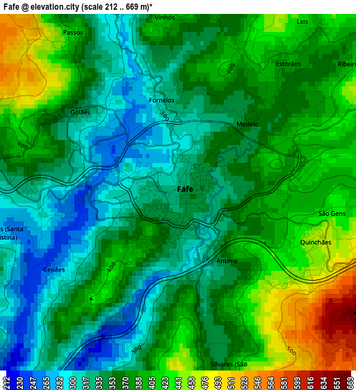
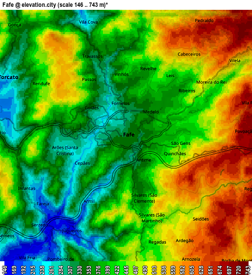
Below is the Elevation map of Fafe, which displays elevation range with different colors. Scale of the first map is from 212 to 669 m (696 to 2195 ft) with average elevation of 368.3 meters (=1208 ft) [note 1]
These maps also provides idea of topography and contour of this city, they are displayed at different zoom levels. More info about maps, scale and edge coordinates you can find below images.
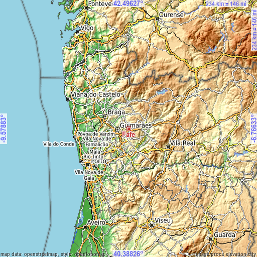
| \ | Map #1 | Map #2 | Topo.Map |
| Scale [m] | 212..669 m | 146..743 m | × |
| Scale [ft] | 696..2195 ft | 479..2438 ft | × |
| Average | 368.3 m = 1208 ft | 430.4 m = 1412 ft | × |
| Width | 7.32 km = 4.5 mi | 14.65 km = 9.1 mi | 234.4 km = 145.6 mi |
| Height | 7.32 km = 4.5 mi | 14.65 km = 9.1 mi | 234.4 km = 145.6 mi |
| ↑Max Latitude | 41.48376° | 41.516673° | 42.49627° |
| Latitude at center | 41.45083° | 41.45083° | 41.45083° |
| ↓Min Latitude | 41.417884° | 41.38492° | 40.38826° |
| ← Min Longitude | -8.216525° | -8.260471° | -9.57883° |
| Longitude center | -8.17258° | -8.17258° | -8.17258° |
| →Max Longitude | -8.128635° | -8.084689° | -6.76633° |
Nearby cities:
Cities around Fafe sort by population:
• Felgueiras elevation 348 m
9.4 km,  190°
190°
• Guimarães 189 m
10.3 km,  266°
266°
• Margaride 308 m
9.8 km, 193°
• Caldas de Vizela 174 m
13.7 km,  236°
236°
• Selho 180 m
14.9 km,  256°
256°
• Serzedo 175 m
6.9 km,  222°
222°
• Ponte 133 m
13.3 km,  279°
279°
• Urgeses 252 m
10.8 km, 255°
• Arões 367 m
3.5 km, 278°
• Vizela 238 m
9.9 km, 219°
• Candoso 205 m
12.7 km, 258°
• Vizela 223 m
10.1 km,  228°
228°
Multilingual:
 En español:
Fafe elevación 338 m.
 En France:
Fafe élévation 338 m.


Sources and notes:
- [note 1] Map square and city borders are not equal. Map elevation data is calculated only from area inside that square.
- [src 1] Elevation data from geonames database provided with same terms of usage.
- [src 2] The elevation map of Fafe is generated using elevation data from NASA's 3 arcsec (90m) resolution SRTM data.
- [src 3] Base (background) map © OpenStreetMap contributors tiles are generated by Geofabrik and OpenTopoMap.
Copyright & License:
This Fafe Elevation Map is licensed under CC BY-SA. You may reuse any part from this page, if you give a proper credit by linking to this URL:
 More info on terms of use page.