Margaride elevation
Margaride (Porto, Felgueiras), Portugal elevation is 308 meters and Margaride elevation in feet is 1010 ft above sea level [src 1]. Margaride is a populated place (feature code) with elevation that is 140 meters (459 ft) bigger than average city elevation in Portugal.
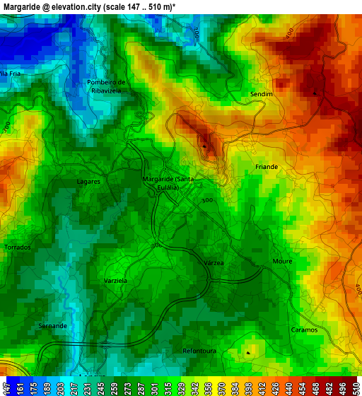
Below is the Elevation map of Margaride, which displays elevation range with different colors. Scale of the first map is from 147 to 510 m (482 to 1673 ft) with average elevation of 313.8 meters (=1030 ft) [note 1]
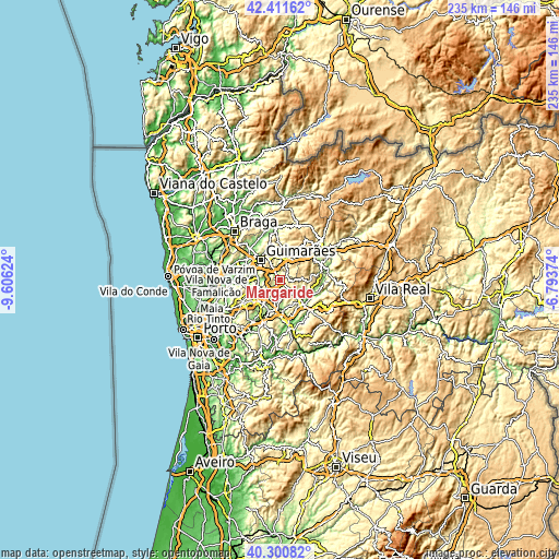
These maps also provides idea of topography and contour of this city, they are displayed at different zoom levels. More info about maps, scale and edge coordinates you can find below images.
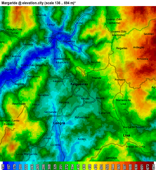
| \ | Map #1 | Map #2 | Topo.Map |
| Scale [m] | 147..510 m | 136..694 m | × |
| Scale [ft] | 482..1673 ft | 446..2277 ft | × |
| Average | 313.8 m = 1030 ft | 362.7 m = 1190 ft | × |
| Width | 7.33 km = 4.6 mi | 14.67 km = 9.1 mi | 234.7 km = 145.8 mi |
| Height | 7.33 km = 4.6 mi | 14.67 km = 9.1 mi | 234.7 km = 145.8 mi |
| ↑Max Latitude | 41.397753° | 41.43071° | 42.41162° |
| Latitude at center | 41.36478° | 41.36478° | 41.36478° |
| ↓Min Latitude | 41.33179° | 41.298783° | 40.30082° |
| ← Min Longitude | -8.243935° | -8.287881° | -9.60624° |
| Longitude center | -8.19999° | -8.19999° | -8.19999° |
| →Max Longitude | -8.156045° | -8.112099° | -6.79374° |
Nearby cities:
Cities around Margaride sort by population:
• Felgueiras elevation 348 m
0.6 km,  54°
54°
• Fafe 338 m
9.8 km,  13°
13°
• Caldas de Vizela 174 m
9.3 km,  281°
281°
• Serzedo 175 m
5.1 km,  331°
331°
• Barrosas 180 m
8.4 km,  262°
262°
• Urgeses 252 m
10.7 km,  310°
310°
• Arões 367 m
10.2 km,  353°
353°
• Lustosa 393 m
10.1 km,  254°
254°
• Telões 262 m
9.6 km,  129°
129°
• Figueiró 332 m
7.8 km,  159°
159°
• Vizela 238 m
4.5 km,  295°
295°
• Vizela 223 m
6.1 km, 298°
Multilingual:
 En español:
Margaride elevación 308 m.
 En France:
Margaride élévation 308 m.
 Auf Deutsch:
Margaride höhe über dem Meeresspiegel ist 308 m.

Sources and notes:
- [note 1] Map square and city borders are not equal. Map elevation data is calculated only from area inside that square.
- [src 1] Elevation data from geonames database provided with same terms of usage.
- [src 2] The elevation map of Margaride is generated using elevation data from NASA's 3 arcsec (90m) resolution SRTM data.
- [src 3] Base (background) map © OpenStreetMap contributors tiles are generated by Geofabrik and OpenTopoMap.
Copyright & License:
This Margaride Elevation Map is licensed under CC BY-SA. You may reuse any part from this page, if you give a proper credit by linking to this URL:
 More info on terms of use page.