Fátima elevation
Fátima (Santarém, Ourém), Portugal elevation is 358 meters and Fátima elevation in feet is 1175 ft above sea level [src 1]. Fátima is a populated place (feature code) with elevation that is 190 meters (623 ft) bigger than average city elevation in Portugal.
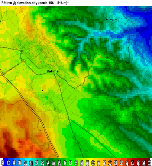
Below is the Elevation map of Fátima, which displays elevation range with different colors. Scale of the first map is from 156 to 516 m (512 to 1693 ft) with average elevation of 318.6 meters (=1045 ft) [note 1]
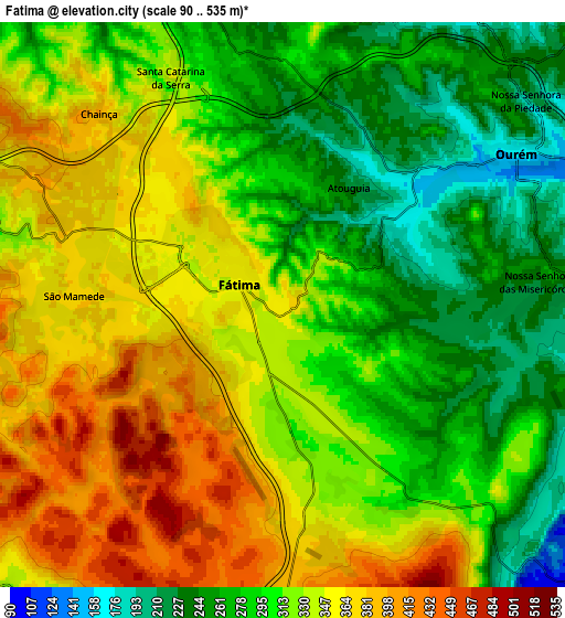
These maps also provides idea of topography and contour of this city, they are displayed at different zoom levels. More info about maps, scale and edge coordinates you can find below images.
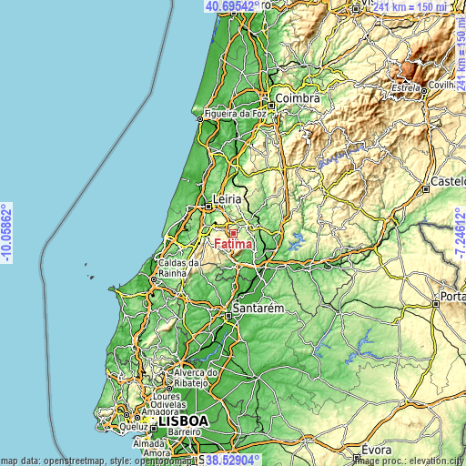
| \ | Map #1 | Map #2 | Topo.Map |
| Scale [m] | 156..516 m | 90..535 m | × |
| Scale [ft] | 512..1693 ft | 295..1755 ft | × |
| Average | 318.6 m = 1045 ft | 318.2 m = 1044 ft | × |
| Width | 7.53 km = 4.7 mi | 15.06 km = 9.4 mi | 240.9 km = 149.7 mi |
| Height | 7.53 km = 4.7 mi | 15.06 km = 9.4 mi | 240.9 km = 149.7 mi |
| ↑Max Latitude | 39.654552° | 39.688378° | 40.69542° |
| Latitude at center | 39.62071° | 39.62071° | 39.62071° |
| ↓Min Latitude | 39.586851° | 39.552976° | 38.52904° |
| ← Min Longitude | -8.696315° | -8.740261° | -10.05862° |
| Longitude center | -8.65237° | -8.65237° | -8.65237° |
| →Max Longitude | -8.608425° | -8.564479° | -7.24612° |
Nearby cities:
Cities around Fátima sort by population:
• Monsanto elevation 143 m
18.4 km,  196°
196°
• Torres Novas 61 m
18.6 km,  149°
149°
• Ourém 315 m
5.7 km,  65°
65°
• Batalha 71 m
15.4 km,  286°
286°
• Porto de Mós 136 m
14.4 km,  261°
261°
• Caranguejeira 129 m
14.7 km,  341°
341°
• Alcanena 85 m
18 km,  184°
184°
• Santa Catarina da Serra 338 m
7.2 km, 335°
• Mira 255 m
10.2 km,  211°
211°
• Madalena 112 m
18.5 km,  107°
107°
• Minde 204 m
12 km,  194°
194°
• Paialvo 98 m
17 km, 111°
Multilingual:
 En español:
Fátima elevación 358 m.
 En France:
Fátima élévation 358 m.


Sources and notes:
- [note 1] Map square and city borders are not equal. Map elevation data is calculated only from area inside that square.
- [src 1] Elevation data from geonames database provided with same terms of usage.
- [src 2] The elevation map of Fátima is generated using elevation data from NASA's 3 arcsec (90m) resolution SRTM data.
- [src 3] Base (background) map © OpenStreetMap contributors tiles are generated by Geofabrik and OpenTopoMap.
Copyright & License:
This Fátima Elevation Map is licensed under CC BY-SA. You may reuse any part from this page, if you give a proper credit by linking to this URL:
 More info on terms of use page.