Ourique elevation
Ourique (Beja), Portugal elevation is 241 meters and Ourique elevation in feet is 791 ft above sea level [src 1]. Ourique is a seat of a second-order administrative division (feature code) with elevation that is 73 meters (240 ft) bigger than average city elevation in Portugal.
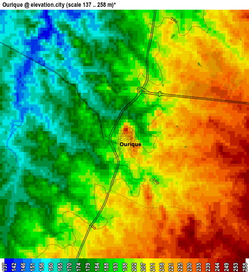
Below is the Elevation map of Ourique, which displays elevation range with different colors. Scale of the first map is from 137 to 258 m (449 to 846 ft) with average elevation of 198.5 meters (=651 ft) [note 1]
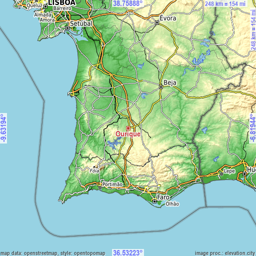
These maps also provides idea of topography and contour of this city, they are displayed at different zoom levels. More info about maps, scale and edge coordinates you can find below images.
| \ | Map #1 | Topo.Map |
| Scale [m] | 137..258 m | × |
| Scale [ft] | 449..846 ft | × |
| Average | 198.5 m = 651 ft | × |
| Width | 7.74 km = 4.8 mi | 247.6 km = 153.9 mi |
| Height | 7.74 km = 4.8 mi | 247.6 km = 153.9 mi |
| ↑Max Latitude | 37.688684° | 38.75888° |
| Latitude at center | 37.6539° | 37.6539° |
| ↓Min Latitude | 37.6191° | 36.53223° |
| ← Min Longitude | -8.269635° | -9.63194° |
| Longitude center | -8.22569° | -8.22569° |
| →Max Longitude | -8.181745° | -6.81944° |
Nearby cities:
Cities around Ourique sort by population:
• São Bartolomeu de Messines elevation 130 m
44.5 km,  186°
186°
• Almodôvar 290 m
21.4 km,  137°
137°
• Odemira 52 m
37 km,  260°
260°
• Aljustrel 182 m
25.4 km,  12°
12°
• São Teotónio 153 m
45.2 km,  249°
249°
• Castro Verde 242 m
13.3 km,  68°
68°
• Ferreira do Alentejo 233 m
47.2 km,  20°
20°
• Cercal 138 m
42.7 km,  292°
292°
• Boavista dos Pinheiros 122 m
39.5 km, 258°
• São Marcos da Serra 115 m
35.2 km,  202°
202°
• Penedo Gordo 205 m
45.7 km,  36°
36°
• São Luis 158 m
39.2 km,  280°
280°
Multilingual:
 En español:
Ourique elevación 241 m.
 En France:
Ourique élévation 241 m.


Sources and notes:
- [note 1] Map square and city borders are not equal. Map elevation data is calculated only from area inside that square.
- [src 1] Elevation data from geonames database provided with same terms of usage.
- [src 2] The elevation map of Ourique is generated using elevation data from NASA's 3 arcsec (90m) resolution SRTM data.
- [src 3] Base (background) map © OpenStreetMap contributors tiles are generated by Geofabrik and OpenTopoMap.
Copyright & License:
This Ourique Elevation Map is licensed under CC BY-SA. You may reuse any part from this page, if you give a proper credit by linking to this URL:
 More info on terms of use page.