Ventosa elevation
Ventosa (Lisbon, Alenquer), Portugal elevation is 133 meters and Ventosa elevation in feet is 436 ft above sea level [src 1]. Ventosa is a populated place (feature code) with elevation that is 35 meters (115 ft) smaller than average city elevation in Portugal.
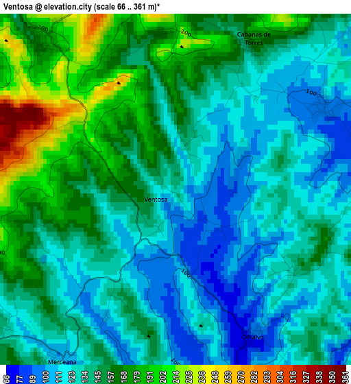
Below is the Elevation map of Ventosa, which displays elevation range with different colors. Scale of the first map is from 66 to 361 m (217 to 1184 ft) with average elevation of 143.3 meters (=470 ft) [note 1]
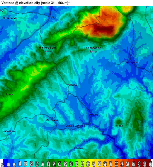
These maps also provides idea of topography and contour of this city, they are displayed at different zoom levels. More info about maps, scale and edge coordinates you can find below images.
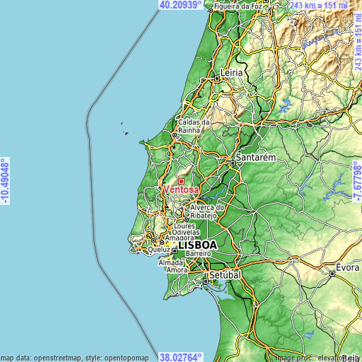
| \ | Map #1 | Map #2 | Topo.Map |
| Scale [m] | 66..361 m | 31..664 m | × |
| Scale [ft] | 217..1184 ft | 102..2178 ft | × |
| Average | 143.3 m = 470 ft | 169.2 m = 555 ft | × |
| Width | 7.58 km = 4.7 mi | 15.16 km = 9.4 mi | 242.6 km = 150.7 mi |
| Height | 7.58 km = 4.7 mi | 15.16 km = 9.4 mi | 242.6 km = 150.7 mi |
| ↑Max Latitude | 39.161042° | 39.195108° | 40.20939° |
| Latitude at center | 39.12696° | 39.12696° | 39.12696° |
| ↓Min Latitude | 39.092861° | 39.058746° | 38.02764° |
| ← Min Longitude | -9.128175° | -9.172121° | -10.49048° |
| Longitude center | -9.08423° | -9.08423° | -9.08423° |
| →Max Longitude | -9.040285° | -8.996339° | -7.67798° |
Nearby cities:
Cities around Ventosa sort by population:
• Carregado elevation 21 m
14.8 km,  141°
141°
• Alenquer 32 m
10.4 km, 141°
• Alcoentre 88 m
14.1 km,  49°
49°
• Campelos 109 m
15.2 km,  300°
300°
• Abrigada 75 m
6 km,  71°
71°
• Sobral de Monte Agraço 262 m
13.3 km,  205°
205°
• Cadaval 105 m
13 km,  352°
352°
• Meca 110 m
6.6 km, 139°
• Cadafais 32 m
15.3 km,  153°
153°
• Ota 42 m
8.2 km,  101°
101°
• Vila Verde 189 m
4.1 km,  319°
319°
• Cabanas de Torres 169 m
3.6 km,  26°
26°
Multilingual:
 En español:
Ventosa elevación 133 m.
 En France:
Ventosa élévation 133 m.


Sources and notes:
- [note 1] Map square and city borders are not equal. Map elevation data is calculated only from area inside that square.
- [src 1] Elevation data from geonames database provided with same terms of usage.
- [src 2] The elevation map of Ventosa is generated using elevation data from NASA's 3 arcsec (90m) resolution SRTM data.
- [src 3] Base (background) map © OpenStreetMap contributors tiles are generated by Geofabrik and OpenTopoMap.
Copyright & License:
This Ventosa Elevation Map is licensed under CC BY-SA. You may reuse any part from this page, if you give a proper credit by linking to this URL:
 More info on terms of use page.