Campelos elevation
Campelos (Lisbon, Torres Vedras), Portugal elevation is 109 meters and Campelos elevation in feet is 358 ft above sea level [src 1]. Campelos is a populated place (feature code) with elevation that is 59 meters (194 ft) smaller than average city elevation in Portugal.
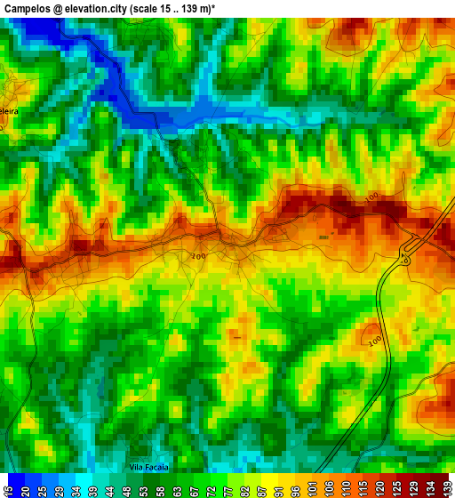
Below is the Elevation map of Campelos, which displays elevation range with different colors. Scale of the first map is from 15 to 139 m (49 to 456 ft) with average elevation of 74 meters (=243 ft) [note 1]
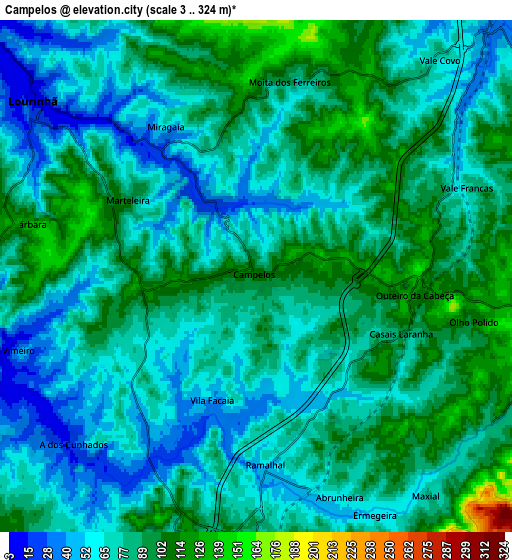
These maps also provides idea of topography and contour of this city, they are displayed at different zoom levels. More info about maps, scale and edge coordinates you can find below images.
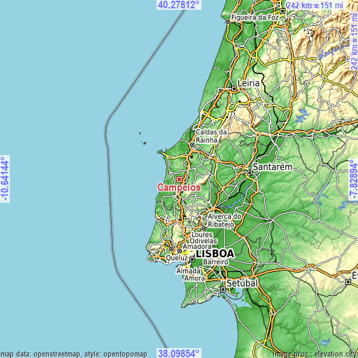
| \ | Map #1 | Map #2 | Topo.Map |
| Scale [m] | 15..139 m | 3..324 m | × |
| Scale [ft] | 49..456 ft | 10..1063 ft | × |
| Average | 74 m = 243 ft | 78.8 m = 259 ft | × |
| Width | 7.57 km = 4.7 mi | 15.15 km = 9.4 mi | 242.3 km = 150.6 mi |
| Height | 7.57 km = 4.7 mi | 15.15 km = 9.4 mi | 242.3 km = 150.6 mi |
| ↑Max Latitude | 39.230828° | 39.26486° | 40.27812° |
| Latitude at center | 39.19678° | 39.19678° | 39.19678° |
| ↓Min Latitude | 39.162715° | 39.128634° | 38.09854° |
| ← Min Longitude | -9.279135° | -9.323081° | -10.64144° |
| Longitude center | -9.23519° | -9.23519° | -9.23519° |
| →Max Longitude | -9.191245° | -9.147299° | -7.82894° |
Nearby cities:
Cities around Campelos sort by population:
• Torres Vedras elevation 41 m
11.9 km,  189°
189°
• Lourinhã 11 m
8.3 km,  306°
306°
• Silveira 37 m
14.6 km,  229°
229°
• A dos Cunhados 32 m
7.3 km, 227°
• Bombarral 47 m
10.3 km,  40°
40°
• Ventosa 133 m
15.2 km,  120°
120°
• Cadaval 105 m
12.5 km,  65°
65°
• Moita dos Ferreiros 93 m
5.8 km,  9°
9°
• Vimeiro 32 m
7.4 km,  253°
253°
• Vila Verde 189 m
11.3 km,  114°
114°
• São Bartolomeu 119 m
9.5 km,  336°
336°
• Cabanas de Torres 169 m
15.3 km, 107°
Multilingual:
 En español:
Campelos elevación 109 m.
 En France:
Campelos élévation 109 m.
 Auf Deutsch:
Campelos höhe über dem Meeresspiegel ist 109 m.

Sources and notes:
- [note 1] Map square and city borders are not equal. Map elevation data is calculated only from area inside that square.
- [src 1] Elevation data from geonames database provided with same terms of usage.
- [src 2] The elevation map of Campelos is generated using elevation data from NASA's 3 arcsec (90m) resolution SRTM data.
- [src 3] Base (background) map © OpenStreetMap contributors tiles are generated by Geofabrik and OpenTopoMap.
Copyright & License:
This Campelos Elevation Map is licensed under CC BY-SA. You may reuse any part from this page, if you give a proper credit by linking to this URL:
 More info on terms of use page.