Lourinhã elevation
Lourinhã (Lisbon), Portugal elevation is 11 meters and Lourinhã elevation in feet is 36 ft above sea level [src 1]. Lourinhã is a seat of a second-order administrative division (feature code) with elevation that is 157 meters (515 ft) smaller than average city elevation in Portugal.
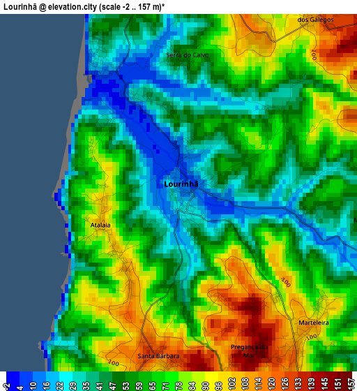
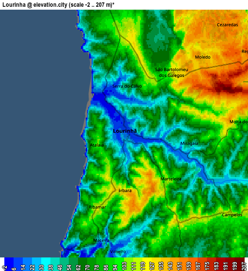
Below is the Elevation map of Lourinhã, which displays elevation range with different colors. Scale of the first map is from -2 to 157 m (-7 to 515 ft) with average elevation of 63 meters (=207 ft) [note 1]
These maps also provides idea of topography and contour of this city, they are displayed at different zoom levels. More info about maps, scale and edge coordinates you can find below images.
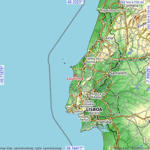
| \ | Map #1 | Map #2 | Topo.Map |
| Scale [m] | -2..157 m | -2..207 m | × |
| Scale [ft] | -7..515 ft | -7..679 ft | × |
| Average | 63 m = 207 ft | 82.3 m = 270 ft | × |
| Width | 7.57 km = 4.7 mi | 15.14 km = 9.4 mi | 242.2 km = 150.5 mi |
| Height | 7.57 km = 4.7 mi | 15.14 km = 9.4 mi | 242.2 km = 150.5 mi |
| ↑Max Latitude | 39.275687° | 39.309697° | 40.3223° |
| Latitude at center | 39.24166° | 39.24166° | 39.24166° |
| ↓Min Latitude | 39.207617° | 39.173557° | 38.14411° |
| ← Min Longitude | -9.356485° | -9.400431° | -10.71879° |
| Longitude center | -9.31254° | -9.31254° | -9.31254° |
| →Max Longitude | -9.268595° | -9.224649° | -7.90629° |
Nearby cities:
Cities around Lourinhã sort by population:
• Torres Vedras elevation 41 m
17.4 km,  164°
164°
• Peniche 17 m
14 km,  335°
335°
• Atouguia da Baleia 31 m
10.8 km,  353°
353°
• Silveira 37 m
15.2 km,  197°
197°
• A dos Cunhados 32 m
10 km,  172°
172°
• Bombarral 47 m
13.6 km,  77°
77°
• Campelos 109 m
8.3 km,  126°
126°
• Ferrel 28 m
13.6 km,  358°
358°
• Moita dos Ferreiros 93 m
7.7 km, 84°
• Vimeiro 32 m
7.1 km,  183°
183°
• Serra de El-Rei 133 m
10.8 km,  20°
20°
• São Bartolomeu 119 m
4.7 km,  37°
37°
Multilingual:
 En español:
Lourinhã elevación 11 m.
 En France:
Lourinha élévation 11 m.


Sources and notes:
- [note 1] Map square and city borders are not equal. Map elevation data is calculated only from area inside that square.
- [src 1] Elevation data from geonames database provided with same terms of usage.
- [src 2] The elevation map of Lourinhã is generated using elevation data from NASA's 3 arcsec (90m) resolution SRTM data.
- [src 3] Base (background) map © OpenStreetMap contributors tiles are generated by Geofabrik and OpenTopoMap.
Copyright & License:
This Lourinhã Elevation Map is licensed under CC BY-SA. You may reuse any part from this page, if you give a proper credit by linking to this URL:
 More info on terms of use page.