‘Anātā elevation
‘Anātā (West Bank, Al Quds), Palestinian Territory elevation is 714 meters and ‘Anātā elevation in feet is 2343 ft above sea level [src 1]. ‘Anātā is a populated place (feature code) with elevation that is 247 meters (810 ft) bigger than average city elevation in Palestinian Territory.
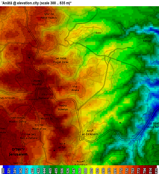
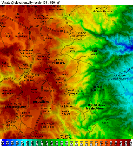
Below is the Elevation map of ‘Anātā, which displays elevation range with different colors. Scale of the first map is from 300 to 835 m (984 to 2740 ft) with average elevation of 632.5 meters (=2075 ft) [note 1]
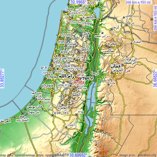
These maps also provides idea of topography and contour of this city, they are displayed at different zoom levels. More info about maps, scale and edge coordinates you can find below images.
| \ | Map #1 | Map #2 | Topo.Map |
| Scale [m] | 300..835 m | 103..880 m | × |
| Scale [ft] | 984..2740 ft | 338..2887 ft | × |
| Average | 632.5 m = 2075 ft | 590.2 m = 1936 ft | × |
| Width | 8.3 km = 5.2 mi | 16.61 km = 10.3 mi | 265.7 km = 165.1 mi |
| Height | 8.3 km = 5.2 mi | 16.61 km = 10.3 mi | 265.7 km = 165.1 mi |
| ↑Max Latitude | 31.846578° | 31.8839° | 32.9965° |
| Latitude at center | 31.80924° | 31.80924° | 31.80924° |
| ↓Min Latitude | 31.771887° | 31.73452° | 30.60652° |
| ← Min Longitude | 35.215075° | 35.171129° | 33.85277° |
| Longitude center | 35.25902° | 35.25902° | 35.25902° |
| →Max Longitude | 35.302965° | 35.346911° | 36.66527° |
Nearby cities:
Cities around ‘Anātā sort by population:
• East Jerusalem elevation 759 m
3.7 km,  219°
219°
• Old City 738 m
4.3 km,  212°
212°
• Kalandia 751 m
7.5 km,  327°
327°
• Ar Rām wa Ḑāḩiyat al Barīd 750 m
5 km, 332°
• Al ‘Ayzarīyah 566 m
4.4 km,  167°
167°
• Abū Dīs 641 m
5.2 km,  177°
177°
• Ḩizmā 601 m
2.7 km,  8°
8°
• Bīr Nabālā 759 m
7 km,  311°
311°
• Az Za‘ayyim 656 m
2.4 km, 165°
• Jaba‘ 664 m
5.3 km,  359°
359°
• Bayt Iksā 775 m
7.6 km,  276°
276°
• Mikhmās 575 m
7.2 km, 12°
Multilingual:
 En español:
‘Anātā elevación 714 m.
 En France:
‘Anātā élévation 714 m.


Sources and notes:
- [note 1] Map square and city borders are not equal. Map elevation data is calculated only from area inside that square.
- [src 1] Elevation data from geonames database provided with same terms of usage.
- [src 2] The elevation map of ‘Anātā is generated using elevation data from NASA's 3 arcsec (90m) resolution SRTM data.
- [src 3] Base (background) map © OpenStreetMap contributors tiles are generated by Geofabrik and OpenTopoMap.
Copyright & License:
This ‘Anātā Elevation Map is licensed under CC BY-SA. You may reuse any part from this page, if you give a proper credit by linking to this URL:
 More info on terms of use page.