Old City elevation
Old City (West Bank), Palestinian Territory elevation is 738 meters and Old City elevation in feet is 2421 ft above sea level [src 1]. Old City is a section of populated place (feature code) with elevation that is 271 meters (889 ft) bigger than average city elevation in Palestinian Territory.
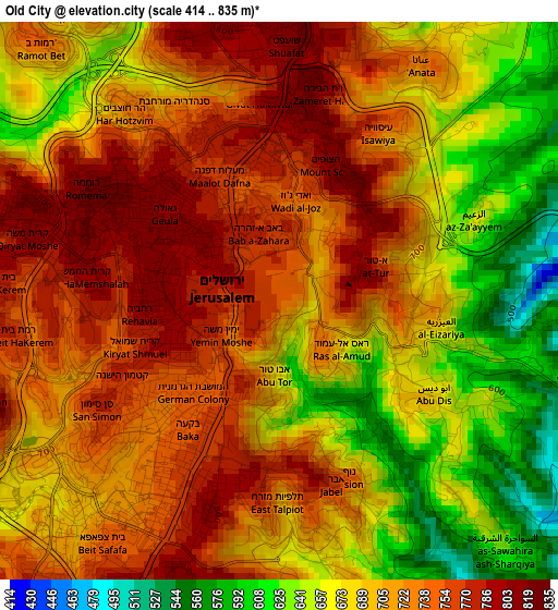
Below is the Elevation map of Old City, which displays elevation range with different colors. Scale of the first map is from 414 to 835 m (1358 to 2740 ft) with average elevation of 704.8 meters (=2312 ft) [note 1]
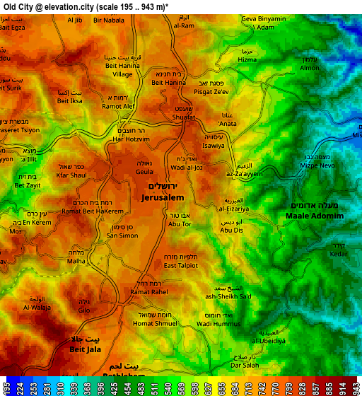
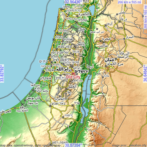
These maps also provides idea of topography and contour of this city, they are displayed at different zoom levels. More info about maps, scale and edge coordinates you can find below images.
| \ | Map #1 | Map #2 | Topo.Map |
| Scale [m] | 414..835 m | 195..943 m | × |
| Scale [ft] | 1358..2740 ft | 640..3094 ft | × |
| Average | 704.8 m = 2312 ft | 636.8 m = 2089 ft | × |
| Width | 8.31 km = 5.2 mi | 16.62 km = 10.3 mi | 265.8 km = 165.2 mi |
| Height | 8.31 km = 5.2 mi | 16.62 km = 10.3 mi | 265.8 km = 165.2 mi |
| ↑Max Latitude | 31.814021° | 31.851356° | 32.96436° |
| Latitude at center | 31.77667° | 31.77667° | 31.77667° |
| ↓Min Latitude | 31.739304° | 31.701923° | 30.57354° |
| ← Min Longitude | 35.190225° | 35.146279° | 33.82792° |
| Longitude center | 35.23417° | 35.23417° | 35.23417° |
| →Max Longitude | 35.278115° | 35.322061° | 36.64042° |
Nearby cities:
Cities around Old City sort by population:
• East Jerusalem elevation 759 m
0.7 km,  357°
357°
• Ar Rām wa Ḑāḩiyat al Barīd 750 m
8.1 km,  0°
0°
• Al ‘Ayzarīyah 566 m
3.4 km,  101°
101°
• Bayt Jālā 792 m
8.1 km,  212°
212°
• ‘Anātā 714 m
4.3 km,  32°
32°
• Abū Dīs 641 m
3.1 km,  121°
121°
• Ḩizmā 601 m
6.9 km,  23°
23°
• Az Za‘ayyim 656 m
3.2 km,  65°
65°
• Ash Shaykh Sa‘d 642 m
4.9 km,  153°
153°
• Bayt Iksā 775 m
6.9 km,  311°
311°
• Khallat Ḩamāmah 757 m
7.3 km, 212°
• Khallat an Nu‘mān 621 m
6.6 km,  173°
173°
Multilingual:
 En español:
Old City elevación 738 m.
 En France:
Old City élévation 738 m.
 Auf Deutsch:
Old City höhe über dem Meeresspiegel ist 738 m.

Sources and notes:
- [note 1] Map square and city borders are not equal. Map elevation data is calculated only from area inside that square.
- [src 1] Elevation data from geonames database provided with same terms of usage.
- [src 2] The elevation map of Old City is generated using elevation data from NASA's 3 arcsec (90m) resolution SRTM data.
- [src 3] Base (background) map © OpenStreetMap contributors tiles are generated by Geofabrik and OpenTopoMap.
Copyright & License:
This Old City Elevation Map is licensed under CC BY-SA. You may reuse any part from this page, if you give a proper credit by linking to this URL:
 More info on terms of use page.