Balāţah elevation
Balāţah (West Bank, Nablus), Palestinian Territory elevation is 494 meters and Balāţah elevation in feet is 1621 ft above sea level [src 1]. Balāţah is a populated place (feature code) with elevation that is 27 meters (89 ft) bigger than average city elevation in Palestinian Territory.
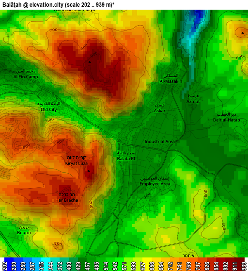
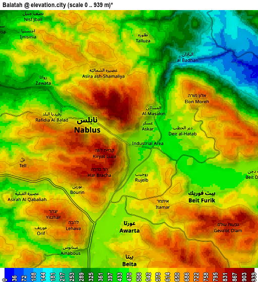
Below is the Elevation map of Balāţah, which displays elevation range with different colors. Scale of the first map is from 202 to 939 m (663 to 3081 ft) with average elevation of 605.2 meters (=1986 ft) [note 1]
These maps also provides idea of topography and contour of this city, they are displayed at different zoom levels. More info about maps, scale and edge coordinates you can find below images.
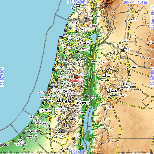
| \ | Map #1 | Map #2 | Topo.Map |
| Scale [m] | 202..939 m | 0..939 m | × |
| Scale [ft] | 663..3081 ft | 0..3081 ft | × |
| Average | 605.2 m = 1986 ft | 536.3 m = 1760 ft | × |
| Width | 8.27 km = 5.1 mi | 16.54 km = 10.3 mi | 264.6 km = 164.4 mi |
| Height | 8.27 km = 5.1 mi | 16.54 km = 10.3 mi | 264.6 km = 164.4 mi |
| ↑Max Latitude | 32.249244° | 32.286402° | 33.39404° |
| Latitude at center | 32.21207° | 32.21207° | 32.21207° |
| ↓Min Latitude | 32.174881° | 32.137677° | 31.01454° |
| ← Min Longitude | 35.241665° | 35.197719° | 33.87936° |
| Longitude center | 35.28561° | 35.28561° | 35.28561° |
| →Max Longitude | 35.329555° | 35.373501° | 36.69186° |
Nearby cities:
Cities around Balāţah sort by population:
• Nablus elevation 569 m
3.1 km,  288°
288°
• Bayt Fūrīk 532 m
6.1 km,  129°
129°
• ‘Aşīrah ash Shamālīyah 638 m
4.7 km,  338°
338°
• ‘Awartā 549 m
5.7 km,  181°
181°
• Sālim 517 m
4.2 km,  93°
93°
• Rūjayb 528 m
2.5 km,  163°
163°
• ‘Azmūţ 473 m
2.6 km,  62°
62°
• Ţallūzah 543 m
6.6 km,  7°
7°
• Būrīn 589 m
4.5 km,  227°
227°
• Kafr Qallīl 531 m
2.1 km,  187°
187°
• Dayr al Ḩaţab 509 m
3.4 km,  80°
80°
• Mādamā 509 m
5.9 km,  240°
240°
Multilingual:
 En español:
Balāţah elevación 494 m.
 En France:
Balāţah élévation 494 m.


Sources and notes:
- [note 1] Map square and city borders are not equal. Map elevation data is calculated only from area inside that square.
- [src 1] Elevation data from geonames database provided with same terms of usage.
- [src 2] The elevation map of Balāţah is generated using elevation data from NASA's 3 arcsec (90m) resolution SRTM data.
- [src 3] Base (background) map © OpenStreetMap contributors tiles are generated by Geofabrik and OpenTopoMap.
Copyright & License:
This Balāţah Elevation Map is licensed under CC BY-SA. You may reuse any part from this page, if you give a proper credit by linking to this URL:
 More info on terms of use page.