Bayt Ūmmar elevation
Bayt Ūmmar (West Bank, Al Khalil), Palestinian Territory elevation is 942 meters and Bayt Ūmmar elevation in feet is 3091 ft above sea level [src 1]. Bayt Ūmmar is a populated place (feature code) with elevation that is 475 meters (1558 ft) bigger than average city elevation in Palestinian Territory.
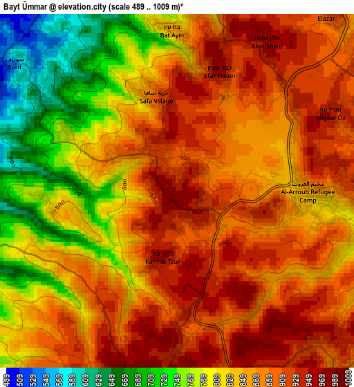
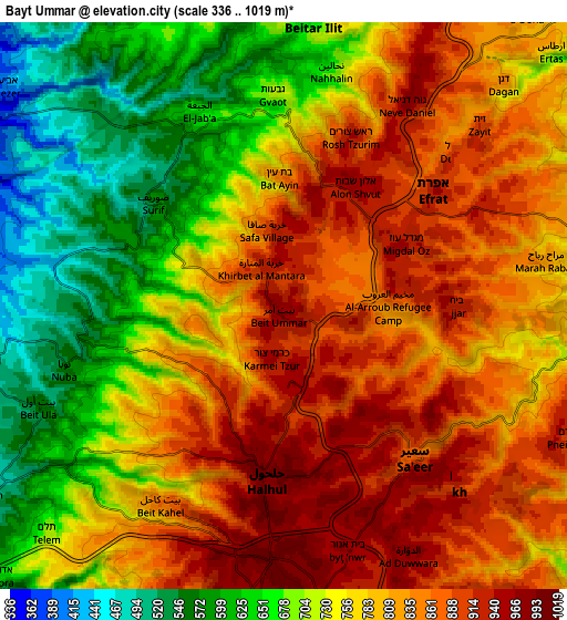
Below is the Elevation map of Bayt Ūmmar, which displays elevation range with different colors. Scale of the first map is from 489 to 1009 m (1604 to 3310 ft) with average elevation of 849.7 meters (=2788 ft) [note 1]
These maps also provides idea of topography and contour of this city, they are displayed at different zoom levels. More info about maps, scale and edge coordinates you can find below images.
| \ | Map #1 | Map #2 | Topo.Map |
| Scale [m] | 489..1009 m | 336..1019 m | × |
| Scale [ft] | 1604..3310 ft | 1102..3343 ft | × |
| Average | 849.7 m = 2788 ft | 772.9 m = 2536 ft | × |
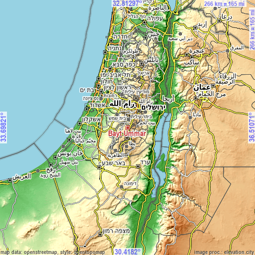
| Width | 8.32 km = 5.2 mi | 16.64 km = 10.3 mi | 266.3 km = 165.5 mi |
| Height | 8.32 km = 5.2 mi | 16.64 km = 10.3 mi | 266.3 km = 165.5 mi |
| ↑Max Latitude | 31.660703° | 31.6981° | 32.81297° |
| Latitude at center | 31.62329° | 31.62329° | 31.62329° |
| ↓Min Latitude | 31.585862° | 31.54842° | 30.4182° |
| ← Min Longitude | 35.060515° | 35.016569° | 33.69821° |
| Longitude center | 35.10446° | 35.10446° | 35.10446° |
| →Max Longitude | 35.148405° | 35.192351° | 36.51071° |
Nearby cities:
Cities around Bayt Ūmmar sort by population:
• Ḩalḩūl elevation 999 m
4.8 km,  183°
183°
• Sa‘īr 919 m
6 km,  145°
145°
• Şūrīf 564 m
4.9 km,  308°
308°
• Bayt Fajjār 963 m
4.7 km,  88°
88°
• Khārās 558 m
6 km,  260°
260°
• Naḩḩālīn 683 m
7.1 km,  12°
12°
• Bayt Kāḩil 859 m
7 km,  212°
212°
• Nūbā 534 m
6.8 km, 256°
• Bayt ‘Īnūn 967 m
7.4 km,  165°
165°
• Shuyūkh al ‘Arrūb 824 m
3.8 km,  100°
100°
• Jūrat ash Sham‘ah 918 m
6.9 km,  63°
63°
• Wādī Raḩḩāl 911 m
7.6 km,  51°
51°
Multilingual:
 En español:
Bayt Ūmmar elevación 942 m.
 En France:
Bayt Ūmmar élévation 942 m.
 Auf Deutsch:
Bayt Ūmmar höhe über dem Meeresspiegel ist 942 m.

Sources and notes:
- [note 1] Map square and city borders are not equal. Map elevation data is calculated only from area inside that square.
- [src 1] Elevation data from geonames database provided with same terms of usage.
- [src 2] The elevation map of Bayt Ūmmar is generated using elevation data from NASA's 3 arcsec (90m) resolution SRTM data.
- [src 3] Base (background) map © OpenStreetMap contributors tiles are generated by Geofabrik and OpenTopoMap.
Copyright & License:
This Bayt Ūmmar Elevation Map is licensed under CC BY-SA. You may reuse any part from this page, if you give a proper credit by linking to this URL:
 More info on terms of use page.