Naḩḩālīn elevation
Naḩḩālīn (West Bank, Bethlehem), Palestinian Territory elevation is 683 meters and Naḩḩālīn elevation in feet is 2241 ft above sea level [src 1]. Naḩḩālīn is a populated place (feature code) with elevation that is 216 meters (709 ft) bigger than average city elevation in Palestinian Territory.
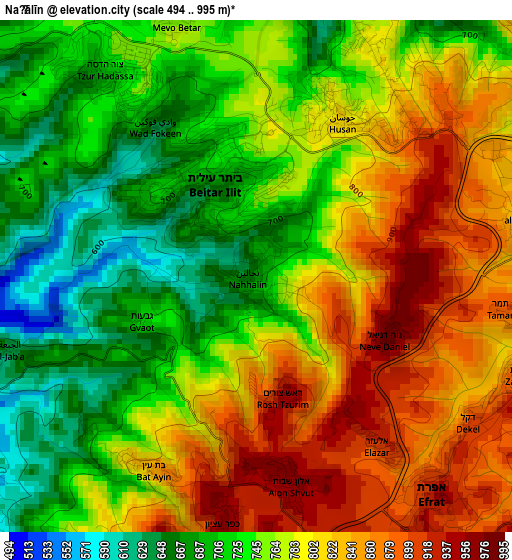
Below is the Elevation map of Naḩḩālīn, which displays elevation range with different colors. Scale of the first map is from 494 to 995 m (1621 to 3264 ft) with average elevation of 772.6 meters (=2535 ft) [note 1]
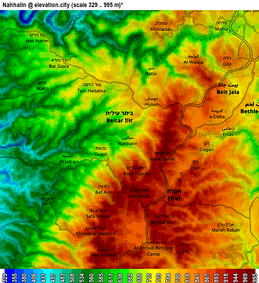
These maps also provides idea of topography and contour of this city, they are displayed at different zoom levels. More info about maps, scale and edge coordinates you can find below images.
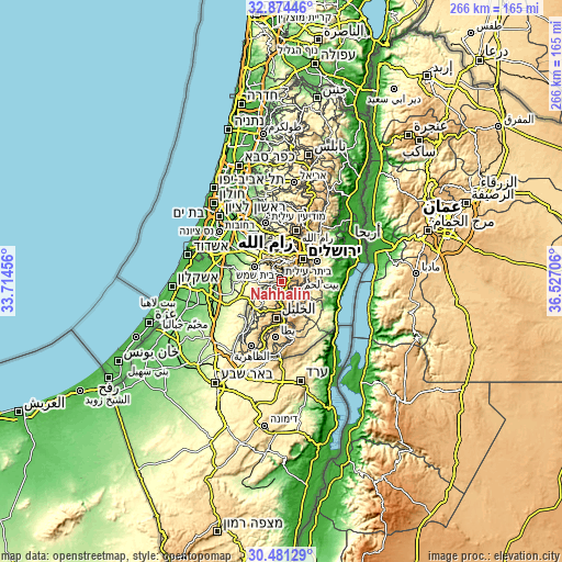
| \ | Map #1 | Map #2 | Topo.Map |
| Scale [m] | 494..995 m | 329..995 m | × |
| Scale [ft] | 1621..3264 ft | 1079..3264 ft | × |
| Average | 772.6 m = 2535 ft | 723.7 m = 2374 ft | × |
| Width | 8.32 km = 5.2 mi | 16.63 km = 10.3 mi | 266.1 km = 165.3 mi |
| Height | 8.32 km = 5.2 mi | 16.63 km = 10.3 mi | 266.1 km = 165.3 mi |
| ↑Max Latitude | 31.722977° | 31.76035° | 32.87446° |
| Latitude at center | 31.68559° | 31.68559° | 31.68559° |
| ↓Min Latitude | 31.648188° | 31.61077° | 30.48129° |
| ← Min Longitude | 35.076865° | 35.032919° | 33.71456° |
| Longitude center | 35.12081° | 35.12081° | 35.12081° |
| →Max Longitude | 35.164755° | 35.208701° | 36.52706° |
Nearby cities:
Cities around Naḩḩālīn sort by population:
• Bayt Jālā elevation 792 m
7.2 km,  62°
62°
• Şūrīf 564 m
6.6 km,  234°
234°
• Bayt Ūmmar 942 m
7.1 km,  192°
192°
• Bayt Fajjār 963 m
7.5 km,  154°
154°
• Ad Dawḩah 838 m
5.9 km,  74°
74°
• Al Khaḑir 828 m
4.5 km,  77°
77°
• Ḩūsān 809 m
2.9 km,  26°
26°
• Battīr 799 m
4.2 km, 26°
• Arţās 708 m
6.3 km,  86°
86°
• Jūrat ash Sham‘ah 918 m
6.1 km,  129°
129°
• Wādī Raḩḩāl 911 m
4.9 km,  117°
117°
• Wādī Fūkīn 637 m
2.9 km,  325°
325°
Multilingual:
 En español:
Naḩḩālīn elevación 683 m.
 En France:
Naḩḩālīn élévation 683 m.
 Auf Deutsch:
Naḩḩālīn höhe über dem Meeresspiegel ist 683 m.

Sources and notes:
- [note 1] Map square and city borders are not equal. Map elevation data is calculated only from area inside that square.
- [src 1] Elevation data from geonames database provided with same terms of usage.
- [src 2] The elevation map of Naḩḩālīn is generated using elevation data from NASA's 3 arcsec (90m) resolution SRTM data.
- [src 3] Base (background) map © OpenStreetMap contributors tiles are generated by Geofabrik and OpenTopoMap.
Copyright & License:
This Naḩḩālīn Elevation Map is licensed under CC BY-SA. You may reuse any part from this page, if you give a proper credit by linking to this URL:
 More info on terms of use page.