Jaba‘ elevation
Jaba‘ (West Bank), Palestinian Territory elevation is 419 meters and Jaba‘ elevation in feet is 1375 ft above sea level [src 1]. Jaba‘ is a populated place (feature code) with elevation that is 48 meters (157 ft) smaller than average city elevation in Palestinian Territory.
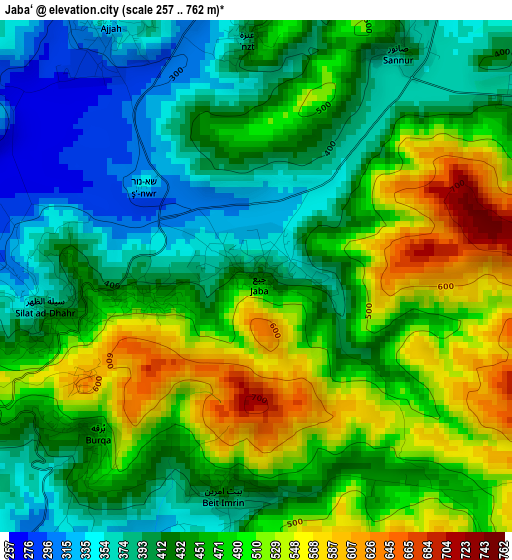
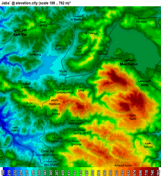
Below is the Elevation map of Jaba‘, which displays elevation range with different colors. Scale of the first map is from 257 to 762 m (843 to 2500 ft) with average elevation of 450.3 meters (=1477 ft) [note 1]
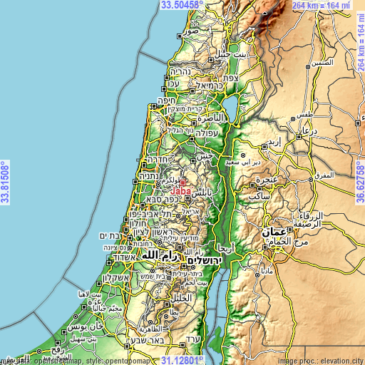
These maps also provides idea of topography and contour of this city, they are displayed at different zoom levels. More info about maps, scale and edge coordinates you can find below images.
| \ | Map #1 | Map #2 | Topo.Map |
| Scale [m] | 257..762 m | 188..762 m | × |
| Scale [ft] | 843..2500 ft | 617..2500 ft | × |
| Average | 450.3 m = 1477 ft | 422.5 m = 1386 ft | × |
| Width | 8.26 km = 5.1 mi | 16.52 km = 10.3 mi | 264.2 km = 164.2 mi |
| Height | 8.26 km = 5.1 mi | 16.52 km = 10.3 mi | 264.3 km = 164.2 mi |
| ↑Max Latitude | 32.361218° | 32.39833° | 33.50458° |
| Latitude at center | 32.32409° | 32.32409° | 32.32409° |
| ↓Min Latitude | 32.286947° | 32.249789° | 31.12801° |
| ← Min Longitude | 35.177385° | 35.133439° | 33.81508° |
| Longitude center | 35.22133° | 35.22133° | 35.22133° |
| →Max Longitude | 35.265275° | 35.309221° | 36.62758° |
Nearby cities:
Cities around Jaba‘ sort by population:
• Maythalūn elevation 381 m
5.7 km,  61°
61°
• Sīlat az̧ Z̧ahr 390 m
3.5 km,  261°
261°
• ‘Ajjah 422 m
4.7 km,  329°
329°
• Şānūr 386 m
4.2 km,  32°
32°
• Burqah 456 m
3.7 km,  227°
227°
• Al Fandaqūmīyah 455 m
1.7 km, 257°
• Sabasţīyah 369 m
5.8 km,  201°
201°
• Bayt Imrīn 442 m
3.5 km,  188°
188°
• Yāşīd 690 m
6.1 km,  119°
119°
• Bazzāryah 478 m
5.5 km,  251°
251°
• ‘Anzah 417 m
3.9 km,  358°
358°
• Al ‘Aţţārah 360 m
5.4 km,  271°
271°
Multilingual:
 En español:
Jaba‘ elevación 419 m.
 En France:
Jaba‘ élévation 419 m.


Sources and notes:
- [note 1] Map square and city borders are not equal. Map elevation data is calculated only from area inside that square.
- [src 1] Elevation data from geonames database provided with same terms of usage.
- [src 2] The elevation map of Jaba‘ is generated using elevation data from NASA's 3 arcsec (90m) resolution SRTM data.
- [src 3] Base (background) map © OpenStreetMap contributors tiles are generated by Geofabrik and OpenTopoMap.
Copyright & License:
This Jaba‘ Elevation Map is licensed under CC BY-SA. You may reuse any part from this page, if you give a proper credit by linking to this URL:
 More info on terms of use page.