Ţūbās elevation
Ţūbās (West Bank, Tubas), Palestinian Territory elevation is 375 meters and Ţūbās elevation in feet is 1230 ft above sea level [src 1]. Ţūbās is a seat of a second-order administrative division (feature code) with elevation that is 92 meters (302 ft) smaller than average city elevation in Palestinian Territory.
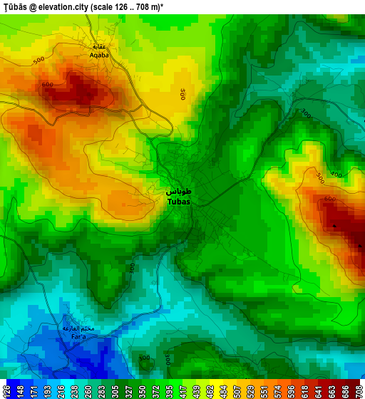
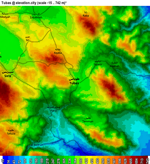
Below is the Elevation map of Ţūbās, which displays elevation range with different colors. Scale of the first map is from 126 to 708 m (413 to 2323 ft) with average elevation of 379.3 meters (=1244 ft) [note 1]
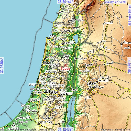
These maps also provides idea of topography and contour of this city, they are displayed at different zoom levels. More info about maps, scale and edge coordinates you can find below images.
| \ | Map #1 | Map #2 | Topo.Map |
| Scale [m] | 126..708 m | -15..742 m | × |
| Scale [ft] | 413..2323 ft | -49..2434 ft | × |
| Average | 379.3 m = 1244 ft | 342.1 m = 1122 ft | × |
| Width | 8.26 km = 5.1 mi | 16.52 km = 10.3 mi | 264.3 km = 164.2 mi |
| Height | 8.26 km = 5.1 mi | 16.52 km = 10.3 mi | 264.3 km = 164.2 mi |
| ↑Max Latitude | 32.358039° | 32.395153° | 33.50144° |
| Latitude at center | 32.32091° | 32.32091° | 32.32091° |
| ↓Min Latitude | 32.283766° | 32.246606° | 31.12479° |
| ← Min Longitude | 35.325945° | 35.281999° | 33.96364° |
| Longitude center | 35.36989° | 35.36989° | 35.36989° |
| →Max Longitude | 35.413835° | 35.457781° | 36.77614° |
Nearby cities:
Cities around Ţūbās sort by population:
• Ţammūn elevation 356 m
4.4 km,  162°
162°
• Maythalūn 381 m
9.5 km,  288°
288°
• Sīrīs 425 m
7.4 km,  276°
276°
• Al Judayyidah 425 m
6.7 km, 284°
• Az Zabābidah 346 m
8.5 km,  329°
329°
• Rābā 494 m
7.4 km,  9°
9°
• Ţallūzah 543 m
9 km,  231°
231°
• Al Bādhān 104 m
7.8 km,  206°
206°
• Tayāsīr 292 m
3.3 km,  48°
48°
• Yāşīd 690 m
9.1 km,  252°
252°
• An Naşşārīyah -16 m
9.5 km,  170°
170°
• Bayt Ḩasan -37 m
9.8 km, 160°
Multilingual:
 En español:
Ţūbās elevación 375 m.
 En France:
Ţūbās élévation 375 m.


Sources and notes:
- [note 1] Map square and city borders are not equal. Map elevation data is calculated only from area inside that square.
- [src 1] Elevation data from geonames database provided with same terms of usage.
- [src 2] The elevation map of Ţūbās is generated using elevation data from NASA's 3 arcsec (90m) resolution SRTM data.
- [src 3] Base (background) map © OpenStreetMap contributors tiles are generated by Geofabrik and OpenTopoMap.
Copyright & License:
This Ţūbās Elevation Map is licensed under CC BY-SA. You may reuse any part from this page, if you give a proper credit by linking to this URL:
 More info on terms of use page.