Chlewiska elevation
Chlewiska (Mazovia, Powiat szydłowiecki), Poland elevation is 220 meters and Chlewiska elevation in feet is 722 ft above sea level [src 1]. Chlewiska is a seat of a third-order administrative division (feature code) with elevation that is 29 meters (95 ft) bigger than average city elevation in Poland.
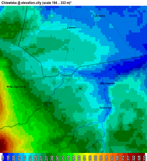
Below is the Elevation map of Chlewiska, which displays elevation range with different colors. Scale of the first map is from 194 to 333 m (636 to 1093 ft) with average elevation of 228.4 meters (=749 ft) [note 1]
These maps also provides idea of topography and contour of this city, they are displayed at different zoom levels. More info about maps, scale and edge coordinates you can find below images.
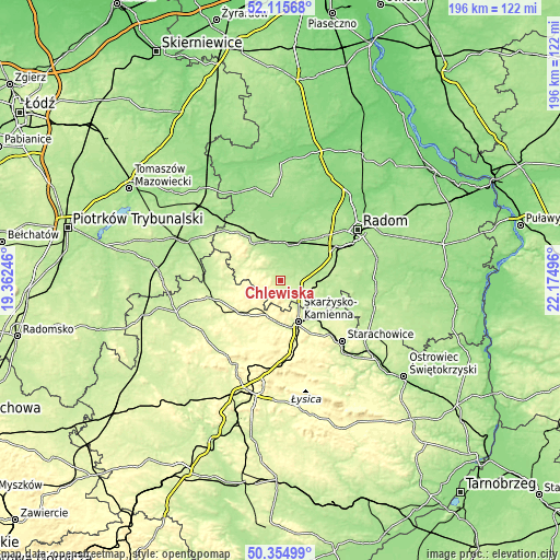
| \ | Map #1 | Topo.Map |
| Scale [m] | 194..333 m | × |
| Scale [ft] | 636..1093 ft | × |
| Average | 228.4 m = 749 ft | × |
| Width | 6.12 km = 3.8 mi | 195.8 km = 121.7 mi |
| Height | 6.12 km = 3.8 mi | 195.8 km = 121.7 mi |
| ↑Max Latitude | 51.271262° | 52.11568° |
| Latitude at center | 51.24376° | 51.24376° |
| ↓Min Latitude | 51.216242° | 50.35499° |
| ← Min Longitude | 20.724765° | 19.36246° |
| Longitude center | 20.76871° | 20.76871° |
| →Max Longitude | 20.812655° | 22.17496° |
Nearby cities:
Cities around Chlewiska sort by population:
• Skarżysko-Kamienna elevation 238 m
16.2 km,  153°
153°
• Szydłowiec 223 m
6.7 km,  105°
105°
• Przysucha 209 m
16 km,  322°
322°
• Stąporków 268 m
18.1 km,  229°
229°
• Skarżysko Kościelne 234 m
15.4 km,  139°
139°
• Bliżyn 265 m
15.1 km,  182°
182°
• Orońsko 179 m
17.3 km,  63°
63°
• Grzybowa Góra 246 m
18.2 km,  132°
132°
• Jastrząb 192 m
12.5 km,  88°
88°
• Wieniawa 170 m
13.2 km,  7°
7°
• Borkowice 224 m
10.4 km,  325°
325°
• Mirów 197 m
19.1 km, 105°
Multilingual:
 En español:
Chlewiska elevación 220 m.
 En France:
Chlewiska élévation 220 m.
 Auf Deutsch:
Chlewiska höhe über dem Meeresspiegel ist 220 m.

Sources and notes:
- [note 1] Map square and city borders are not equal. Map elevation data is calculated only from area inside that square.
- [src 1] Elevation data from geonames database provided with same terms of usage.
- [src 2] The elevation map of Chlewiska is generated using elevation data from NASA's 3 arcsec (90m) resolution SRTM data.
- [src 3] Base (background) map © OpenStreetMap contributors tiles are generated by Geofabrik and OpenTopoMap.
Copyright & License:
This Chlewiska Elevation Map is licensed under CC BY-SA. You may reuse any part from this page, if you give a proper credit by linking to this URL:
 More info on terms of use page.