Stąporków elevation
Stąporków (Świętokrzyskie, Powiat konecki), Poland elevation is 268 meters and Stąporków elevation in feet is 879 ft above sea level [src 1]. Stąporków is a seat of a third-order administrative division (feature code) with elevation that is 77 meters (253 ft) bigger than average city elevation in Poland.
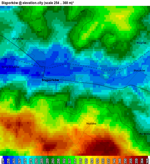
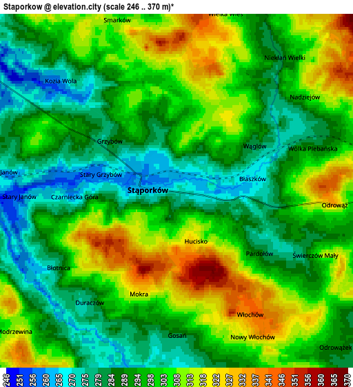
Below is the Elevation map of Stąporków, which displays elevation range with different colors. Scale of the first map is from 254 to 368 m (833 to 1207 ft) with average elevation of 297.1 meters (=975 ft) [note 1]
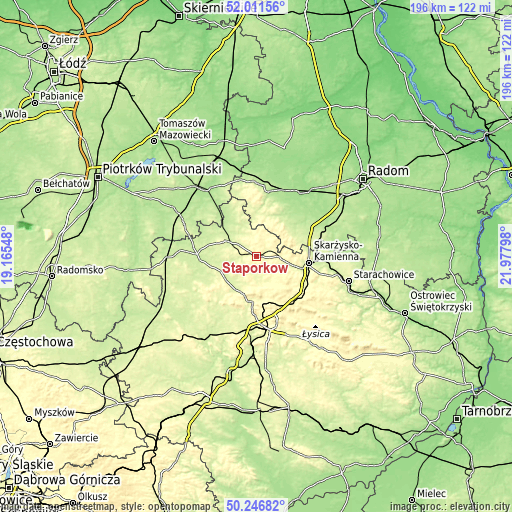
These maps also provides idea of topography and contour of this city, they are displayed at different zoom levels. More info about maps, scale and edge coordinates you can find below images.
| \ | Map #1 | Map #2 | Topo.Map |
| Scale [m] | 254..368 m | 246..370 m | × |
| Scale [ft] | 833..1207 ft | 807..1214 ft | × |
| Average | 297.1 m = 975 ft | 297.4 m = 976 ft | × |
| Width | 6.13 km = 3.8 mi | 12.26 km = 7.6 mi | 196.2 km = 121.9 mi |
| Height | 6.13 km = 3.8 mi | 12.26 km = 7.6 mi | 196.2 km = 121.9 mi |
| ↑Max Latitude | 51.165185° | 51.192734° | 52.01156° |
| Latitude at center | 51.13762° | 51.13762° | 51.13762° |
| ↓Min Latitude | 51.110038° | 51.08244° | 50.24682° |
| ← Min Longitude | 20.527785° | 20.483839° | 19.16548° |
| Longitude center | 20.57173° | 20.57173° | 20.57173° |
| →Max Longitude | 20.615675° | 20.659621° | 21.97798° |
Nearby cities:
Cities around Stąporków sort by population:
• Skarżysko-Kamienna elevation 238 m
21.1 km,  97°
97°
• Końskie 249 m
13 km,  297°
297°
• Suchedniów 265 m
20.6 km,  119°
119°
• Bliżyn 265 m
13.5 km, 104°
• Mniów 275 m
15.2 km,  203°
203°
• Zagnańsk 319 m
18.6 km,  159°
159°
• Gowarczów 235 m
18.2 km,  329°
329°
• Rogów 236 m
12.1 km,  307°
307°
• Kaniów 314 m
18.1 km, 159°
• Chlewiska 220 m
18.1 km,  49°
49°
• Borkowice 224 m
21.7 km,  20°
20°
• Smyków 291 m
15.8 km,  229°
229°
Multilingual:
 En español:
Stąporków elevación 268 m.
 En France:
Stąporków élévation 268 m.
 Auf Deutsch:
Stąporków höhe über dem Meeresspiegel ist 268 m.

Sources and notes:
- [note 1] Map square and city borders are not equal. Map elevation data is calculated only from area inside that square.
- [src 1] Elevation data from geonames database provided with same terms of usage.
- [src 2] The elevation map of Stąporków is generated using elevation data from NASA's 3 arcsec (90m) resolution SRTM data.
- [src 3] Base (background) map © OpenStreetMap contributors tiles are generated by Geofabrik and OpenTopoMap.
Copyright & License:
This Stąporków Elevation Map is licensed under CC BY-SA. You may reuse any part from this page, if you give a proper credit by linking to this URL:
 More info on terms of use page.