Przysucha elevation
Przysucha (Mazovia, Powiat przysuski), Poland elevation is 209 meters and Przysucha elevation in feet is 686 ft above sea level [src 1]. Przysucha is a seat of a second-order administrative division (feature code) with elevation that is 18 meters (59 ft) bigger than average city elevation in Poland.
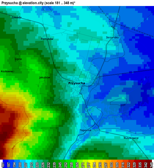
Below is the Elevation map of Przysucha, which displays elevation range with different colors. Scale of the first map is from 181 to 348 m (594 to 1142 ft) with average elevation of 223.2 meters (=732 ft) [note 1]
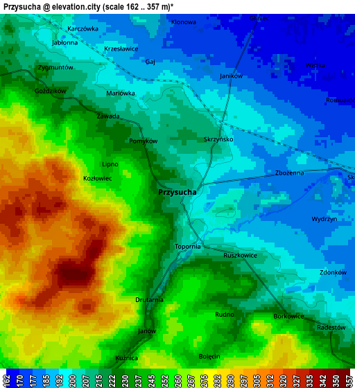
These maps also provides idea of topography and contour of this city, they are displayed at different zoom levels. More info about maps, scale and edge coordinates you can find below images.
| \ | Map #1 | Map #2 | Topo.Map |
| Scale [m] | 181..348 m | 162..357 m | × |
| Scale [ft] | 594..1142 ft | 531..1171 ft | × |
| Average | 223.2 m = 732 ft | 226.5 m = 743 ft | × |
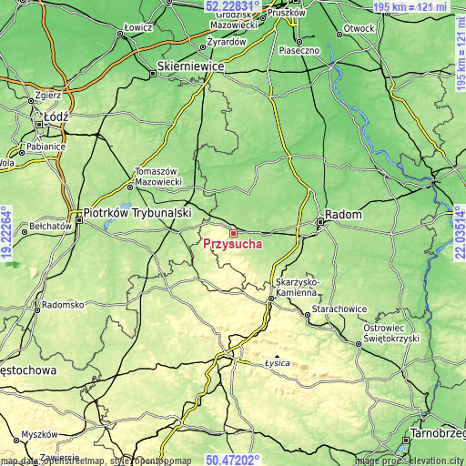
| Width | 6.1 km = 3.8 mi | 12.2 km = 7.6 mi | 195.3 km = 121.4 mi |
| Height | 6.1 km = 3.8 mi | 12.2 km = 7.6 mi | 195.3 km = 121.4 mi |
| ↑Max Latitude | 51.386013° | 51.41343° | 52.22831° |
| Latitude at center | 51.35858° | 51.35858° | 51.35858° |
| ↓Min Latitude | 51.33113° | 51.303664° | 50.47202° |
| ← Min Longitude | 20.584945° | 20.540999° | 19.22264° |
| Longitude center | 20.62889° | 20.62889° | 20.62889° |
| →Max Longitude | 20.672835° | 20.716781° | 22.03514° |
Nearby cities:
Cities around Przysucha sort by population:
• Szydłowiec elevation 223 m
21.7 km,  131°
131°
• Drzewica 161 m
14.7 km,  314°
314°
• Odrzywół 146 m
18.6 km,  344°
344°
• Gowarczów 235 m
16 km,  236°
236°
• Rogów 236 m
21.8 km,  218°
218°
• Gielniów 199 m
11.3 km,  294°
294°
• Chlewiska 220 m
16 km,  142°
142°
• Potworów 175 m
17.9 km,  21°
21°
• Rusinów 170 m
9.2 km, 341°
• Wieniawa 170 m
11.5 km,  88°
88°
• Borkowice 224 m
5.7 km, 138°
• Klwów 158 m
19.6 km,  1°
1°
Multilingual:
 En español:
Przysucha elevación 209 m.
 En France:
Przysucha élévation 209 m.
 Auf Deutsch:
Przysucha höhe über dem Meeresspiegel ist 209 m.

Sources and notes:
- [note 1] Map square and city borders are not equal. Map elevation data is calculated only from area inside that square.
- [src 1] Elevation data from geonames database provided with same terms of usage.
- [src 2] The elevation map of Przysucha is generated using elevation data from NASA's 3 arcsec (90m) resolution SRTM data.
- [src 3] Base (background) map © OpenStreetMap contributors tiles are generated by Geofabrik and OpenTopoMap.
Copyright & License:
This Przysucha Elevation Map is licensed under CC BY-SA. You may reuse any part from this page, if you give a proper credit by linking to this URL:
 More info on terms of use page.