Jasieniec elevation
Jasieniec (Mazovia, Powiat grójecki), Poland elevation is 137 meters and Jasieniec elevation in feet is 449 ft above sea level [src 1]. Jasieniec is a populated place (feature code) with elevation that is 54 meters (177 ft) smaller than average city elevation in Poland.
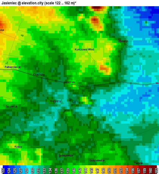
Below is the Elevation map of Jasieniec, which displays elevation range with different colors. Scale of the first map is from 122 to 162 m (400 to 531 ft) with average elevation of 136.1 meters (=447 ft) [note 1]
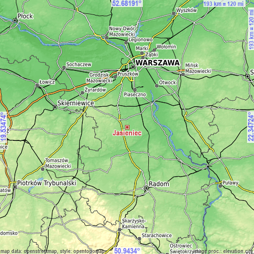
These maps also provides idea of topography and contour of this city, they are displayed at different zoom levels. More info about maps, scale and edge coordinates you can find below images.
| \ | Map #1 | Topo.Map |
| Scale [m] | 122..162 m | × |
| Scale [ft] | 400..531 ft | × |
| Average | 136.1 m = 447 ft | × |
| Width | 6.04 km = 3.8 mi | 193.3 km = 120.1 mi |
| Height | 6.04 km = 3.8 mi | 193.3 km = 120.1 mi |
| ↑Max Latitude | 51.848195° | 52.68191° |
| Latitude at center | 51.82104° | 51.82104° |
| ↓Min Latitude | 51.793868° | 50.9434° |
| ← Min Longitude | 20.897045° | 19.53474° |
| Longitude center | 20.94099° | 20.94099° |
| →Max Longitude | 20.984935° | 22.34724° |
Nearby cities:
Cities around Jasieniec sort by population:
• Grójec elevation 153 m
6.8 km,  312°
312°
• Warka 115 m
17.7 km,  103°
103°
• Białobrzegi 114 m
19.4 km,  178°
178°
• Tarczyn 145 m
19.3 km,  337°
337°
• Sułkowice 112 m
15.2 km,  41°
41°
• Błędów 156 m
17.4 km,  253°
253°
• Goszczyn 142 m
11.7 km,  211°
211°
• Prażmów 120 m
13.3 km,  4°
4°
• Chynów 118 m
13.4 km,  46°
46°
• Promna 118 m
15.7 km, 175°
• Pniewy 174 m
17 km, 307°
• Belsk Duży 176 m
9.1 km,  273°
273°
Multilingual:
 En español:
Jasieniec elevación 137 m.
 En France:
Jasieniec élévation 137 m.
 Auf Deutsch:
Jasieniec höhe über dem Meeresspiegel ist 137 m.

Sources and notes:
- [note 1] Map square and city borders are not equal. Map elevation data is calculated only from area inside that square.
- [src 1] Elevation data from geonames database provided with same terms of usage.
- [src 2] The elevation map of Jasieniec is generated using elevation data from NASA's 3 arcsec (90m) resolution SRTM data.
- [src 3] Base (background) map © OpenStreetMap contributors tiles are generated by Geofabrik and OpenTopoMap.
Copyright & License:
This Jasieniec Elevation Map is licensed under CC BY-SA. You may reuse any part from this page, if you give a proper credit by linking to this URL:
 More info on terms of use page.