Warka elevation
Warka (Mazovia, Powiat grójecki), Poland elevation is 115 meters and Warka elevation in feet is 377 ft above sea level [src 1]. Warka is a seat of a third-order administrative division (feature code) with elevation that is 76 meters (249 ft) smaller than average city elevation in Poland.
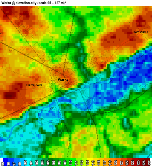
Below is the Elevation map of Warka, which displays elevation range with different colors. Scale of the first map is from 95 to 127 m (312 to 417 ft) with average elevation of 110.5 meters (=363 ft) [note 1]
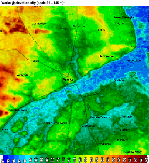
These maps also provides idea of topography and contour of this city, they are displayed at different zoom levels. More info about maps, scale and edge coordinates you can find below images.
| \ | Map #1 | Map #2 | Topo.Map |
| Scale [m] | 95..127 m | 91..145 m | × |
| Scale [ft] | 312..417 ft | 299..476 ft | × |
| Average | 110.5 m = 363 ft | 112.9 m = 370 ft | × |
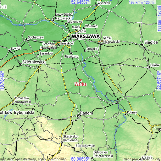
| Width | 6.05 km = 3.8 mi | 12.09 km = 7.5 mi | 193.5 km = 120.2 mi |
| Height | 6.05 km = 3.8 mi | 12.09 km = 7.5 mi | 193.4 km = 120.2 mi |
| ↑Max Latitude | 51.811477° | 51.838638° | 52.64587° |
| Latitude at center | 51.7843° | 51.7843° | 51.7843° |
| ↓Min Latitude | 51.757106° | 51.729896° | 50.90595° |
| ← Min Longitude | 21.146965° | 21.103019° | 19.78466° |
| Longitude center | 21.19091° | 21.19091° | 21.19091° |
| →Max Longitude | 21.234855° | 21.278801° | 22.59716° |
Nearby cities:
Cities around Warka sort by population:
• Grójec elevation 153 m
23.9 km,  291°
291°
• Góra Kalwaria 113 m
21.4 km,  4°
4°
• Białobrzegi 114 m
22.5 km,  227°
227°
• Ryczywół 105 m
19 km,  123°
123°
• Jasieniec 137 m
17.7 km,  283°
283°
• Sułkowice 112 m
16.9 km,  335°
335°
• Wilga 98 m
14.9 km,  59°
59°
• Stromiec 130 m
16.7 km,  203°
203°
• Sobienie Jeziory 97 m
18.2 km,  25°
25°
• Prażmów 120 m
23.8 km,  316°
316°
• Chynów 118 m
15.3 km,  330°
330°
• Promna 118 m
19.7 km, 234°
Multilingual:
 En español:
Warka elevación 115 m.
 En France:
Warka élévation 115 m.


Sources and notes:
- [note 1] Map square and city borders are not equal. Map elevation data is calculated only from area inside that square.
- [src 1] Elevation data from geonames database provided with same terms of usage.
- [src 2] The elevation map of Warka is generated using elevation data from NASA's 3 arcsec (90m) resolution SRTM data.
- [src 3] Base (background) map © OpenStreetMap contributors tiles are generated by Geofabrik and OpenTopoMap.
Copyright & License:
This Warka Elevation Map is licensed under CC BY-SA. You may reuse any part from this page, if you give a proper credit by linking to this URL:
 More info on terms of use page.