Ostrołęka elevation
Ostrołęka (Mazovia), Poland elevation is 97 meters and Ostrołęka elevation in feet is 318 ft above sea level [src 1]. Ostrołęka is a seat of a third-order administrative division (feature code) with elevation that is 94 meters (308 ft) smaller than average city elevation in Poland.
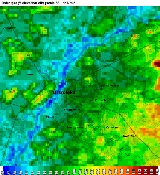
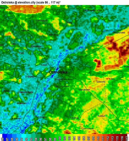
Below is the Elevation map of Ostrołęka, which displays elevation range with different colors. Scale of the first map is from 86 to 116 m (282 to 381 ft) with average elevation of 96.3 meters (=316 ft) [note 1]
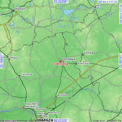
These maps also provides idea of topography and contour of this city, they are displayed at different zoom levels. More info about maps, scale and edge coordinates you can find below images.
| \ | Map #1 | Map #2 | Topo.Map |
| Scale [m] | 86..116 m | 86..117 m | × |
| Scale [ft] | 282..381 ft | 282..384 ft | × |
| Average | 96.3 m = 316 ft | 98 m = 322 ft | × |
| Width | 5.87 km = 3.6 mi | 11.74 km = 7.3 mi | 187.8 km = 116.7 mi |
| Height | 5.87 km = 3.6 mi | 11.74 km = 7.3 mi | 187.8 km = 116.7 mi |
| ↑Max Latitude | 53.112596° | 53.138966° | 53.92256° |
| Latitude at center | 53.08621° | 53.08621° | 53.08621° |
| ↓Min Latitude | 53.059808° | 53.033389° | 52.23329° |
| ← Min Longitude | 21.531715° | 21.487769° | 20.16941° |
| Longitude center | 21.57566° | 21.57566° | 21.57566° |
| →Max Longitude | 21.619605° | 21.663551° | 22.98191° |
Nearby cities:
Cities around Ostrołęka sort by population:
• Kadzidło elevation 120 m
18.1 km,  335°
335°
• Różan 116 m
25.3 km,  209°
209°
• Nowogród 126 m
25.7 km,  52°
52°
• Rzekuń 104 m
5.2 km,  145°
145°
• Śniadowo 126 m
28.2 km,  100°
100°
• Baranowo 108 m
21 km,  298°
298°
• Zbójna 107 m
22.5 km,  39°
39°
• Goworowo 97 m
20.7 km,  183°
183°
• Czerwin 107 m
19.5 km,  141°
141°
• Troszyn 110 m
12 km,  120°
120°
• Sypniewo 103 m
20 km,  243°
243°
• Młynarze 93 m
18.3 km,  216°
216°
Multilingual:
 En español:
Ostrołęka elevación 97 m.
 En France:
Ostrołęka élévation 97 m.
 Auf Deutsch:
Ostrołęka höhe über dem Meeresspiegel ist 97 m.

Sources and notes:
- [note 1] Map square and city borders are not equal. Map elevation data is calculated only from area inside that square.
- [src 1] Elevation data from geonames database provided with same terms of usage.
- [src 2] The elevation map of Ostrołęka is generated using elevation data from NASA's 3 arcsec (90m) resolution SRTM data.
- [src 3] Base (background) map © OpenStreetMap contributors tiles are generated by Geofabrik and OpenTopoMap.
Copyright & License:
This Ostrołęka Elevation Map is licensed under CC BY-SA. You may reuse any part from this page, if you give a proper credit by linking to this URL:
 More info on terms of use page.