Kadzidło elevation
Kadzidło (Mazovia, Powiat ostrołęcki), Poland elevation is 120 meters and Kadzidło elevation in feet is 394 ft above sea level [src 1]. Kadzidło is a seat of a third-order administrative division (feature code) with elevation that is 71 meters (233 ft) smaller than average city elevation in Poland.
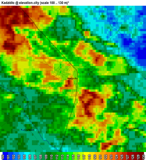
Below is the Elevation map of Kadzidło, which displays elevation range with different colors. Scale of the first map is from 100 to 130 m (328 to 427 ft) with average elevation of 113 meters (=371 ft) [note 1]
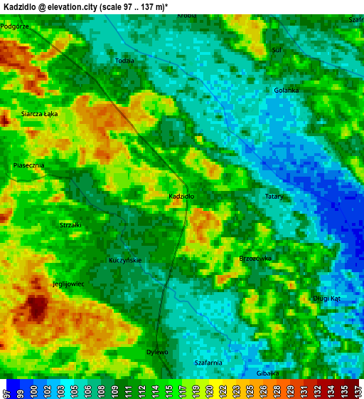
These maps also provides idea of topography and contour of this city, they are displayed at different zoom levels. More info about maps, scale and edge coordinates you can find below images.
| \ | Map #1 | Map #2 | Topo.Map |
| Scale [m] | 100..130 m | 97..137 m | × |
| Scale [ft] | 328..427 ft | 318..449 ft | × |
| Average | 113 m = 371 ft | 112.1 m = 368 ft | × |
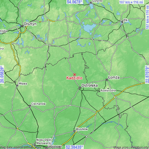
| Width | 5.85 km = 3.6 mi | 11.7 km = 7.3 mi | 187.2 km = 116.3 mi |
| Height | 5.85 km = 3.6 mi | 11.7 km = 7.3 mi | 187.2 km = 116.3 mi |
| ↑Max Latitude | 53.260645° | 53.286924° | 54.0678° |
| Latitude at center | 53.23435° | 53.23435° | 53.23435° |
| ↓Min Latitude | 53.208039° | 53.181711° | 52.38435° |
| ← Min Longitude | 21.420595° | 21.376649° | 20.05829° |
| Longitude center | 21.46454° | 21.46454° | 21.46454° |
| →Max Longitude | 21.508485° | 21.552431° | 22.87079° |
Nearby cities:
Cities around Kadzidło sort by population:
• Ostrołęka elevation 97 m
18.1 km,  155°
155°
• Myszyniec 124 m
18 km,  334°
334°
• Łyse 119 m
15.9 km,  24°
24°
• Nowogród 126 m
27.8 km,  91°
91°
• Jednorożec 117 m
29.4 km,  249°
249°
• Rzekuń 104 m
23.2 km,  153°
153°
• Rozogi 130 m
28.7 km,  346°
346°
• Baranowo 108 m
12.9 km,  239°
239°
• Zbójna 107 m
21.6 km, 87°
• Troszyn 110 m
28.7 km,  141°
141°
• Sypniewo 103 m
27.5 km,  202°
202°
• Czarnia 124 m
22.4 km,  307°
307°
Multilingual:
 En español:
Kadzidło elevación 120 m.
 En France:
Kadzidło élévation 120 m.
 Auf Deutsch:
Kadzidło höhe über dem Meeresspiegel ist 120 m.

Sources and notes:
- [note 1] Map square and city borders are not equal. Map elevation data is calculated only from area inside that square.
- [src 1] Elevation data from geonames database provided with same terms of usage.
- [src 2] The elevation map of Kadzidło is generated using elevation data from NASA's 3 arcsec (90m) resolution SRTM data.
- [src 3] Base (background) map © OpenStreetMap contributors tiles are generated by Geofabrik and OpenTopoMap.
Copyright & License:
This Kadzidło Elevation Map is licensed under CC BY-SA. You may reuse any part from this page, if you give a proper credit by linking to this URL:
 More info on terms of use page.