Radom elevation
Radom (Mazovia), Poland elevation is 159 meters and Radom elevation in feet is 522 ft above sea level [src 1]. Radom is a seat of a second-order administrative division (feature code) with elevation that is 32 meters (105 ft) smaller than average city elevation in Poland.
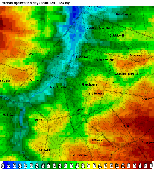
Below is the Elevation map of Radom, which displays elevation range with different colors. Scale of the first map is from 139 to 188 m (456 to 617 ft) with average elevation of 164.2 meters (=539 ft) [note 1]
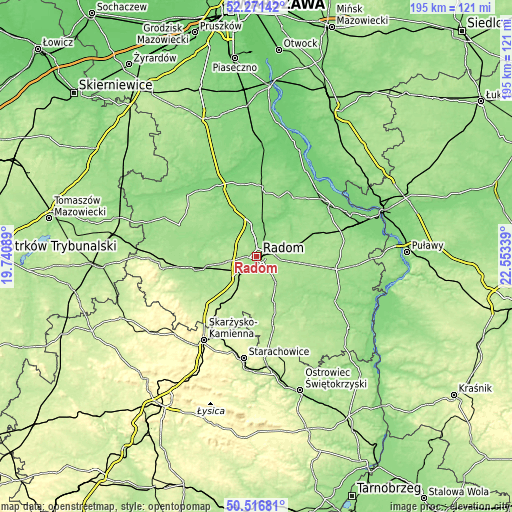
These maps also provides idea of topography and contour of this city, they are displayed at different zoom levels. More info about maps, scale and edge coordinates you can find below images.
| \ | Map #1 | Map #2 | Topo.Map |
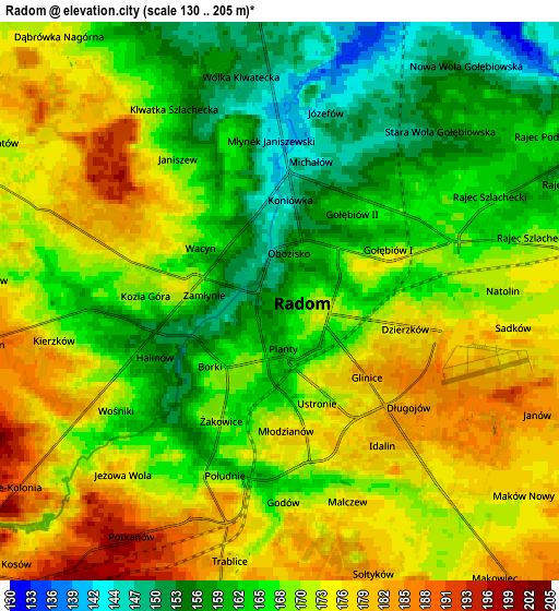
| Scale [m] | 139..188 m | 130..205 m | × |
| Scale [ft] | 456..617 ft | 427..673 ft | × |
| Average | 164.2 m = 539 ft | 168.7 m = 553 ft | × |
| Width | 6.1 km = 3.8 mi | 12.19 km = 7.6 mi | 195.1 km = 121.2 mi |
| Height | 6.1 km = 3.8 mi | 12.19 km = 7.6 mi | 195.1 km = 121.2 mi |
| ↑Max Latitude | 51.429937° | 51.457327° | 52.27142° |
| Latitude at center | 51.40253° | 51.40253° | 51.40253° |
| ↓Min Latitude | 51.375107° | 51.347667° | 50.51681° |
| ← Min Longitude | 21.103195° | 21.059249° | 19.74089° |
| Longitude center | 21.14714° | 21.14714° | 21.14714° |
| →Max Longitude | 21.191085° | 21.235031° | 22.55339° |
Nearby cities:
Cities around Radom sort by population:
• Skaryszew elevation 176 m
12.5 km,  144°
144°
• Wierzbica 203 m
17.6 km,  194°
194°
• Jedlnia-Letnisko 157 m
13.4 km,  76°
76°
• Jedlińsk 127 m
12.6 km,  350°
350°
• Trablice 179 m
5.7 km, 192°
• Orońsko 179 m
14.7 km,  227°
227°
• Kowala 191 m
10.2 km,  211°
211°
• Jastrzębia 145 m
12.3 km,  30°
30°
• Przytyk 146 m
18.1 km,  292°
292°
• Gózd 171 m
16.3 km,  99°
99°
• Wolanów 184 m
12.1 km,  258°
258°
• Zakrzew 161 m
11 km, 292°
Multilingual:
 En español:
Radom elevación 159 m.
 En France:
Radom élévation 159 m.


Sources and notes:
- [note 1] Map square and city borders are not equal. Map elevation data is calculated only from area inside that square.
- [src 1] Elevation data from geonames database provided with same terms of usage.
- [src 2] The elevation map of Radom is generated using elevation data from NASA's 3 arcsec (90m) resolution SRTM data.
- [src 3] Base (background) map © OpenStreetMap contributors tiles are generated by Geofabrik and OpenTopoMap.
Copyright & License:
This Radom Elevation Map is licensed under CC BY-SA. You may reuse any part from this page, if you give a proper credit by linking to this URL:
 More info on terms of use page.