Gózd elevation
Gózd (Mazovia, Powiat radomski), Poland elevation is 171 meters and Gózd elevation in feet is 561 ft above sea level [src 1]. Gózd is a seat of a third-order administrative division (feature code) with elevation that is 20 meters (66 ft) smaller than average city elevation in Poland.
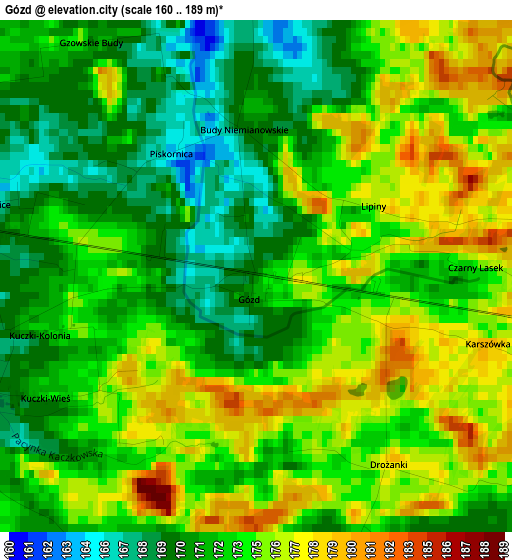
Below is the Elevation map of Gózd, which displays elevation range with different colors. Scale of the first map is from 160 to 189 m (525 to 620 ft) with average elevation of 173.2 meters (=568 ft) [note 1]
These maps also provides idea of topography and contour of this city, they are displayed at different zoom levels. More info about maps, scale and edge coordinates you can find below images.
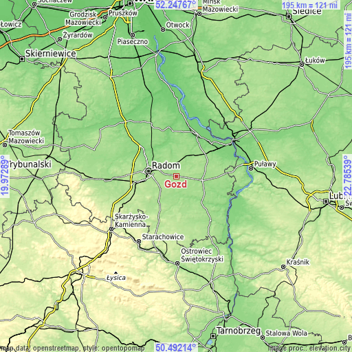
| \ | Map #1 | Topo.Map |
| Scale [m] | 160..189 m | × |
| Scale [ft] | 525..620 ft | × |
| Average | 173.2 m = 568 ft | × |
| Width | 6.1 km = 3.8 mi | 195.2 km = 121.3 mi |
| Height | 6.1 km = 3.8 mi | 195.2 km = 121.3 mi |
| ↑Max Latitude | 51.405741° | 52.24767° |
| Latitude at center | 51.37832° | 51.37832° |
| ↓Min Latitude | 51.350882° | 50.49214° |
| ← Min Longitude | 21.335195° | 19.97289° |
| Longitude center | 21.37914° | 21.37914° |
| →Max Longitude | 21.423085° | 22.78539° |
Nearby cities:
Cities around Gózd sort by population:
• Radom elevation 159 m
16.3 km,  279°
279°
• Pionki 145 m
11.9 km,  24°
24°
• Zwoleń 153 m
14.7 km,  99°
99°
• Skaryszew 176 m
11.6 km,  229°
229°
• Jedlnia-Letnisko 157 m
6.6 km,  332°
332°
• Garbatka-Letnisko 153 m
19.8 km,  54°
54°
• Policzna 161 m
19.2 km,  63°
63°
• Trablice 179 m
17.6 km,  260°
260°
• Jastrzębia 145 m
16.5 km,  323°
323°
• Ciepielów 148 m
19.8 km,  136°
136°
• Tczów 170 m
7.5 km, 141°
• Kazanów 153 m
12.9 km,  151°
151°
Multilingual:
 En español:
Gózd elevación 171 m.
 En France:
Gózd élévation 171 m.


Sources and notes:
- [note 1] Map square and city borders are not equal. Map elevation data is calculated only from area inside that square.
- [src 1] Elevation data from geonames database provided with same terms of usage.
- [src 2] The elevation map of Gózd is generated using elevation data from NASA's 3 arcsec (90m) resolution SRTM data.
- [src 3] Base (background) map © OpenStreetMap contributors tiles are generated by Geofabrik and OpenTopoMap.
Copyright & License:
This Gózd Elevation Map is licensed under CC BY-SA. You may reuse any part from this page, if you give a proper credit by linking to this URL:
 More info on terms of use page.