Tomaszów Mazowiecki elevation
Tomaszów Mazowiecki (Łódź Voivodeship, Powiat tomaszowski), Poland elevation is 164 meters and Tomaszów Mazowiecki elevation in feet is 538 ft above sea level [src 1]. Tomaszów Mazowiecki is a seat of a second-order administrative division (feature code) with elevation that is 27 meters (89 ft) smaller than average city elevation in Poland.
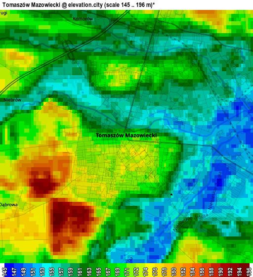
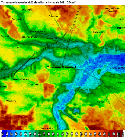
Below is the Elevation map of Tomaszów Mazowiecki, which displays elevation range with different colors. Scale of the first map is from 145 to 196 m (476 to 643 ft) with average elevation of 164.8 meters (=541 ft) [note 1]
These maps also provides idea of topography and contour of this city, they are displayed at different zoom levels. More info about maps, scale and edge coordinates you can find below images.
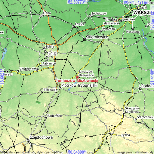
| \ | Map #1 | Map #2 | Topo.Map |
| Scale [m] | 145..196 m | 142..204 m | × |
| Scale [ft] | 476..643 ft | 466..669 ft | × |
| Average | 164.8 m = 541 ft | 172.6 m = 566 ft | × |
| Width | 6.08 km = 3.8 mi | 12.16 km = 7.6 mi | 194.5 km = 120.9 mi |
| Height | 6.08 km = 3.8 mi | 12.16 km = 7.6 mi | 194.5 km = 120.9 mi |
| ↑Max Latitude | 51.55864° | 51.585953° | 52.39773° |
| Latitude at center | 51.53131° | 51.53131° | 51.53131° |
| ↓Min Latitude | 51.503964° | 51.476602° | 50.64808° |
| ← Min Longitude | 19.964605° | 19.920659° | 18.6023° |
| Longitude center | 20.00855° | 20.00855° | 20.00855° |
| →Max Longitude | 20.052495° | 20.096441° | 21.4148° |
Nearby cities:
Cities around Tomaszów Mazowiecki sort by population:
• Wolbórz elevation 171 m
12.7 km,  255°
255°
• Moszczenica 191 m
20.2 km, 261°
• Ujazd 174 m
9.5 km,  321°
321°
• Budziszewice 201 m
15.9 km,  341°
341°
• Inowłódz 152 m
14.8 km,  91°
91°
• Czerniewice 175 m
17 km,  36°
36°
• Rokiciny 197 m
19.5 km,  312°
312°
• Lubochnia 176 m
9.1 km,  20°
20°
• Będków 184 m
19 km,  289°
289°
• Mniszków 220 m
18 km,  173°
173°
• Żelechlinek 187 m
20.2 km,  5°
5°
• Sławno 212 m
17.9 km,  149°
149°
Multilingual:
 En español:
Tomaszów Mazowiecki elevación 164 m.
 En France:
Tomaszów Mazowiecki élévation 164 m.
 Auf Deutsch:
Tomaszów Mazowiecki höhe über dem Meeresspiegel ist 164 m.
 На русском:
Томашув-Мазовецкий высота над уровнем моря 164 м
Sources and notes:
- [note 1] Map square and city borders are not equal. Map elevation data is calculated only from area inside that square.
- [src 1] Elevation data from geonames database provided with same terms of usage.
- [src 2] The elevation map of Tomaszów Mazowiecki is generated using elevation data from NASA's 3 arcsec (90m) resolution SRTM data.
- [src 3] Base (background) map © OpenStreetMap contributors tiles are generated by Geofabrik and OpenTopoMap.
Copyright & License:
This Tomaszów Mazowiecki Elevation Map is licensed under CC BY-SA. You may reuse any part from this page, if you give a proper credit by linking to this URL:
 More info on terms of use page.