Wolbórz elevation
Wolbórz (Łódź Voivodeship, Powiat piotrkowski), Poland elevation is 171 meters and Wolbórz elevation in feet is 561 ft above sea level [src 1]. Wolbórz is a seat of a third-order administrative division (feature code) with elevation that is 20 meters (66 ft) smaller than average city elevation in Poland.
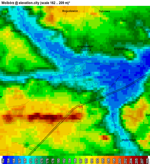
Below is the Elevation map of Wolbórz, which displays elevation range with different colors. Scale of the first map is from 162 to 209 m (531 to 686 ft) with average elevation of 180.9 meters (=594 ft) [note 1]
These maps also provides idea of topography and contour of this city, they are displayed at different zoom levels. More info about maps, scale and edge coordinates you can find below images.
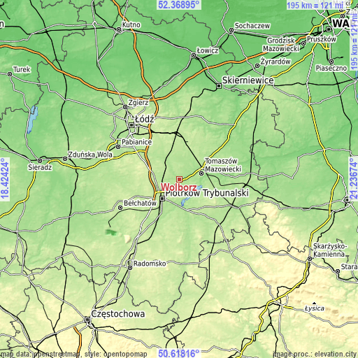
| \ | Map #1 | Topo.Map |
| Scale [m] | 162..209 m | × |
| Scale [ft] | 531..686 ft | × |
| Average | 180.9 m = 594 ft | × |
| Width | 6.08 km = 3.8 mi | 194.7 km = 121 mi |
| Height | 6.08 km = 3.8 mi | 194.7 km = 121 mi |
| ↑Max Latitude | 51.529307° | 52.36895° |
| Latitude at center | 51.50196° | 51.50196° |
| ↓Min Latitude | 51.474596° | 50.61816° |
| ← Min Longitude | 19.786545° | 18.42424° |
| Longitude center | 19.83049° | 19.83049° |
| →Max Longitude | 19.874435° | 21.23674° |
Nearby cities:
Cities around Wolbórz sort by population:
• Piotrków Trybunalski elevation 194 m
13.9 km,  219°
219°
• Tomaszów Mazowiecki 164 m
12.7 km,  75°
75°
• Sulejów 168 m
16.8 km,  166°
166°
• Moszczenica 191 m
7.7 km,  270°
270°
• Ujazd 174 m
12.4 km,  30°
30°
• Rokiciny-Kolonia 202 m
18.4 km,  349°
349°
• Czarnocin 207 m
14.3 km,  314°
314°
• Budziszewice 201 m
19.8 km,  21°
21°
• Rokiciny 197 m
16.7 km, 353°
• Lubochnia 176 m
19.4 km,  52°
52°
• Będków 184 m
11 km,  329°
329°
• Mniszków 220 m
20.6 km,  135°
135°
Multilingual:
 En español:
Wolbórz elevación 171 m.
 En France:
Wolbórz élévation 171 m.


Sources and notes:
- [note 1] Map square and city borders are not equal. Map elevation data is calculated only from area inside that square.
- [src 1] Elevation data from geonames database provided with same terms of usage.
- [src 2] The elevation map of Wolbórz is generated using elevation data from NASA's 3 arcsec (90m) resolution SRTM data.
- [src 3] Base (background) map © OpenStreetMap contributors tiles are generated by Geofabrik and OpenTopoMap.
Copyright & License:
This Wolbórz Elevation Map is licensed under CC BY-SA. You may reuse any part from this page, if you give a proper credit by linking to this URL:
 More info on terms of use page.