Częstochowa elevation
Częstochowa (Silesia), Poland elevation is 253 meters and Częstochowa elevation in feet is 830 ft above sea level [src 1]. Częstochowa is a seat of a third-order administrative division (feature code) with elevation that is 62 meters (203 ft) bigger than average city elevation in Poland.
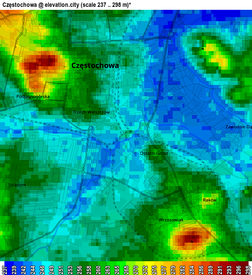
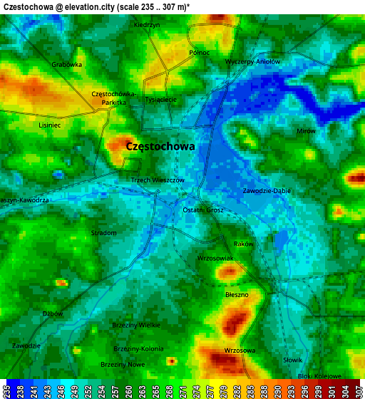
Below is the Elevation map of Częstochowa, which displays elevation range with different colors. Scale of the first map is from 237 to 298 m (778 to 978 ft) with average elevation of 253.5 meters (=832 ft) [note 1]
These maps also provides idea of topography and contour of this city, they are displayed at different zoom levels. More info about maps, scale and edge coordinates you can find below images.
| \ | Map #1 | Map #2 | Topo.Map |
| Scale [m] | 237..298 m | 235..307 m | × |
| Scale [ft] | 778..978 ft | 771..1007 ft | × |
| Average | 253.5 m = 832 ft | 259 m = 850 ft | × |
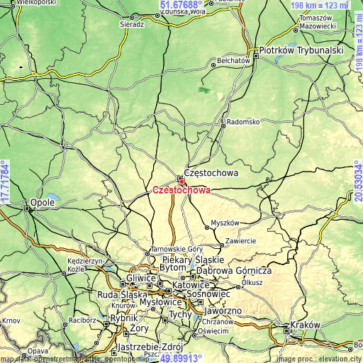
| Width | 6.18 km = 3.8 mi | 12.35 km = 7.7 mi | 197.7 km = 122.8 mi |
| Height | 6.18 km = 3.8 mi | 12.35 km = 7.7 mi | 197.7 km = 122.8 mi |
| ↑Max Latitude | 50.824229° | 50.851981° | 51.67688° |
| Latitude at center | 50.79646° | 50.79646° | 50.79646° |
| ↓Min Latitude | 50.768675° | 50.740873° | 49.89913° |
| ← Min Longitude | 19.080145° | 19.036199° | 17.71784° |
| Longitude center | 19.12409° | 19.12409° | 19.12409° |
| →Max Longitude | 19.168035° | 19.211981° | 20.53034° |
Nearby cities:
Cities around Częstochowa sort by population:
• Blachownia elevation 262 m
11.4 km,  260°
260°
• Rędziny 278 m
9.5 km,  42°
42°
• Poraj 273 m
14.6 km,  154°
154°
• Konopiska 279 m
11.3 km,  226°
226°
• Olsztyn 298 m
11.2 km,  116°
116°
• Huta Stara B 290 m
6.5 km,  174°
174°
• Rudniki 254 m
12.5 km, 43°
• Kościelec 237 m
12.9 km,  29°
29°
• Mstów 237 m
11.9 km,  71°
71°
• Kalej 287 m
10.8 km,  294°
294°
• Kamienica Polska 271 m
14 km,  180°
180°
• Kamyk 228 m
13.5 km,  330°
330°
Multilingual:
 En español:
Częstochowa elevación 253 m.
 En France:
Częstochowa élévation 253 m.
 Auf Deutsch:
Czenstochau höhe über dem Meeresspiegel ist 253 m.

Sources and notes:
- [note 1] Map square and city borders are not equal. Map elevation data is calculated only from area inside that square.
- [src 1] Elevation data from geonames database provided with same terms of usage.
- [src 2] The elevation map of Częstochowa is generated using elevation data from NASA's 3 arcsec (90m) resolution SRTM data.
- [src 3] Base (background) map © OpenStreetMap contributors tiles are generated by Geofabrik and OpenTopoMap.
Copyright & License:
This Częstochowa Elevation Map is licensed under CC BY-SA. You may reuse any part from this page, if you give a proper credit by linking to this URL:
 More info on terms of use page.