Poraj elevation
Poraj (Silesia, Powiat myszkowski), Poland elevation is 273 meters and Poraj elevation in feet is 896 ft above sea level [src 1]. Poraj is a populated place (feature code) with elevation that is 82 meters (269 ft) bigger than average city elevation in Poland.
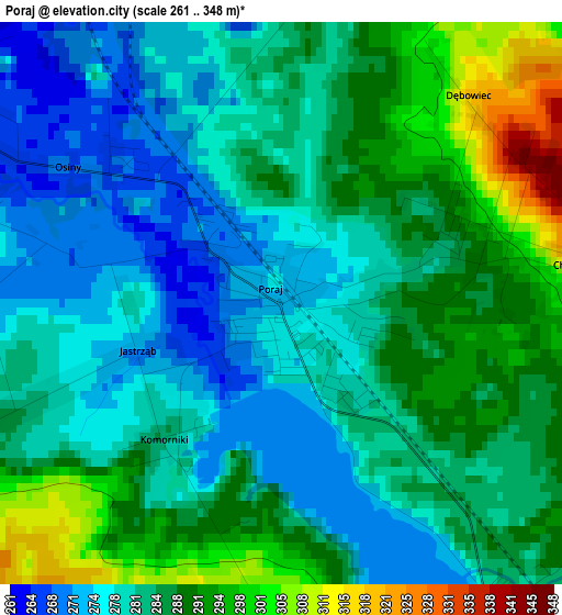
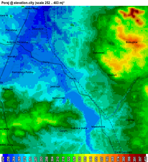
Below is the Elevation map of Poraj, which displays elevation range with different colors. Scale of the first map is from 261 to 348 m (856 to 1142 ft) with average elevation of 283.9 meters (=931 ft) [note 1]
These maps also provides idea of topography and contour of this city, they are displayed at different zoom levels. More info about maps, scale and edge coordinates you can find below images.
| \ | Map #1 | Map #2 | Topo.Map |
| Scale [m] | 261..348 m | 252..403 m | × |
| Scale [ft] | 856..1142 ft | 827..1322 ft | × |
| Average | 283.9 m = 931 ft | 292.6 m = 960 ft | × |
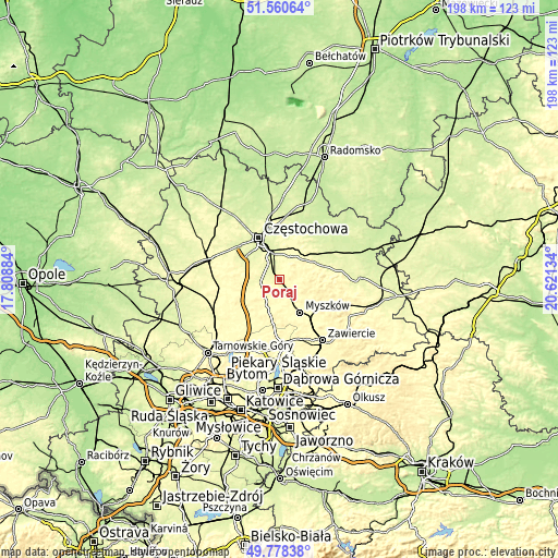
| Width | 6.19 km = 3.8 mi | 12.39 km = 7.7 mi | 198.2 km = 123.2 mi |
| Height | 6.19 km = 3.8 mi | 12.39 km = 7.7 mi | 198.2 km = 123.2 mi |
| ↑Max Latitude | 50.705809° | 50.733631° | 51.56064° |
| Latitude at center | 50.67797° | 50.67797° | 50.67797° |
| ↓Min Latitude | 50.650115° | 50.622243° | 49.77838° |
| ← Min Longitude | 19.171145° | 19.127199° | 17.80884° |
| Longitude center | 19.21509° | 19.21509° | 19.21509° |
| →Max Longitude | 19.259035° | 19.302981° | 20.62134° |
Nearby cities:
Cities around Poraj sort by population:
• Myszków elevation 294 m
13.8 km,  145°
145°
• Żarki 333 m
12 km,  119°
119°
• Koziegłowy 300 m
9.4 km,  203°
203°
• Żarki-Letnisko 292 m
7.4 km, 145°
• Olsztyn 298 m
9 km,  24°
24°
• Huta Stara B 290 m
8.8 km,  319°
319°
• Kamienica Polska 271 m
6.6 km,  263°
263°
• Jastrząb 276 m
2.5 km,  249°
249°
• Starcza 285 m
12.3 km, 262°
• Choroń 327 m
3.2 km,  82°
82°
• Cynków 362 m
14.5 km,  207°
207°
• Gniazdów 333 m
11.7 km,  218°
218°
Multilingual:
 En español:
Poraj elevación 273 m.
 En France:
Poraj élévation 273 m.


Sources and notes:
- [note 1] Map square and city borders are not equal. Map elevation data is calculated only from area inside that square.
- [src 1] Elevation data from geonames database provided with same terms of usage.
- [src 2] The elevation map of Poraj is generated using elevation data from NASA's 3 arcsec (90m) resolution SRTM data.
- [src 3] Base (background) map © OpenStreetMap contributors tiles are generated by Geofabrik and OpenTopoMap.
Copyright & License:
This Poraj Elevation Map is licensed under CC BY-SA. You may reuse any part from this page, if you give a proper credit by linking to this URL:
 More info on terms of use page.