Rędziny elevation
Rędziny (Silesia, Powiat częstochowski), Poland elevation is 278 meters and Rędziny elevation in feet is 912 ft above sea level [src 1]. Rędziny is a populated place (feature code) with elevation that is 87 meters (285 ft) bigger than average city elevation in Poland.
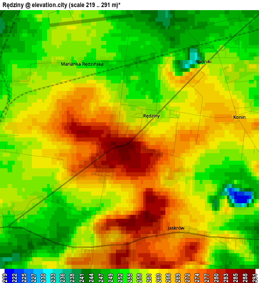
Below is the Elevation map of Rędziny, which displays elevation range with different colors. Scale of the first map is from 219 to 291 m (719 to 955 ft) with average elevation of 260.5 meters (=855 ft) [note 1]
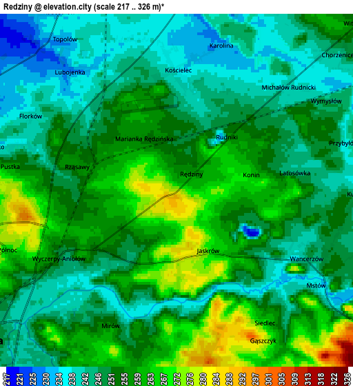
These maps also provides idea of topography and contour of this city, they are displayed at different zoom levels. More info about maps, scale and edge coordinates you can find below images.
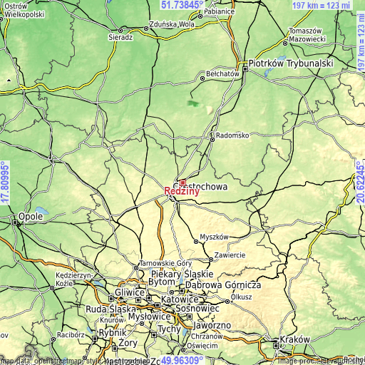
| \ | Map #1 | Map #2 | Topo.Map |
| Scale [m] | 219..291 m | 217..326 m | × |
| Scale [ft] | 719..955 ft | 712..1070 ft | × |
| Average | 260.5 m = 855 ft | 252.2 m = 827 ft | × |
| Width | 6.17 km = 3.8 mi | 12.34 km = 7.7 mi | 197.4 km = 122.7 mi |
| Height | 6.17 km = 3.8 mi | 12.34 km = 7.7 mi | 197.4 km = 122.7 mi |
| ↑Max Latitude | 50.886951° | 50.914666° | 51.73845° |
| Latitude at center | 50.85922° | 50.85922° | 50.85922° |
| ↓Min Latitude | 50.831472° | 50.803708° | 49.96309° |
| ← Min Longitude | 19.172255° | 19.128309° | 17.80995° |
| Longitude center | 19.2162° | 19.2162° | 19.2162° |
| →Max Longitude | 19.260145° | 19.304091° | 20.62245° |
Nearby cities:
Cities around Rędziny sort by population:
• Częstochowa elevation 253 m
9.5 km,  222°
222°
• Kłomnice 230 m
12.1 km,  54°
54°
• Olsztyn 298 m
12.5 km,  163°
163°
• Huta Stara B 290 m
14.7 km,  203°
203°
• Ostrowy nad Okszą 208 m
17.4 km,  319°
319°
• Rudniki 254 m
3 km,  44°
44°
• Kościelec 237 m
4.2 km,  359°
359°
• Mstów 237 m
5.9 km,  124°
124°
• Kalej 287 m
16.5 km,  261°
261°
• Borowno 241 m
9.1 km,  26°
26°
• Kamyk 228 m
14 km,  289°
289°
• Mykanów 240 m
7.2 km,  351°
351°
Multilingual:
 En español:
Rędziny elevación 278 m.
 En France:
Rędziny élévation 278 m.


Sources and notes:
- [note 1] Map square and city borders are not equal. Map elevation data is calculated only from area inside that square.
- [src 1] Elevation data from geonames database provided with same terms of usage.
- [src 2] The elevation map of Rędziny is generated using elevation data from NASA's 3 arcsec (90m) resolution SRTM data.
- [src 3] Base (background) map © OpenStreetMap contributors tiles are generated by Geofabrik and OpenTopoMap.
Copyright & License:
This Rędziny Elevation Map is licensed under CC BY-SA. You may reuse any part from this page, if you give a proper credit by linking to this URL:
 More info on terms of use page.