Grabica elevation
Grabica (Łódź Voivodeship, Powiat piotrkowski), Poland elevation is 222 meters and Grabica elevation in feet is 728 ft above sea level [src 1]. Grabica is a seat of a third-order administrative division (feature code) with elevation that is 31 meters (102 ft) bigger than average city elevation in Poland.
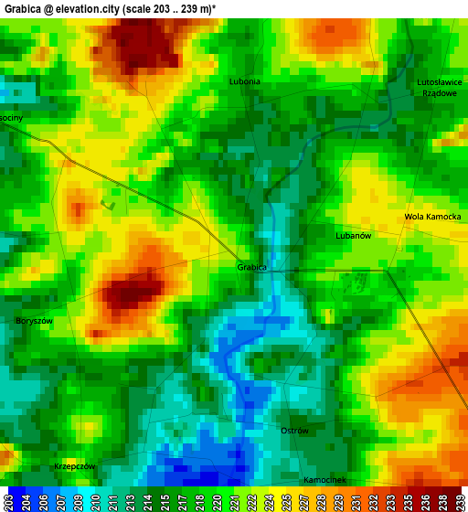
Below is the Elevation map of Grabica, which displays elevation range with different colors. Scale of the first map is from 203 to 239 m (666 to 784 ft) with average elevation of 219.2 meters (=719 ft) [note 1]
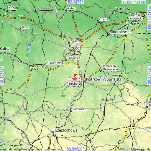
These maps also provides idea of topography and contour of this city, they are displayed at different zoom levels. More info about maps, scale and edge coordinates you can find below images.
| \ | Map #1 | Topo.Map |
| Scale [m] | 203..239 m | × |
| Scale [ft] | 666..784 ft | × |
| Average | 219.2 m = 719 ft | × |
| Width | 6.09 km = 3.8 mi | 194.8 km = 121 mi |
| Height | 6.09 km = 3.8 mi | 194.7 km = 121 mi |
| ↑Max Latitude | 51.50725° | 52.3473° |
| Latitude at center | 51.47989° | 51.47989° |
| ↓Min Latitude | 51.452513° | 50.59566° |
| ← Min Longitude | 19.487425° | 18.12512° |
| Longitude center | 19.53137° | 19.53137° |
| →Max Longitude | 19.575315° | 20.93762° |
Nearby cities:
Cities around Grabica sort by population:
• Piotrków Trybunalski elevation 194 m
14.5 km,  124°
124°
• Bełchatów 202 m
17.3 km,  224°
224°
• Tuszyn 209 m
14.4 km,  359°
359°
• Rzgów 188 m
20.6 km,  352°
352°
• Wolbórz 171 m
20.9 km,  83°
83°
• Moszczenica 191 m
13.3 km, 78°
• Wola Krzysztoporska 204 m
15.5 km,  167°
167°
• Rozprza 194 m
21.2 km,  158°
158°
• Czarnocin 207 m
16.2 km,  39°
39°
• Dłutów 212 m
13.1 km,  312°
312°
• Będków 184 m
19.3 km,  51°
51°
• Drużbice 198 m
9.7 km,  259°
259°
Multilingual:
 En español:
Grabica elevación 222 m.
 En France:
Grabica élévation 222 m.


Sources and notes:
- [note 1] Map square and city borders are not equal. Map elevation data is calculated only from area inside that square.
- [src 1] Elevation data from geonames database provided with same terms of usage.
- [src 2] The elevation map of Grabica is generated using elevation data from NASA's 3 arcsec (90m) resolution SRTM data.
- [src 3] Base (background) map © OpenStreetMap contributors tiles are generated by Geofabrik and OpenTopoMap.
Copyright & License:
This Grabica Elevation Map is licensed under CC BY-SA. You may reuse any part from this page, if you give a proper credit by linking to this URL:
 More info on terms of use page.