Kolonowskie elevation
Kolonowskie (Opole Voivodeship, Powiat strzelecki), Poland elevation is 199 meters and Kolonowskie elevation in feet is 653 ft above sea level [src 1]. Kolonowskie is a seat of a third-order administrative division (feature code) with elevation that is 8 meters (26 ft) bigger than average city elevation in Poland.
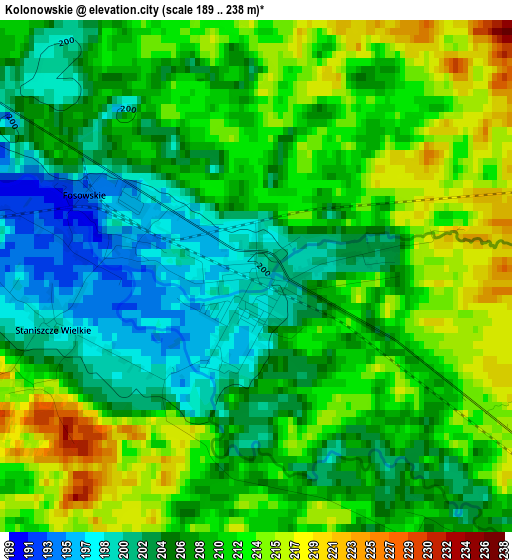
Below is the Elevation map of Kolonowskie, which displays elevation range with different colors. Scale of the first map is from 189 to 238 m (620 to 781 ft) with average elevation of 208.5 meters (=684 ft) [note 1]
These maps also provides idea of topography and contour of this city, they are displayed at different zoom levels. More info about maps, scale and edge coordinates you can find below images.
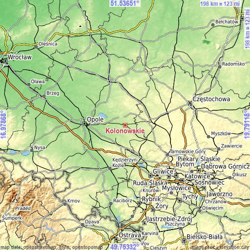
| \ | Map #1 | Topo.Map |
| Scale [m] | 189..238 m | × |
| Scale [ft] | 620..781 ft | × |
| Average | 208.5 m = 684 ft | × |
| Width | 6.2 km = 3.9 mi | 198.3 km = 123.2 mi |
| Height | 6.2 km = 3.9 mi | 198.3 km = 123.2 mi |
| ↑Max Latitude | 50.681234° | 51.53651° |
| Latitude at center | 50.65338° | 50.65338° |
| ↓Min Latitude | 50.62551° | 49.75332° |
| ← Min Longitude | 18.340985° | 16.97868° |
| Longitude center | 18.38493° | 18.38493° |
| →Max Longitude | 18.428875° | 19.79118° |
Nearby cities:
Cities around Kolonowskie sort by population:
• Lubliniec elevation 258 m
21.2 km,  85°
85°
• Strzelce Opolskie 236 m
16.9 km,  200°
200°
• Ozimek 183 m
12.4 km,  283°
283°
• Zawadzkie 212 m
8.9 km,  127°
127°
• Dobrodzień 234 m
9.4 km,  26°
26°
• Jemielnica 215 m
12 km,  182°
182°
• Krupski Młyn 232 m
19 km,  117°
117°
• Ciasna 243 m
19.3 km,  54°
54°
• Zębowice 219 m
12.5 km,  346°
346°
• Pawonków 261 m
14.6 km,  71°
71°
• Nakło 178 m
20.5 km,  246°
246°
• Izbicko 186 m
18.5 km,  240°
240°
Multilingual:
 En español:
Kolonowskie elevación 199 m.
 En France:
Kolonowskie élévation 199 m.
 Auf Deutsch:
Colonnowska höhe über dem Meeresspiegel ist 199 m.

Sources and notes:
- [note 1] Map square and city borders are not equal. Map elevation data is calculated only from area inside that square.
- [src 1] Elevation data from geonames database provided with same terms of usage.
- [src 2] The elevation map of Kolonowskie is generated using elevation data from NASA's 3 arcsec (90m) resolution SRTM data.
- [src 3] Base (background) map © OpenStreetMap contributors tiles are generated by Geofabrik and OpenTopoMap.
Copyright & License:
This Kolonowskie Elevation Map is licensed under CC BY-SA. You may reuse any part from this page, if you give a proper credit by linking to this URL:
 More info on terms of use page.