Izbicko elevation
Izbicko (Opole Voivodeship, Powiat strzelecki), Poland elevation is 186 meters and Izbicko elevation in feet is 610 ft above sea level [src 1]. Izbicko is a seat of a third-order administrative division (feature code) with elevation that is 5 meters (16 ft) smaller than average city elevation in Poland.
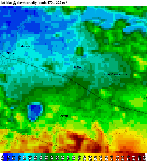
Below is the Elevation map of Izbicko, which displays elevation range with different colors. Scale of the first map is from 170 to 222 m (558 to 728 ft) with average elevation of 187.9 meters (=616 ft) [note 1]
These maps also provides idea of topography and contour of this city, they are displayed at different zoom levels. More info about maps, scale and edge coordinates you can find below images.
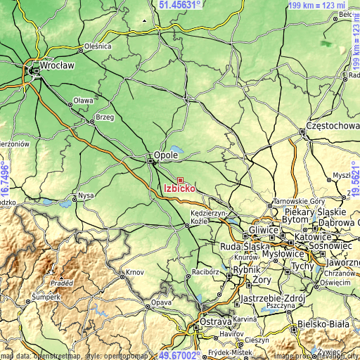
| \ | Map #1 | Topo.Map |
| Scale [m] | 170..222 m | × |
| Scale [ft] | 558..728 ft | × |
| Average | 187.9 m = 616 ft | × |
| Width | 6.21 km = 3.9 mi | 198.6 km = 123.4 mi |
| Height | 6.21 km = 3.9 mi | 198.6 km = 123.4 mi |
| ↑Max Latitude | 50.599532° | 51.45631° |
| Latitude at center | 50.57163° | 50.57163° |
| ↓Min Latitude | 50.543711° | 49.67002° |
| ← Min Longitude | 18.111905° | 16.7496° |
| Longitude center | 18.15585° | 18.15585° |
| →Max Longitude | 18.199795° | 19.5621° |
Nearby cities:
Cities around Izbicko sort by population:
• Strzelce Opolskie elevation 236 m
12.3 km,  123°
123°
• Krapkowice 176 m
17.2 km,  231°
231°
• Zdzieszowice 185 m
16.5 km,  187°
187°
• Ozimek 183 m
12.7 km,  18°
18°
• Gogolin 172 m
13 km, 227°
• Tarnów Opolski 178 m
5.1 km,  275°
275°
• Jemielnica 215 m
16 km,  100°
100°
• Leśnica 222 m
15.8 km,  172°
172°
• Nakło 178 m
2.8 km,  288°
288°
• Chrząstowice 164 m
12 km,  330°
330°
• Rozwadza 177 m
15.7 km, 194°
• Górażdże 170 m
11.3 km,  245°
245°
Multilingual:
 En español:
Izbicko elevación 186 m.
 En France:
Izbicko élévation 186 m.


Sources and notes:
- [note 1] Map square and city borders are not equal. Map elevation data is calculated only from area inside that square.
- [src 1] Elevation data from geonames database provided with same terms of usage.
- [src 2] The elevation map of Izbicko is generated using elevation data from NASA's 3 arcsec (90m) resolution SRTM data.
- [src 3] Base (background) map © OpenStreetMap contributors tiles are generated by Geofabrik and OpenTopoMap.
Copyright & License:
This Izbicko Elevation Map is licensed under CC BY-SA. You may reuse any part from this page, if you give a proper credit by linking to this URL:
 More info on terms of use page.