Uthal elevation
Uthal (Balochistan), Pakistan elevation is 43 meters and Uthal elevation in feet is 141 ft above sea level [src 1]. Uthal is a seat of a second-order administrative division (feature code) with elevation that is 303 meters (994 ft) smaller than average city elevation in Pakistan.
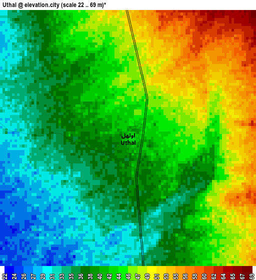
Below is the Elevation map of Uthal, which displays elevation range with different colors. Scale of the first map is from 22 to 69 m (72 to 226 ft) with average elevation of 41.3 meters (=135 ft) [note 1]
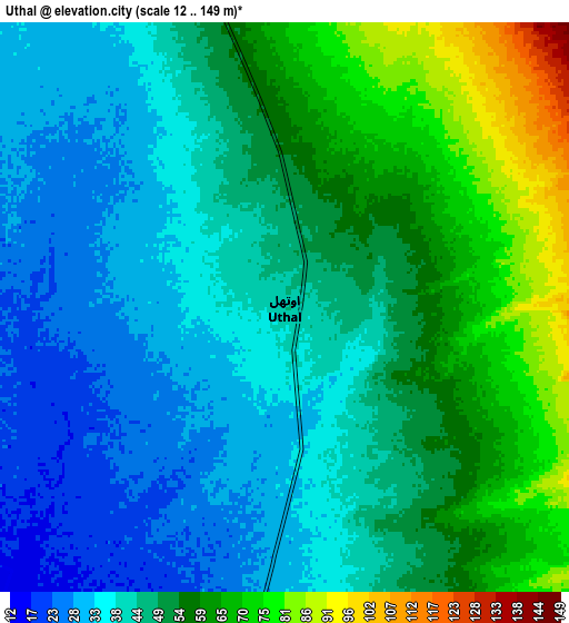
These maps also provides idea of topography and contour of this city, they are displayed at different zoom levels. More info about maps, scale and edge coordinates you can find below images.
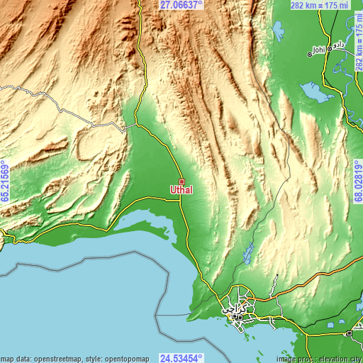
| \ | Map #1 | Map #2 | Topo.Map |
| Scale [m] | 22..69 m | 12..149 m | × |
| Scale [ft] | 72..226 ft | 39..489 ft | × |
| Average | 41.3 m = 135 ft | 48.2 m = 158 ft | × |
| Width | 8.8 km = 5.5 mi | 17.6 km = 10.9 mi | 281.5 km = 174.9 mi |
| Height | 8.8 km = 5.5 mi | 17.6 km = 10.9 mi | 281.5 km = 174.9 mi |
| ↑Max Latitude | 25.846776° | 25.886318° | 27.06637° |
| Latitude at center | 25.80722° | 25.80722° | 25.80722° |
| ↓Min Latitude | 25.767651° | 25.728069° | 24.53454° |
| ← Min Longitude | 66.577995° | 66.534049° | 65.21569° |
| Longitude center | 66.62194° | 66.62194° | 66.62194° |
| →Max Longitude | 66.665885° | 66.709831° | 68.02819° |
Nearby cities:
Cities around Uthal sort by population:
• Karachi elevation 8 m
112.2 km,  159°
159°
• Malir Cantonment 52 m
112.5 km,  148°
148°
• Dadu 24 m
154.3 km,  48°
48°
• Sehwan 40 m
141.5 km,  60°
60°
• Bela 92 m
56 km,  326°
326°
• Gharo 5 m
153 km,  140°
140°
• Bhan 40 m
137.9 km, 52°
• Johi 43 m
139.6 km, 45°
• Daulatpur 46 m
155.2 km, 60°
• Gadani 9 m
77.3 km,  171°
171°
• Sann 35 m
153.8 km,  80°
80°
• Awaran 530 m
156.5 km,  297°
297°
Multilingual:
 En español:
Uthal elevación 43 m.
 En France:
Uthal élévation 43 m.


Sources and notes:
- [note 1] Map square and city borders are not equal. Map elevation data is calculated only from area inside that square.
- [src 1] Elevation data from geonames database provided with same terms of usage.
- [src 2] The elevation map of Uthal is generated using elevation data from NASA's 3 arcsec (90m) resolution SRTM data.
- [src 3] Base (background) map © OpenStreetMap contributors tiles are generated by Geofabrik and OpenTopoMap.
Copyright & License:
This Uthal Elevation Map is licensed under CC BY-SA. You may reuse any part from this page, if you give a proper credit by linking to this URL:
 More info on terms of use page.