Johi elevation
Johi (Sindh), Pakistan elevation is 43 meters and Johi elevation in feet is 141 ft above sea level [src 1]. Johi is a populated place (feature code) with elevation that is 303 meters (994 ft) smaller than average city elevation in Pakistan.
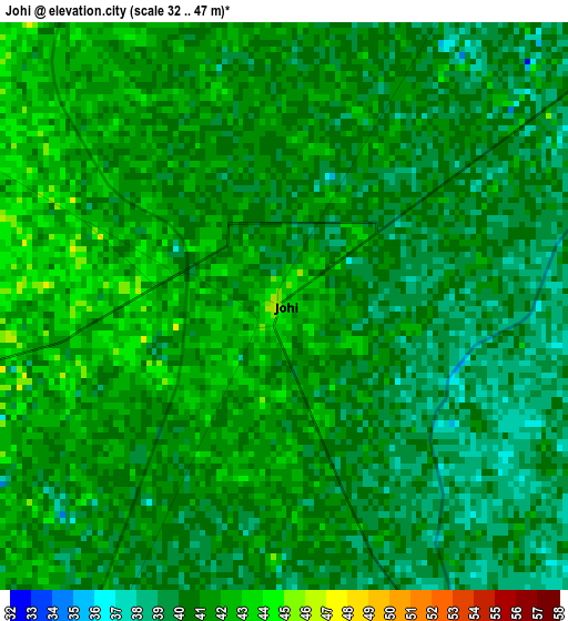
Below is the Elevation map of Johi, which displays elevation range with different colors. Scale of the first map is from 32 to 47 m (105 to 154 ft) with average elevation of 40.4 meters (=133 ft) [note 1]
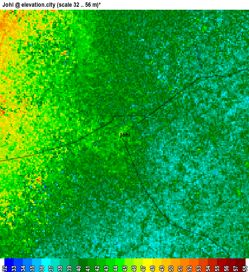
These maps also provides idea of topography and contour of this city, they are displayed at different zoom levels. More info about maps, scale and edge coordinates you can find below images.
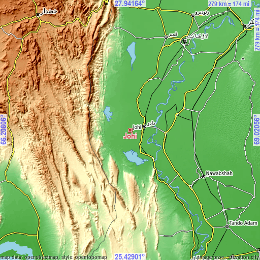
| \ | Map #1 | Map #2 | Topo.Map |
| Scale [m] | 32..47 m | 32..56 m | × |
| Scale [ft] | 105..154 ft | 105..184 ft | × |
| Average | 40.4 m = 133 ft | 40.6 m = 133 ft | × |
| Width | 8.73 km = 5.4 mi | 17.46 km = 10.8 mi | 279.4 km = 173.6 mi |
| Height | 8.73 km = 5.4 mi | 17.46 km = 10.8 mi | 279.4 km = 173.6 mi |
| ↑Max Latitude | 26.731505° | 26.770747° | 27.94164° |
| Latitude at center | 26.69225° | 26.69225° | 26.69225° |
| ↓Min Latitude | 26.652981° | 26.613699° | 25.42901° |
| ← Min Longitude | 67.570365° | 67.526419° | 66.20806° |
| Longitude center | 67.61431° | 67.61431° | 67.61431° |
| →Max Longitude | 67.658255° | 67.702201° | 69.02056° |
Nearby cities:
Cities around Johi sort by population:
• Dadu elevation 24 m
16.7 km,  75°
75°
• Moro 44 m
38.5 km,  94°
94°
• Sehwan 40 m
38.6 km,  140°
140°
• Mehar 48 m
58 km,  20°
20°
• Khairpur Nathan Shah 49 m
45.9 km, 15°
• Sīta Road 44 m
44.6 km,  31°
31°
• Tharu Shah 49 m
57.2 km,  60°
60°
• Naushahro Firoz 51 m
53.1 km,  71°
71°
• Bhan 40 m
18.3 km, 144°
• Daulatpur 46 m
41.3 km,  120°
120°
• Bhiria 50 m
62.5 km, 67°
• Goth Phulji 45 m
22 km, 17°
Multilingual:
 En español:
Johi elevación 43 m.
 En France:
Johi élévation 43 m.


Sources and notes:
- [note 1] Map square and city borders are not equal. Map elevation data is calculated only from area inside that square.
- [src 1] Elevation data from geonames database provided with same terms of usage.
- [src 2] The elevation map of Johi is generated using elevation data from NASA's 3 arcsec (90m) resolution SRTM data.
- [src 3] Base (background) map © OpenStreetMap contributors tiles are generated by Geofabrik and OpenTopoMap.
Copyright & License:
This Johi Elevation Map is licensed under CC BY-SA. You may reuse any part from this page, if you give a proper credit by linking to this URL:
 More info on terms of use page.