Tharu Shah elevation
Tharu Shah (Sindh), Pakistan elevation is 49 meters and Tharu Shah elevation in feet is 161 ft above sea level [src 1]. Tharu Shah is a populated place (feature code) with elevation that is 297 meters (974 ft) smaller than average city elevation in Pakistan.
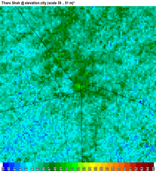
Below is the Elevation map of Tharu Shah, which displays elevation range with different colors. Scale of the first map is from 39 to 51 m (128 to 167 ft) with average elevation of 44.4 meters (=146 ft) [note 1]
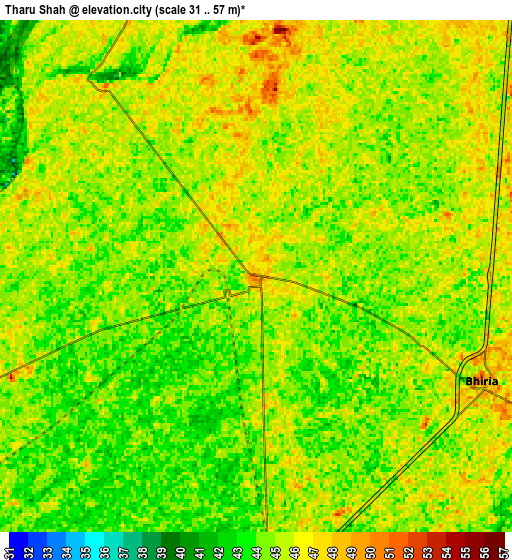
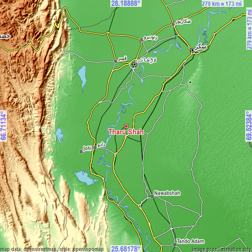
These maps also provides idea of topography and contour of this city, they are displayed at different zoom levels. More info about maps, scale and edge coordinates you can find below images.
| \ | Map #1 | Map #2 | Topo.Map |
| Scale [m] | 39..51 m | 31..57 m | × |
| Scale [ft] | 128..167 ft | 102..187 ft | × |
| Average | 44.4 m = 146 ft | 44.7 m = 147 ft | × |
| Width | 8.71 km = 5.4 mi | 17.42 km = 10.8 mi | 278.8 km = 173.2 mi |
| Height | 8.71 km = 5.4 mi | 17.42 km = 10.8 mi | 278.8 km = 173.2 mi |
| ↑Max Latitude | 26.981469° | 27.020624° | 28.18888° |
| Latitude at center | 26.9423° | 26.9423° | 26.9423° |
| ↓Min Latitude | 26.903118° | 26.863922° | 25.68178° |
| ← Min Longitude | 68.073645° | 68.029699° | 66.71134° |
| Longitude center | 68.11759° | 68.11759° | 68.11759° |
| →Max Longitude | 68.161535° | 68.205481° | 69.52384° |
Nearby cities:
Cities around Tharu Shah sort by population:
• Dadu elevation 24 m
41.2 km,  235°
235°
• Moro 44 m
33.2 km,  200°
200°
• Mehar 48 m
39.6 km,  311°
311°
• Sīta Road 44 m
28.4 km,  290°
290°
• Kandiaro 51 m
15.9 km,  35°
35°
• Pad Idan 49 m
26.1 km,  135°
135°
• Naushahro Firoz 51 m
11.4 km,  177°
177°
• Goth Radhan 50 m
32.8 km,  330°
330°
• Bhiria 50 m
8.4 km,  114°
114°
• Darya Khan Marri 44 m
33.9 km,  150°
150°
• Karaundi 50 m
29.1 km,  99°
99°
• Kandiari 58 m
40.2 km,  94°
94°
Multilingual:
 En español:
Tharu Shah elevación 49 m.
 En France:
Tharu Shah élévation 49 m.
 Auf Deutsch:
Tharu Shah höhe über dem Meeresspiegel ist 49 m.

Sources and notes:
- [note 1] Map square and city borders are not equal. Map elevation data is calculated only from area inside that square.
- [src 1] Elevation data from geonames database provided with same terms of usage.
- [src 2] The elevation map of Tharu Shah is generated using elevation data from NASA's 3 arcsec (90m) resolution SRTM data.
- [src 3] Base (background) map © OpenStreetMap contributors tiles are generated by Geofabrik and OpenTopoMap.
Copyright & License:
This Tharu Shah Elevation Map is licensed under CC BY-SA. You may reuse any part from this page, if you give a proper credit by linking to this URL:
 More info on terms of use page.