Zhob elevation
Zhob (Balochistan), Pakistan elevation is 1409 meters and Zhob elevation in feet is 4623 ft above sea level [src 1]. Zhob is a seat of a second-order administrative division (feature code) with elevation that is 1063 meters (3488 ft) bigger than average city elevation in Pakistan.
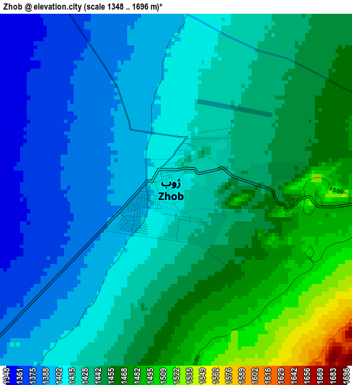
Below is the Elevation map of Zhob, which displays elevation range with different colors. Scale of the first map is from 1348 to 1696 m (4423 to 5564 ft) with average elevation of 1427.8 meters (=4684 ft) [note 1]
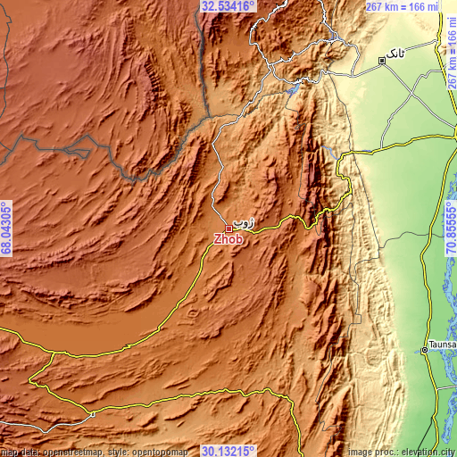
These maps also provides idea of topography and contour of this city, they are displayed at different zoom levels. More info about maps, scale and edge coordinates you can find below images.
| \ | Map #1 | Map #2 | Topo.Map |
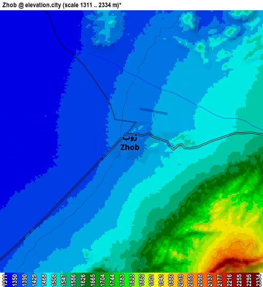
| Scale [m] | 1348..1696 m | 1311..2334 m | × |
| Scale [ft] | 4423..5564 ft | 4301..7657 ft | × |
| Average | 1427.8 m = 4684 ft | 1476.5 m = 4844 ft | × |
| Width | 8.35 km = 5.2 mi | 16.69 km = 10.4 mi | 267.1 km = 166 mi |
| Height | 8.35 km = 5.2 mi | 16.69 km = 10.4 mi | 267.1 km = 166 mi |
| ↑Max Latitude | 31.378346° | 31.415856° | 32.53416° |
| Latitude at center | 31.34082° | 31.34082° | 31.34082° |
| ↓Min Latitude | 31.303279° | 31.265724° | 30.13215° |
| ← Min Longitude | 69.405355° | 69.361409° | 68.04305° |
| Longitude center | 69.4493° | 69.4493° | 69.4493° |
| →Max Longitude | 69.493245° | 69.537191° | 70.85555° |
Nearby cities:
Cities around Zhob sort by population:
• Dera Ismail Khan elevation 177 m
148 km,  68°
68°
• Layyah 151 m
147.9 km,  106°
106°
• Taunsa 175 m
134.6 km,  121°
121°
• Tank 259 m
131.5 km,  42°
42°
• Loralai 1440 m
135.1 km,  216°
216°
• Karor 157 m
143.3 km,  95°
95°
• Kulachi 218 m
116 km,  55°
55°
• Wana 1390 m
107.2 km,  6°
6°
• Bakhri Ahmad Khan 141 m
148.4 km, 116°
• Moza Shahwala 144 m
146 km, 114°
• Qila Saifullah 1561 m
125.9 km,  235°
235°
• Musa Khel Bazar 1349 m
64.2 km,  146°
146°
Multilingual:
 En español:
Zhob elevación 1409 m.
 En France:
Zhob élévation 1409 m.


Sources and notes:
- [note 1] Map square and city borders are not equal. Map elevation data is calculated only from area inside that square.
- [src 1] Elevation data from geonames database provided with same terms of usage.
- [src 2] The elevation map of Zhob is generated using elevation data from NASA's 3 arcsec (90m) resolution SRTM data.
- [src 3] Base (background) map © OpenStreetMap contributors tiles are generated by Geofabrik and OpenTopoMap.
Copyright & License:
This Zhob Elevation Map is licensed under CC BY-SA. You may reuse any part from this page, if you give a proper credit by linking to this URL:
 More info on terms of use page.