Carranglan elevation
Carranglan (Central Luzon, Province of Nueva Ecija), Philippines elevation is 247 meters and Carranglan elevation in feet is 810 ft above sea level [src 1]. Carranglan is a populated place (feature code) with elevation that is 159 meters (522 ft) bigger than average city elevation in Philippines.
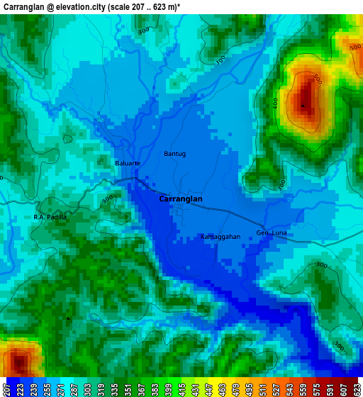
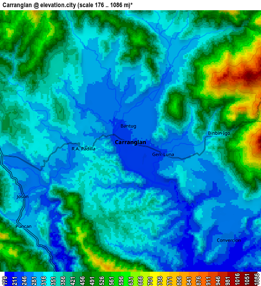
Below is the Elevation map of Carranglan, which displays elevation range with different colors. Scale of the first map is from 207 to 623 m (679 to 2044 ft) with average elevation of 300.1 meters (=985 ft) [note 1]
These maps also provides idea of topography and contour of this city, they are displayed at different zoom levels. More info about maps, scale and edge coordinates you can find below images.
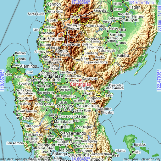
| \ | Map #1 | Map #2 | Topo.Map |
| Scale [m] | 207..623 m | 176..1086 m | × |
| Scale [ft] | 679..2044 ft | 577..3563 ft | × |
| Average | 300.1 m = 985 ft | 380.6 m = 1249 ft | × |
| Width | 9.4 km = 5.8 mi | 18.79 km = 11.7 mi | 300.6 km = 186.8 mi |
| Height | 9.4 km = 5.8 mi | 18.79 km = 11.7 mi | 300.7 km = 186.8 mi |
| ↑Max Latitude | 16.003547° | 16.045784° | 17.30866° |
| Latitude at center | 15.9613° | 15.9613° | 15.9613° |
| ↓Min Latitude | 15.919044° | 15.87678° | 14.60482° |
| ← Min Longitude | 121.020155° | 120.976209° | 119.65785° |
| Longitude center | 121.0641° | 121.0641° | 121.0641° |
| →Max Longitude | 121.108045° | 121.151991° | 122.47035° |
Nearby cities:
Cities around Carranglan sort by population:
• Lupao elevation 146 m
19.9 km,  242°
242°
• Pantabangan 278 m
18.8 km,  152°
152°
• Estrella 101 m
23.7 km,  187°
187°
• Tayabo 157 m
14.5 km, 194°
• Puncan 294 m
9.9 km,  232°
232°
• Burgos 402 m
12.4 km,  352°
352°
• Salvacion I 113 m
20.8 km, 229°
• Parista 137 m
18.8 km, 230°
• Digdig 283 m
9.3 km,  261°
261°
• Porais 117 m
23 km, 185°
• Conversion 269 m
9.8 km,  135°
135°
• Sibul 114 m
19.2 km,  200°
200°
Multilingual:
 En español:
Carranglan elevación 247 m.
 En France:
Carranglan élévation 247 m.
 Auf Deutsch:
Carranglan höhe über dem Meeresspiegel ist 247 m.

Sources and notes:
- [note 1] Map square and city borders are not equal. Map elevation data is calculated only from area inside that square.
- [src 1] Elevation data from geonames database provided with same terms of usage.
- [src 2] The elevation map of Carranglan is generated using elevation data from NASA's 3 arcsec (90m) resolution SRTM data.
- [src 3] Base (background) map © OpenStreetMap contributors tiles are generated by Geofabrik and OpenTopoMap.
Copyright & License:
This Carranglan Elevation Map is licensed under CC BY-SA. You may reuse any part from this page, if you give a proper credit by linking to this URL:
 More info on terms of use page.