Tayabo elevation
Tayabo (Central Luzon, Province of Nueva Ecija), Philippines elevation is 157 meters and Tayabo elevation in feet is 515 ft above sea level [src 1]. Tayabo is a populated place (feature code) with elevation that is 69 meters (226 ft) bigger than average city elevation in Philippines.
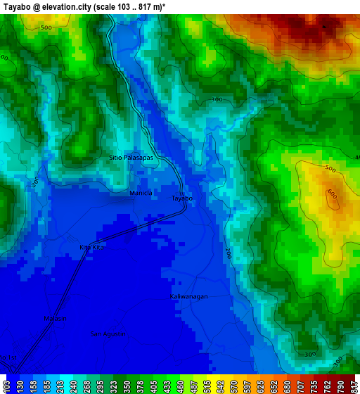
Below is the Elevation map of Tayabo, which displays elevation range with different colors. Scale of the first map is from 103 to 817 m (338 to 2680 ft) with average elevation of 279.8 meters (=918 ft) [note 1]
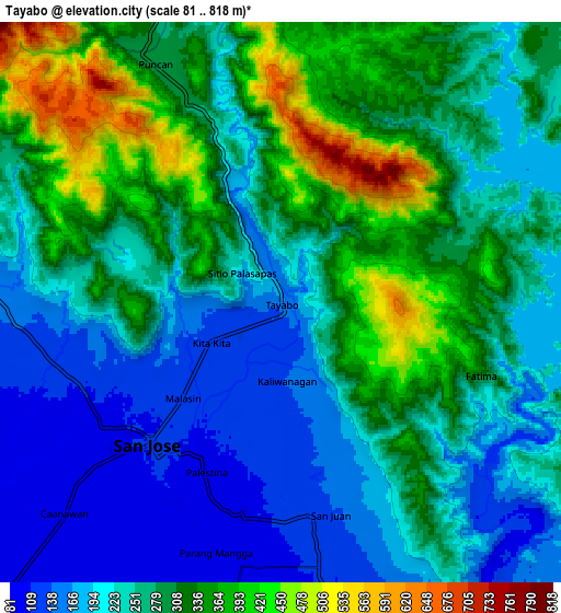
These maps also provides idea of topography and contour of this city, they are displayed at different zoom levels. More info about maps, scale and edge coordinates you can find below images.
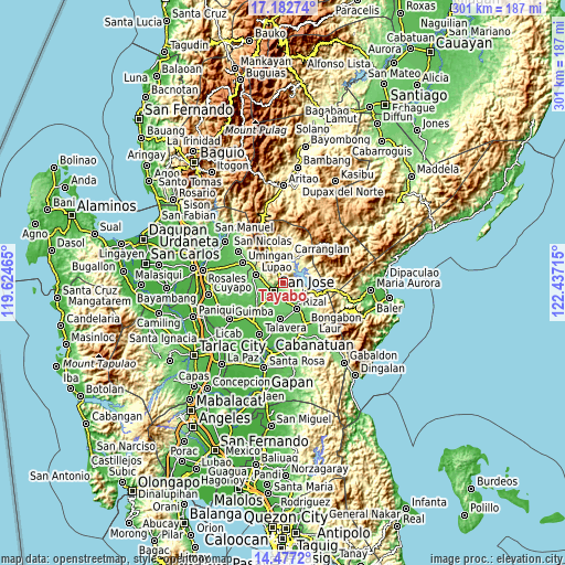
| \ | Map #1 | Map #2 | Topo.Map |
| Scale [m] | 103..817 m | 81..818 m | × |
| Scale [ft] | 338..2680 ft | 266..2684 ft | × |
| Average | 279.8 m = 918 ft | 267.7 m = 878 ft | × |
| Width | 9.4 km = 5.8 mi | 18.8 km = 11.7 mi | 300.8 km = 186.9 mi |
| Height | 9.4 km = 5.8 mi | 18.8 km = 11.7 mi | 300.9 km = 187 mi |
| ↑Max Latitude | 15.876773° | 15.919038° | 17.18274° |
| Latitude at center | 15.8345° | 15.8345° | 15.8345° |
| ↓Min Latitude | 15.792218° | 15.749927° | 14.4772° |
| ← Min Longitude | 120.986955° | 120.943009° | 119.62465° |
| Longitude center | 121.0309° | 121.0309° | 121.0309° |
| →Max Longitude | 121.074845° | 121.118791° | 122.43715° |
Nearby cities:
Cities around Tayabo sort by population:
• Carranglan elevation 247 m
14.5 km,  14°
14°
• Pantabangan 278 m
12.4 km,  102°
102°
• Santo Tomas 88 m
11.9 km,  217°
217°
• Estrella 101 m
9.4 km,  178°
178°
• Puncan 294 m
9.1 km,  331°
331°
• Salvacion I 113 m
12.3 km,  272°
272°
• Parista 137 m
11.2 km,  280°
280°
• Digdig 283 m
13.9 km,  335°
335°
• Tondod 86 m
14.6 km,  207°
207°
• Porais 117 m
8.9 km,  171°
171°
• Conversion 269 m
12.6 km,  55°
55°
• Sibul 114 m
5.1 km, 220°
Multilingual:
 En español:
Tayabo elevación 157 m.
 En France:
Tayabo élévation 157 m.


Sources and notes:
- [note 1] Map square and city borders are not equal. Map elevation data is calculated only from area inside that square.
- [src 1] Elevation data from geonames database provided with same terms of usage.
- [src 2] The elevation map of Tayabo is generated using elevation data from NASA's 3 arcsec (90m) resolution SRTM data.
- [src 3] Base (background) map © OpenStreetMap contributors tiles are generated by Geofabrik and OpenTopoMap.
Copyright & License:
This Tayabo Elevation Map is licensed under CC BY-SA. You may reuse any part from this page, if you give a proper credit by linking to this URL:
 More info on terms of use page.