Pantabangan elevation
Pantabangan (Central Luzon, Province of Nueva Ecija), Philippines elevation is 278 meters and Pantabangan elevation in feet is 912 ft above sea level [src 1]. Pantabangan is a seat of a third-order administrative division (feature code) with elevation that is 190 meters (623 ft) bigger than average city elevation in Philippines.
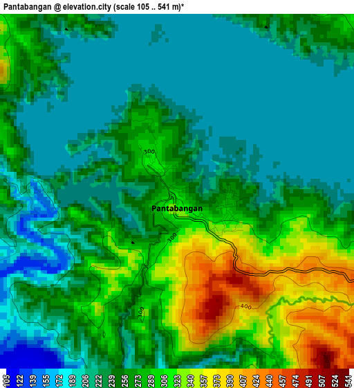
Below is the Elevation map of Pantabangan, which displays elevation range with different colors. Scale of the first map is from 105 to 541 m (344 to 1775 ft) with average elevation of 258.4 meters (=848 ft) [note 1]
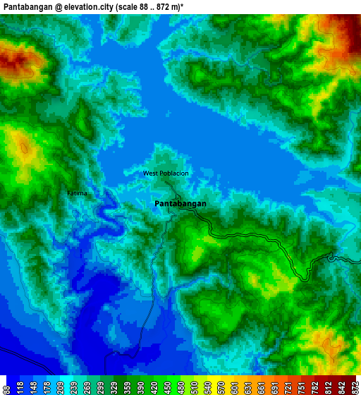
These maps also provides idea of topography and contour of this city, they are displayed at different zoom levels. More info about maps, scale and edge coordinates you can find below images.
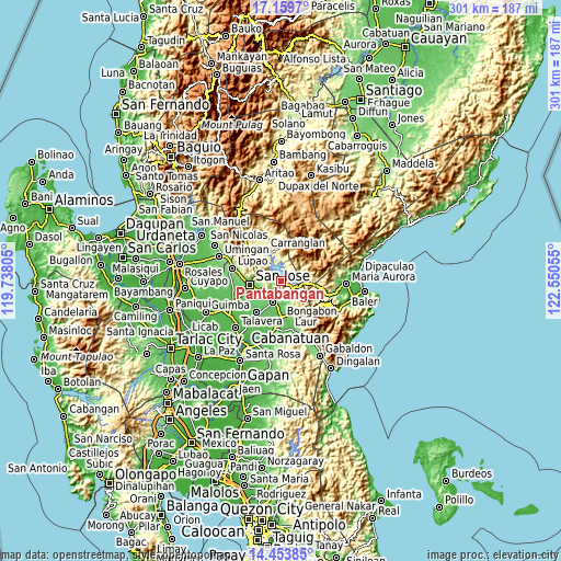
| \ | Map #1 | Map #2 | Topo.Map |
| Scale [m] | 105..541 m | 88..872 m | × |
| Scale [ft] | 344..1775 ft | 289..2861 ft | × |
| Average | 258.4 m = 848 ft | 295.3 m = 969 ft | × |
| Width | 9.4 km = 5.8 mi | 18.81 km = 11.7 mi | 300.9 km = 187 mi |
| Height | 9.4 km = 5.8 mi | 18.81 km = 11.7 mi | 300.9 km = 187 mi |
| ↑Max Latitude | 15.853578° | 15.895848° | 17.1597° |
| Latitude at center | 15.8113° | 15.8113° | 15.8113° |
| ↓Min Latitude | 15.769013° | 15.726717° | 14.45385° |
| ← Min Longitude | 121.100355° | 121.056409° | 119.73805° |
| Longitude center | 121.1443° | 121.1443° | 121.1443° |
| →Max Longitude | 121.188245° | 121.232191° | 122.55055° |
Nearby cities:
Cities around Pantabangan sort by population:
• Rizal elevation 91 m
11.8 km,  200°
200°
• Carranglan 247 m
18.8 km,  332°
332°
• Estrella 101 m
13.7 km,  240°
240°
• Tayabo 157 m
12.4 km,  282°
282°
• Agbannawag 84 m
16.1 km, 203°
• Del Pilar 80 m
14.3 km,  205°
205°
• Porais 117 m
12.5 km, 240°
• Conversion 269 m
9.8 km,  349°
349°
• General Luna 185 m
9.7 km,  157°
157°
• Paco Roman 77 m
17.9 km, 199°
• Sibul 114 m
15.5 km,  265°
265°
• Macapsing 78 m
14.8 km,  185°
185°
Multilingual:
 En español:
Pantabangan elevación 278 m.
 En France:
Pantabangan élévation 278 m.
 Auf Deutsch:
Pantabangan höhe über dem Meeresspiegel ist 278 m.

Sources and notes:
- [note 1] Map square and city borders are not equal. Map elevation data is calculated only from area inside that square.
- [src 1] Elevation data from geonames database provided with same terms of usage.
- [src 2] The elevation map of Pantabangan is generated using elevation data from NASA's 3 arcsec (90m) resolution SRTM data.
- [src 3] Base (background) map © OpenStreetMap contributors tiles are generated by Geofabrik and OpenTopoMap.
Copyright & License:
This Pantabangan Elevation Map is licensed under CC BY-SA. You may reuse any part from this page, if you give a proper credit by linking to this URL:
 More info on terms of use page.