Del Pilar elevation
Del Pilar (Central Luzon, Province of Nueva Ecija), Philippines elevation is 80 meters and Del Pilar elevation in feet is 262 ft above sea level [src 1]. Del Pilar is a populated place (feature code) with elevation that is 8 meters (26 ft) smaller than average city elevation in Philippines.
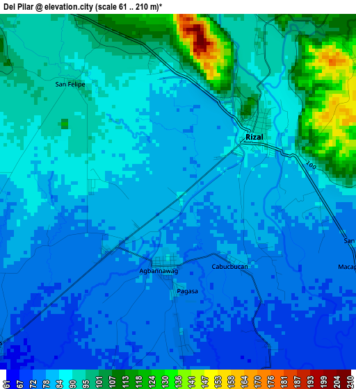
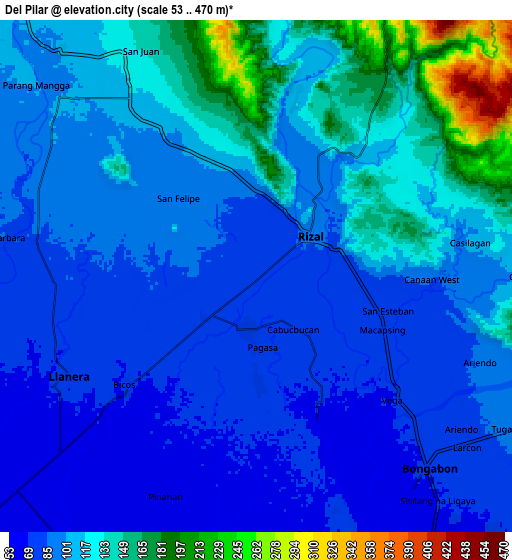
Below is the Elevation map of Del Pilar, which displays elevation range with different colors. Scale of the first map is from 61 to 210 m (200 to 689 ft) with average elevation of 86.8 meters (=285 ft) [note 1]
These maps also provides idea of topography and contour of this city, they are displayed at different zoom levels. More info about maps, scale and edge coordinates you can find below images.
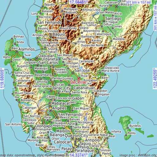
| \ | Map #1 | Map #2 | Topo.Map |
| Scale [m] | 61..210 m | 53..470 m | × |
| Scale [ft] | 200..689 ft | 174..1542 ft | × |
| Average | 86.8 m = 285 ft | 106.6 m = 350 ft | × |
| Width | 9.41 km = 5.8 mi | 18.82 km = 11.7 mi | 301 km = 187 mi |
| Height | 9.41 km = 5.8 mi | 18.82 km = 11.7 mi | 301.1 km = 187.1 mi |
| ↑Max Latitude | 15.737902° | 15.780196° | 17.04481° |
| Latitude at center | 15.6956° | 15.6956° | 15.6956° |
| ↓Min Latitude | 15.653289° | 15.610969° | 14.33741° |
| ← Min Longitude | 121.042355° | 120.998409° | 119.68005° |
| Longitude center | 121.0863° | 121.0863° | 121.0863° |
| →Max Longitude | 121.130245° | 121.174191° | 122.49255° |
Nearby cities:
Cities around Del Pilar sort by population:
• Bongabon elevation 74 m
9.4 km,  138°
138°
• Rizal 91 m
2.8 km,  49°
49°
• Llanera 70 m
8.1 km,  243°
243°
• Estrella 101 m
8.3 km,  316°
316°
• Bicos 76 m
6.2 km,  230°
230°
• Agbannawag 84 m
1.9 km,  189°
189°
• Porais 117 m
8.1 km, 324°
• Piñahan 68 m
8.1 km,  198°
198°
• Plaridel 72 m
8.2 km, 239°
• General Luna 185 m
10.7 km,  68°
68°
• Paco Roman 77 m
4 km,  177°
177°
• Macapsing 78 m
5.2 km,  111°
111°
Multilingual:
 En español:
Del Pilar elevación 80 m.
 En France:
Del Pilar élévation 80 m.
 Auf Deutsch:
Del Pilar höhe über dem Meeresspiegel ist 80 m.

Sources and notes:
- [note 1] Map square and city borders are not equal. Map elevation data is calculated only from area inside that square.
- [src 1] Elevation data from geonames database provided with same terms of usage.
- [src 2] The elevation map of Del Pilar is generated using elevation data from NASA's 3 arcsec (90m) resolution SRTM data.
- [src 3] Base (background) map © OpenStreetMap contributors tiles are generated by Geofabrik and OpenTopoMap.
Copyright & License:
This Del Pilar Elevation Map is licensed under CC BY-SA. You may reuse any part from this page, if you give a proper credit by linking to this URL:
 More info on terms of use page.