Bongabon elevation
Bongabon (Central Luzon, Province of Nueva Ecija), Philippines elevation is 74 meters and Bongabon elevation in feet is 243 ft above sea level [src 1]. Bongabon is a seat of a third-order administrative division (feature code) with elevation that is 14 meters (46 ft) smaller than average city elevation in Philippines.
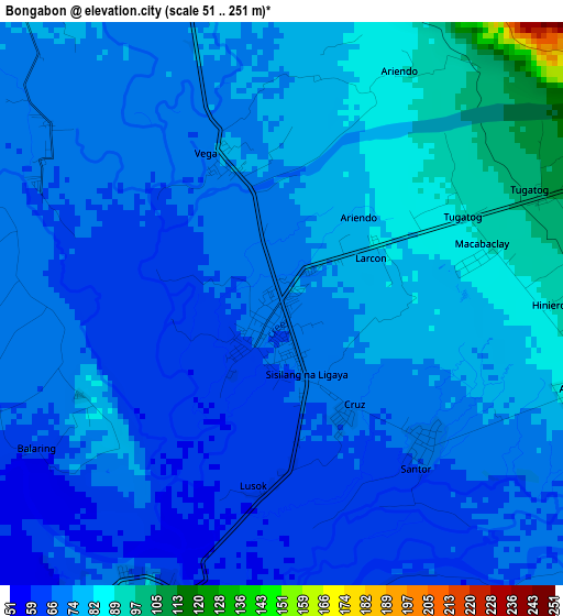
Below is the Elevation map of Bongabon, which displays elevation range with different colors. Scale of the first map is from 51 to 251 m (167 to 823 ft) with average elevation of 73.4 meters (=241 ft) [note 1]
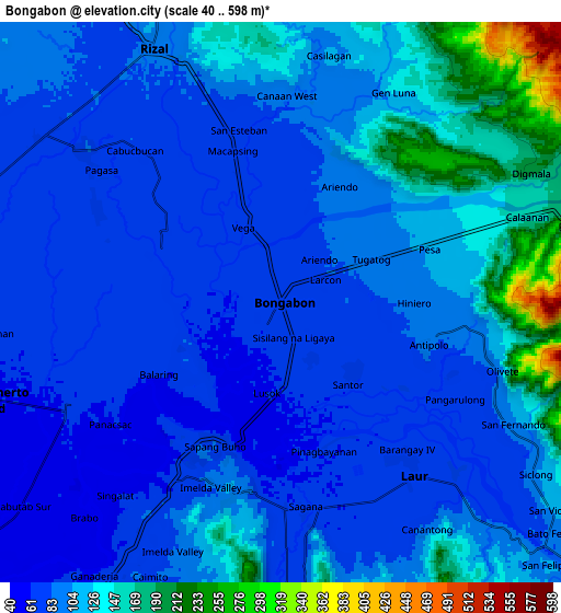
These maps also provides idea of topography and contour of this city, they are displayed at different zoom levels. More info about maps, scale and edge coordinates you can find below images.
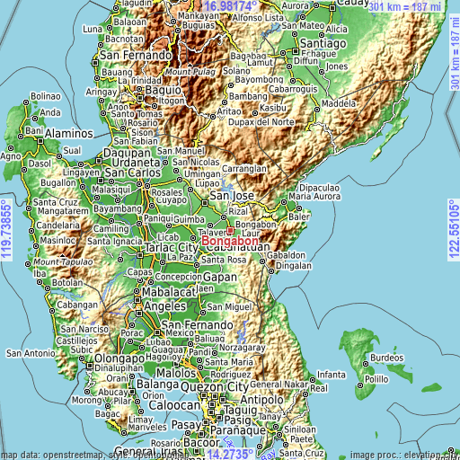
| \ | Map #1 | Map #2 | Topo.Map |
| Scale [m] | 51..251 m | 40..598 m | × |
| Scale [ft] | 167..823 ft | 131..1962 ft | × |
| Average | 73.4 m = 241 ft | 103.5 m = 340 ft | × |
| Width | 9.41 km = 5.8 mi | 18.82 km = 11.7 mi | 301.1 km = 187.1 mi |
| Height | 9.41 km = 5.8 mi | 18.82 km = 11.7 mi | 301.2 km = 187.2 mi |
| ↑Max Latitude | 15.674415° | 15.716722° | 16.98174° |
| Latitude at center | 15.6321° | 15.6321° | 15.6321° |
| ↓Min Latitude | 15.589776° | 15.547443° | 14.2735° |
| ← Min Longitude | 121.100855° | 121.056909° | 119.73855° |
| Longitude center | 121.1448° | 121.1448° | 121.1448° |
| →Max Longitude | 121.188745° | 121.232691° | 122.55105° |
Nearby cities:
Cities around Bongabon sort by population:
• Rizal elevation 91 m
9.8 km,  334°
334°
• Laur 73 m
6.5 km,  140°
140°
• General Mamerto Natividad 60 m
10.5 km,  251°
251°
• Agbannawag 84 m
8.4 km,  308°
308°
• Del Pilar 80 m
9.4 km,  318°
318°
• Antipolo 87 m
5.1 km,  107°
107°
• Sapang Buho 75 m
5.1 km,  205°
205°
• Piñahan 68 m
8.9 km,  266°
266°
• Paco Roman 77 m
6.8 km,  296°
296°
• Siclong 102 m
10.2 km,  123°
123°
• Sagana 68 m
7.1 km,  173°
173°
• Macapsing 78 m
5.3 km,  344°
344°
Multilingual:
 En español:
Bongabon elevación 74 m.
 En France:
Bongabon élévation 74 m.


Sources and notes:
- [note 1] Map square and city borders are not equal. Map elevation data is calculated only from area inside that square.
- [src 1] Elevation data from geonames database provided with same terms of usage.
- [src 2] The elevation map of Bongabon is generated using elevation data from NASA's 3 arcsec (90m) resolution SRTM data.
- [src 3] Base (background) map © OpenStreetMap contributors tiles are generated by Geofabrik and OpenTopoMap.
Copyright & License:
This Bongabon Elevation Map is licensed under CC BY-SA. You may reuse any part from this page, if you give a proper credit by linking to this URL:
 More info on terms of use page.