Asentamiento Humano Nicolas de Pierola elevation
Asentamiento Humano Nicolas de Pierola (Lima region, Lima), Peru elevation is 1016 meters and Asentamiento Humano Nicolas de Pierola elevation in feet is 3333 ft above sea level [src 1]. Asentamiento Humano Nicolas de Pierola is a populated place (feature code) with elevation that is 1305 meters (4281 ft) smaller than average city elevation in Peru.
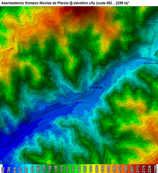
Below is the Elevation map of Asentamiento Humano Nicolas de Pierola, which displays elevation range with different colors. Scale of the first map is from 692 to 2298 m (2270 to 7539 ft) with average elevation of 1278.6 meters (=4195 ft) [note 1]
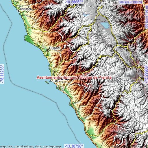
These maps also provides idea of topography and contour of this city, they are displayed at different zoom levels. More info about maps, scale and edge coordinates you can find below images.
| \ | Map #1 | Map #2 | Topo.Map |
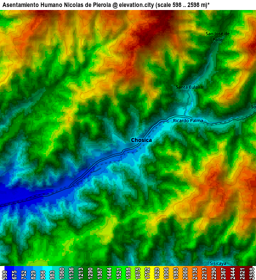
| Scale [m] | 692..2298 m | 598..2598 m | × |
| Scale [ft] | 2270..7539 ft | 1962..8524 ft | × |
| Average | 1278.6 m = 4195 ft | 1467.3 m = 4814 ft | × |
| Width | 9.56 km = 5.9 mi | 19.12 km = 11.9 mi | 305.9 km = 190.1 mi |
| Height | 9.56 km = 5.9 mi | 19.12 km = 11.9 mi | 306 km = 190.1 mi |
| ↑Max Latitude | -11.892731° | -11.849726° | -10.55652° |
| Latitude at center | -11.93573° | -11.93573° | -11.93573° |
| ↓Min Latitude | -11.978722° | -12.021707° | -13.30796° |
| ← Min Longitude | -76.750055° | -76.794001° | -78.11236° |
| Longitude center | -76.70611° | -76.70611° | -76.70611° |
| →Max Longitude | -76.662165° | -76.618219° | -75.29986° |
Nearby cities:
Cities around Asentamiento Humano Nicolas de Pierola sort by population:
• Chosica elevation 831 m
0.9 km,  203°
203°
• Santa María 545 m
21.8 km,  249°
249°
• Ricardo Palma 1084 m
5.7 km,  71°
71°
• La Molina 236 m
31.2 km,  238°
238°
• Yangas 921 m
30.8 km,  330°
330°
• Surco 2030 m
29.5 km,  78°
78°
• Vitarte 330 m
27 km, 246°
• Cieneguilla 272 m
25 km,  208°
208°
• Cocachacra 1470 m
18.4 km, 82°
• Callahuanca 1732 m
15.4 km,  39°
39°
• Chaclacayo 835 m
8.5 km,  231°
231°
• Santa Eulalia 1030 m
6.1 km,  50°
50°
Multilingual:
 En español:
Asentamiento Humano Nicolas de Pierola elevación 1016 m.
 En France:
Asentamiento Humano Nicolas de Pierola élévation 1016 m.
 Auf Deutsch:
Asentamiento Humano Nicolas de Pierola höhe über dem Meeresspiegel ist 1016 m.
 На русском:
Asentamiento Humano Nicolas de Pierola высота над уровнем моря 1016 м
Sources and notes:
- [note 1] Map square and city borders are not equal. Map elevation data is calculated only from area inside that square.
- [src 1] Elevation data from geonames database provided with same terms of usage.
- [src 2] The elevation map of Asentamiento Humano Nicolas de Pierola is generated using elevation data from NASA's 3 arcsec (90m) resolution SRTM data.
- [src 3] Base (background) map © OpenStreetMap contributors tiles are generated by Geofabrik and OpenTopoMap.
Copyright & License:
This Asentamiento Humano Nicolas de Pierola Elevation Map is licensed under CC BY-SA. You may reuse any part from this page, if you give a proper credit by linking to this URL:
 More info on terms of use page.