Quilmaná elevation
Quilmaná (Lima region, Provincia de Cañete), Peru elevation is 162 meters and Quilmaná elevation in feet is 531 ft above sea level [src 1]. Quilmaná is a populated place (feature code) with elevation that is 2159 meters (7083 ft) smaller than average city elevation in Peru.
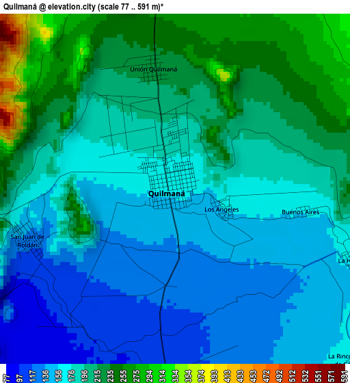
Below is the Elevation map of Quilmaná, which displays elevation range with different colors. Scale of the first map is from 77 to 591 m (253 to 1939 ft) with average elevation of 185.6 meters (=609 ft) [note 1]
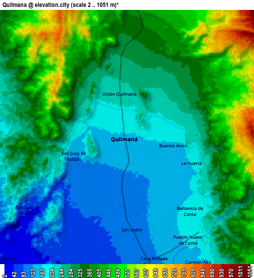
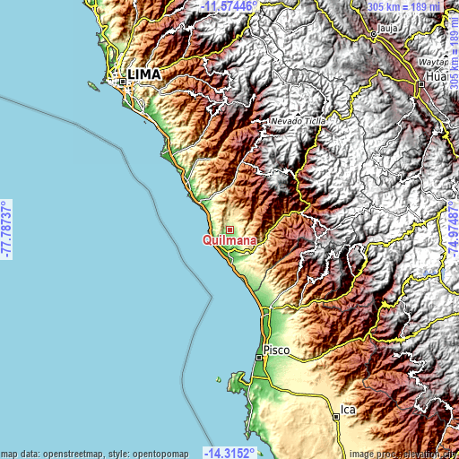
These maps also provides idea of topography and contour of this city, they are displayed at different zoom levels. More info about maps, scale and edge coordinates you can find below images.
| \ | Map #1 | Map #2 | Topo.Map |
| Scale [m] | 77..591 m | 2..1051 m | × |
| Scale [ft] | 253..1939 ft | 7..3448 ft | × |
| Average | 185.6 m = 609 ft | 293.1 m = 962 ft | × |
| Width | 9.52 km = 5.9 mi | 19.05 km = 11.8 mi | 304.7 km = 189.3 mi |
| Height | 9.52 km = 5.9 mi | 19.05 km = 11.8 mi | 304.8 km = 189.4 mi |
| ↑Max Latitude | -12.905768° | -12.86293° | -11.57446° |
| Latitude at center | -12.9486° | -12.9486° | -12.9486° |
| ↓Min Latitude | -12.991424° | -13.034241° | -14.3152° |
| ← Min Longitude | -76.425065° | -76.469011° | -77.78737° |
| Longitude center | -76.38112° | -76.38112° | -76.38112° |
| →Max Longitude | -76.337175° | -76.293229° | -74.97487° |
Nearby cities:
Cities around Quilmaná sort by population:
• Nuevo Imperial elevation 153 m
15.7 km,  153°
153°
• Imperial 91 m
12.7 km,  165°
165°
• San Vicente de Cañete 45 m
14.1 km,  181°
181°
• Mala 34 m
42.2 km,  320°
320°
• Chocos 2710 m
56.3 km,  86°
86°
• Catahuasi 1172 m
55.6 km,  72°
72°
• San Pedro 93 m
55.5 km, 154°
• Calango 315 m
50.1 km,  339°
339°
• Tauripampa 4525 m
49.7 km,  35°
35°
• Omas 1618 m
49.2 km,  12°
12°
• Asia 26 m
27.2 km,  312°
312°
• Coayllo 260 m
25.7 km, 338°
Multilingual:
 En español:
Quilmaná elevación 162 m.
 En France:
Quilmaná élévation 162 m.
 Auf Deutsch:
Quilmaná höhe über dem Meeresspiegel ist 162 m.

Sources and notes:
- [note 1] Map square and city borders are not equal. Map elevation data is calculated only from area inside that square.
- [src 1] Elevation data from geonames database provided with same terms of usage.
- [src 2] The elevation map of Quilmaná is generated using elevation data from NASA's 3 arcsec (90m) resolution SRTM data.
- [src 3] Base (background) map © OpenStreetMap contributors tiles are generated by Geofabrik and OpenTopoMap.
Copyright & License:
This Quilmaná Elevation Map is licensed under CC BY-SA. You may reuse any part from this page, if you give a proper credit by linking to this URL:
 More info on terms of use page.