Tocache elevation
Tocache (San Martín), Peru elevation is 498 meters and Tocache elevation in feet is 1634 ft above sea level [src 1]. Tocache is a populated place (feature code) with elevation that is 1823 meters (5981 ft) smaller than average city elevation in Peru.
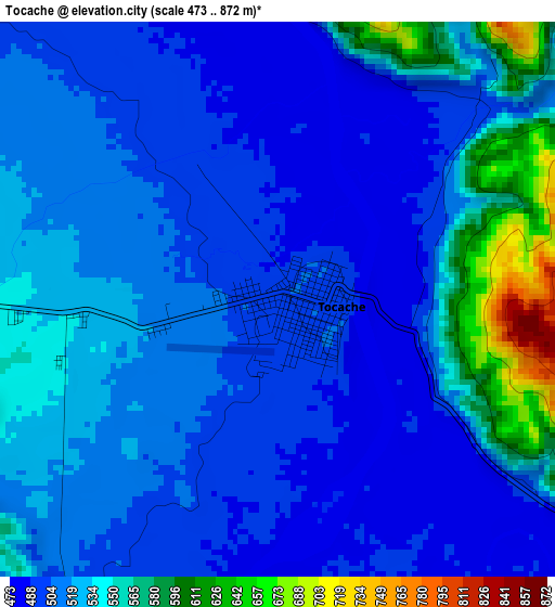
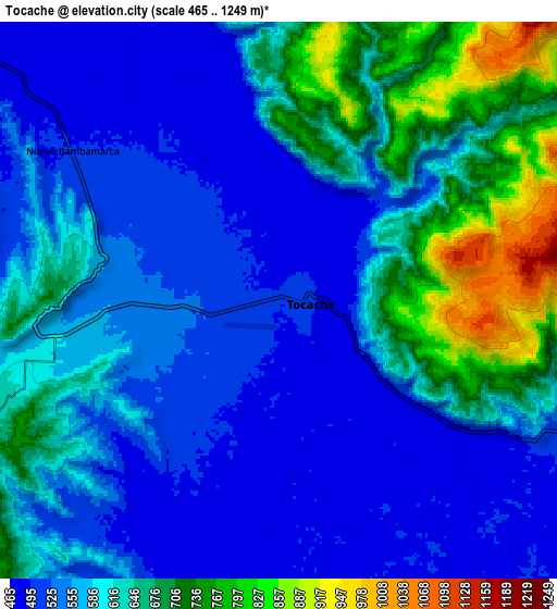
Below is the Elevation map of Tocache, which displays elevation range with different colors. Scale of the first map is from 473 to 872 m (1552 to 2861 ft) with average elevation of 521.4 meters (=1711 ft) [note 1]
These maps also provides idea of topography and contour of this city, they are displayed at different zoom levels. More info about maps, scale and edge coordinates you can find below images.
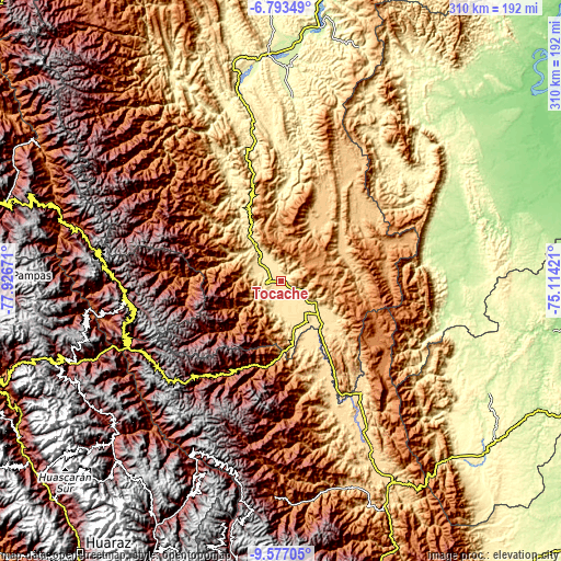
| \ | Map #1 | Map #2 | Topo.Map |
| Scale [m] | 473..872 m | 465..1249 m | × |
| Scale [ft] | 1552..2861 ft | 1526..4098 ft | × |
| Average | 521.4 m = 1711 ft | 595.8 m = 1955 ft | × |
| Width | 9.67 km = 6 mi | 19.35 km = 12 mi | 309.5 km = 192.3 mi |
| Height | 9.67 km = 6 mi | 19.35 km = 12 mi | 309.5 km = 192.3 mi |
| ↑Max Latitude | -8.1442° | -8.100696° | -6.79349° |
| Latitude at center | -8.1877° | -8.1877° | -8.1877° |
| ↓Min Latitude | -8.231195° | -8.274685° | -9.57705° |
| ← Min Longitude | -76.564405° | -76.608351° | -77.92671° |
| Longitude center | -76.52046° | -76.52046° | -76.52046° |
| →Max Longitude | -76.476515° | -76.432569° | -75.11421° |
Nearby cities:
Cities around Tocache sort by population:
• Uchiza elevation 563 m
30.8 km,  168°
168°
• Huicungo 301 m
100.6 km,  343°
343°
• Ullulluco 3191 m
104.1 km,  253°
253°
• Taurija 3061 m
100.1 km,  262°
262°
• Urpay 2693 m
97.2 km, 259°
• Aucayacu 569 m
94 km,  151°
151°
• Challas 3296 m
92.3 km, 252°
• Huancaspata 3306 m
90.7 km, 250°
• Huaylillas 2391 m
90.5 km,  270°
270°
• Tayabamba 3241 m
86 km, 263°
• Huacrachuco 3955 m
80.5 km,  230°
230°
• Nuevo Progreso 503 m
36.5 km,  143°
143°
Multilingual:
 En español:
Tocache elevación 498 m.
 En France:
Tocache élévation 498 m.


Sources and notes:
- [note 1] Map square and city borders are not equal. Map elevation data is calculated only from area inside that square.
- [src 1] Elevation data from geonames database provided with same terms of usage.
- [src 2] The elevation map of Tocache is generated using elevation data from NASA's 3 arcsec (90m) resolution SRTM data.
- [src 3] Base (background) map © OpenStreetMap contributors tiles are generated by Geofabrik and OpenTopoMap.
Copyright & License:
This Tocache Elevation Map is licensed under CC BY-SA. You may reuse any part from this page, if you give a proper credit by linking to this URL:
 More info on terms of use page.