Gamawa elevation
Gamawa (Bauchi), Nigeria elevation is 364 meters and Gamawa elevation in feet is 1194 ft above sea level [src 1]. Gamawa is a seat of a second-order administrative division (feature code) with elevation that is 67 meters (220 ft) bigger than average city elevation in Nigeria.
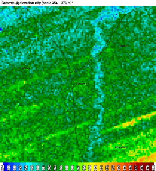
Below is the Elevation map of Gamawa, which displays elevation range with different colors. Scale of the first map is from 354 to 373 m (1161 to 1224 ft) with average elevation of 362.1 meters (=1188 ft) [note 1]
These maps also provides idea of topography and contour of this city, they are displayed at different zoom levels. More info about maps, scale and edge coordinates you can find below images.
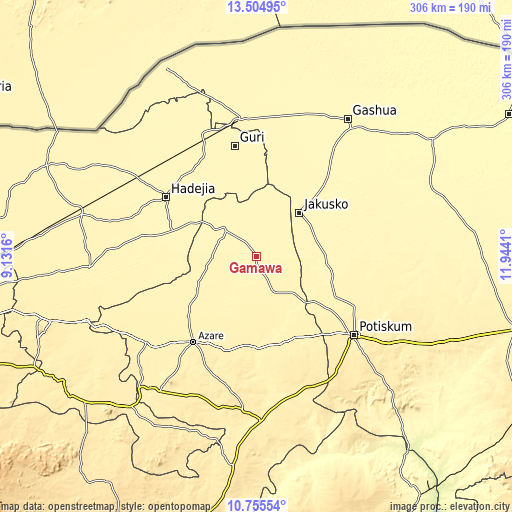
| \ | Map #1 | Map #2 | Topo.Map |
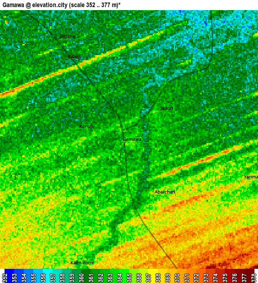
| Scale [m] | 354..373 m | 352..377 m | × |
| Scale [ft] | 1161..1224 ft | 1155..1237 ft | × |
| Average | 362.1 m = 1188 ft | 362.8 m = 1190 ft | × |
| Width | 9.55 km = 5.9 mi | 19.11 km = 11.9 mi | 305.7 km = 190 mi |
| Height | 9.55 km = 5.9 mi | 19.11 km = 11.9 mi | 305.7 km = 190 mi |
| ↑Max Latitude | 12.17675° | 12.219703° | 13.50495° |
| Latitude at center | 12.13379° | 12.13379° | 12.13379° |
| ↓Min Latitude | 12.090823° | 12.047849° | 10.75554° |
| ← Min Longitude | 10.493905° | 10.449959° | 9.1316° |
| Longitude center | 10.53785° | 10.53785° | 10.53785° |
| →Max Longitude | 10.581795° | 10.625741° | 11.9441° |
Nearby cities:
Cities around Gamawa sort by population:
• Hadejia elevation 359 m
64.6 km,  303°
303°
• Azare 413 m
63.5 km,  216°
216°
• Kafin Hausa 364 m
69.1 km,  279°
279°
• Gorgoram 348 m
59.1 km,  17°
17°
• Katagum 362 m
26.4 km,  309°
309°
• Madara 392 m
40.6 km,  193°
193°
• Kiri Kasamma 354 m
69.3 km,  333°
333°
• Auyo 364 m
68.8 km,  288°
288°
• Guri 354 m
67.3 km,  349°
349°
• Sabon Garin Nangere 394 m
66.3 km,  118°
118°
• Dambam 397 m
53.9 km,  159°
159°
• Jakusko 352 m
36.8 km,  44°
44°
Multilingual:
 En español:
Gamawa elevación 364 m.
 En France:
Gamawa élévation 364 m.


Sources and notes:
- [note 1] Map square and city borders are not equal. Map elevation data is calculated only from area inside that square.
- [src 1] Elevation data from geonames database provided with same terms of usage.
- [src 2] The elevation map of Gamawa is generated using elevation data from NASA's 3 arcsec (90m) resolution SRTM data.
- [src 3] Base (background) map © OpenStreetMap contributors tiles are generated by Geofabrik and OpenTopoMap.
Copyright & License:
This Gamawa Elevation Map is licensed under CC BY-SA. You may reuse any part from this page, if you give a proper credit by linking to this URL:
 More info on terms of use page.