Hadejia elevation
Hadejia (Jigawa), Nigeria elevation is 359 meters and Hadejia elevation in feet is 1178 ft above sea level [src 1]. Hadejia is a seat of a second-order administrative division (feature code) with elevation that is 62 meters (203 ft) bigger than average city elevation in Nigeria.
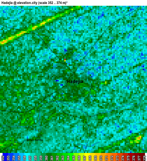
Below is the Elevation map of Hadejia, which displays elevation range with different colors. Scale of the first map is from 352 to 374 m (1155 to 1227 ft) with average elevation of 358.1 meters (=1175 ft) [note 1]
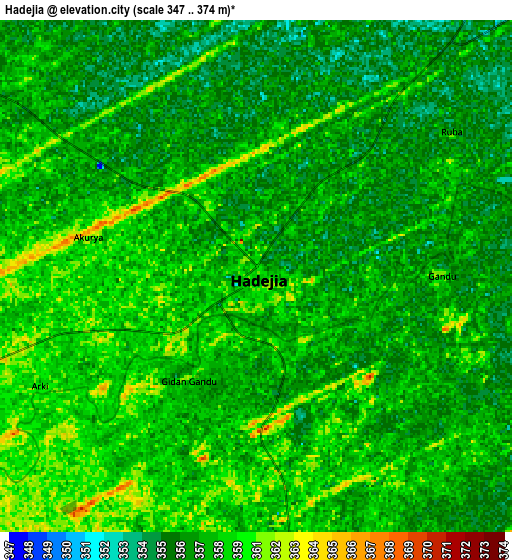
These maps also provides idea of topography and contour of this city, they are displayed at different zoom levels. More info about maps, scale and edge coordinates you can find below images.
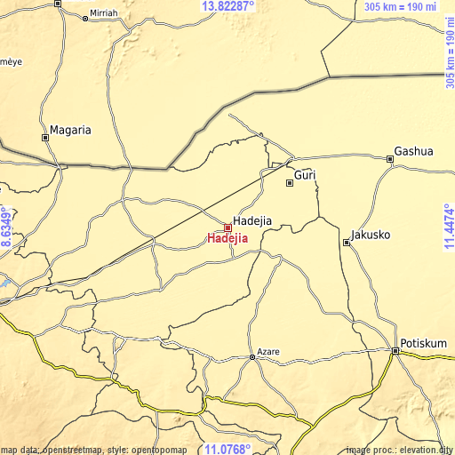
| \ | Map #1 | Map #2 | Topo.Map |
| Scale [m] | 352..374 m | 347..374 m | × |
| Scale [ft] | 1155..1227 ft | 1138..1227 ft | × |
| Average | 358.1 m = 1175 ft | 357.9 m = 1174 ft | × |
| Width | 9.54 km = 5.9 mi | 19.09 km = 11.9 mi | 305.3 km = 189.7 mi |
| Height | 9.54 km = 5.9 mi | 19.09 km = 11.9 mi | 305.4 km = 189.8 mi |
| ↑Max Latitude | 12.496378° | 12.539278° | 13.82287° |
| Latitude at center | 12.45347° | 12.45347° | 12.45347° |
| ↓Min Latitude | 12.410555° | 12.367633° | 11.0768° |
| ← Min Longitude | 9.997205° | 9.953259° | 8.6349° |
| Longitude center | 10.04115° | 10.04115° | 10.04115° |
| →Max Longitude | 10.085095° | 10.129041° | 11.4474° |
Nearby cities:
Cities around Hadejia sort by population:
• Kafin Hausa elevation 364 m
27.7 km,  210°
210°
• Gagarawa 374 m
55.9 km,  264°
264°
• Mallammaduri 357 m
15.3 km,  323°
323°
• Katagum 362 m
38.4 km,  119°
119°
• Birniwa 353 m
43.1 km,  29°
29°
• Jahun 374 m
61.5 km,  226°
226°
• Guri 354 m
51.2 km,  53°
53°
• Miga 372 m
42.8 km,  236°
236°
• Kiri Kasamma 354 m
35.3 km,  41°
41°
• Kaugama 366 m
33.1 km,  274°
274°
• Malam Madori 360 m
21.4 km,  305°
305°
• Auyo 364 m
17.4 km,  219°
219°
Multilingual:
 En español:
Hadejia elevación 359 m.
 En France:
Hadejia élévation 359 m.


Sources and notes:
- [note 1] Map square and city borders are not equal. Map elevation data is calculated only from area inside that square.
- [src 1] Elevation data from geonames database provided with same terms of usage.
- [src 2] The elevation map of Hadejia is generated using elevation data from NASA's 3 arcsec (90m) resolution SRTM data.
- [src 3] Base (background) map © OpenStreetMap contributors tiles are generated by Geofabrik and OpenTopoMap.
Copyright & License:
This Hadejia Elevation Map is licensed under CC BY-SA. You may reuse any part from this page, if you give a proper credit by linking to this URL:
 More info on terms of use page.